Posted:
Dec 26, 2014 @ 6:58 am

The avalanche danger remains CONSIDERABLE. Dangerous avalanche conditions exist in the west central Montana backcountry above 6000 feet.  On terrain steeper than 30 degrees, natural avalanches are possible, human triggered avalanches likely. Careful snowpack evaluation, cautious route-finding and conservative decision making is essential for safe travel in avalanche terrain.

Good morning backcountry skiers and riders! This is Steve Karkanen with the backcountry avalanche advisory for west central Montana. This information is provided under an agreement with the Forest Service, who is wholly responsible for it’s content. The information does not apply to operating ski areas.


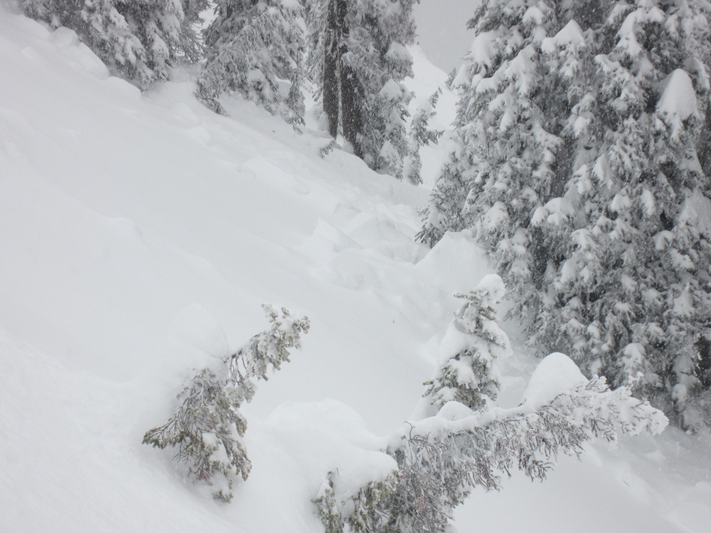
Weather and Snowpack

This morning mountain temperatures are in the twenties with light snow as a shortwave trough passes through the area.

Since Tuesday, mountain locations picked up several more inches of storm snow but without the high winds we experienced earlier in the week. Southern Bitterroot locations picked up the most snowfall with close to 14 inches near Saddle Mountain and around 8 inches in the northern mountains. Christmas Day was a great day to be out in the snow.

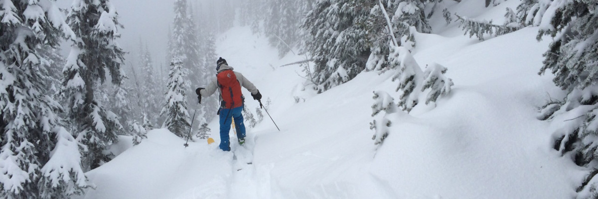
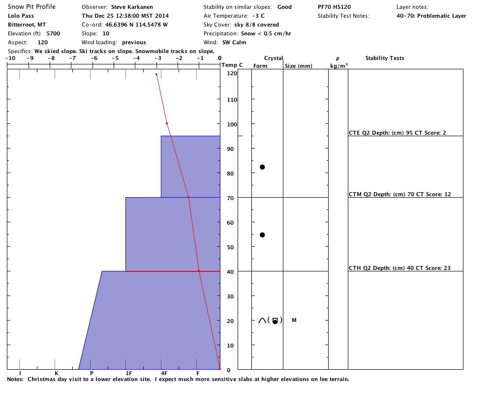
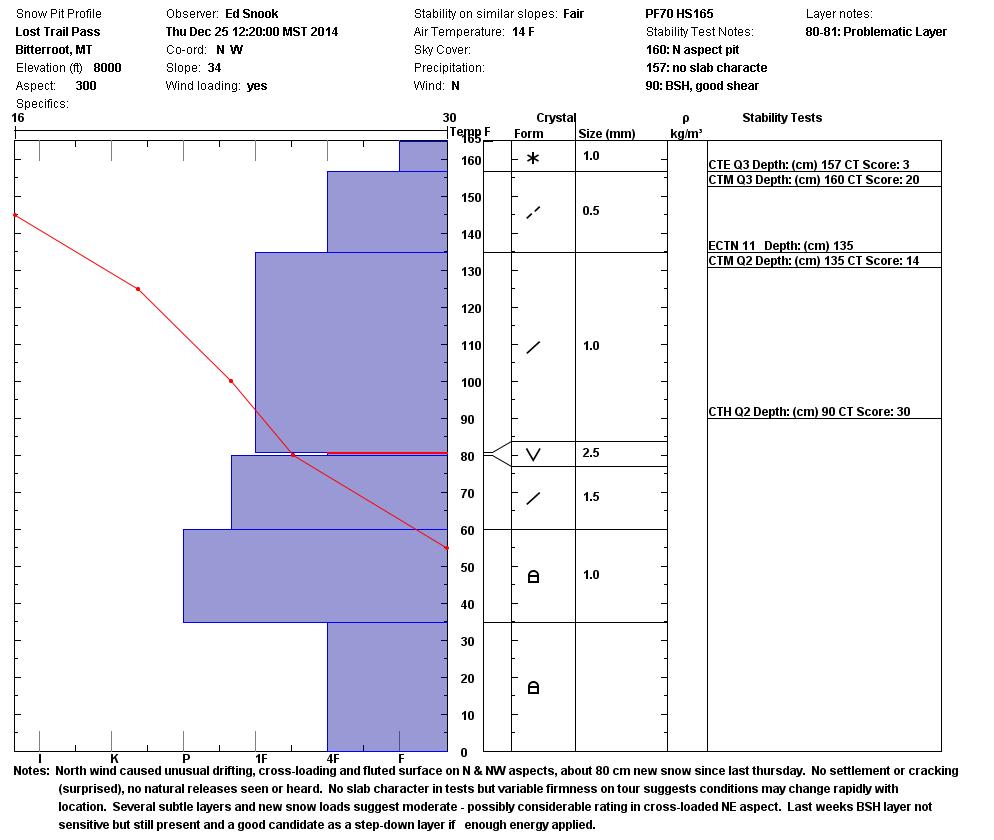
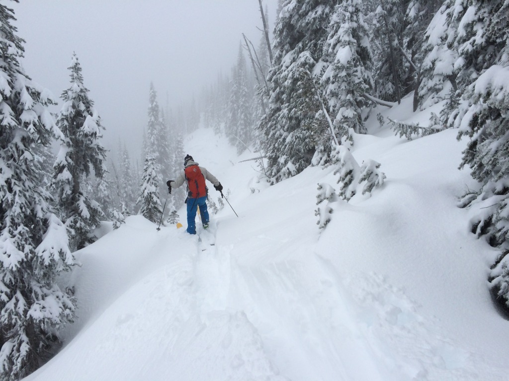
Our information is somewhat limited today due to the holiday but I did get out for a look at conditions near Lolo Pass and Ed Snook toured near Lost Trail Pass on Christmas.  Below 6000 feet the snow is well settled with only the newest snow failing on a density change in stability testing. The situation is a bit different above 6000 feet especially on lee terrain below the ridges. We have not seen or heard of any natural or human triggered avalanches since Monday but the wind slabs that formed earlier in the week are still sensitive and now appear inviting with the recent snowfall.

Many steep slopes slid during the Solstice storm last Sunday. There are many more that did not avalanche and it may not be easy to see if the weak layer was cleaned out in the areas that did. These places may be reloaded again. On Tuesday Dudley mentioned that it is a good idea to tiptoe around for a few more days to give the snow time to adjust to the added weight.  Good advice to follow for a few more days particularly on any wind loaded terrain.


Weather and Avalanche Forecast

Snow will decrease and cloud cover will break up for a short time this afternoon.  The next system arrives Saturday and has  potential for moderate to heavy snowfall through Sunday. On Sunday an Arctic front moves into western Montana with high winds and much colder temperatures.

If the next storm plays out as expected with heavy snow and high winds, the avalanche danger may increase to HIGH.  Pay close attention to the weather forecast and note wind speed and direction.  There is a ton of snow available for transport right now and the expected northeast winds will redistribute it onto more west and south facing terrain.

Dudley will issue the next regular advisory on Tuesday, December 30.


Your observations are valuable to us! Send a quick note to [email protected] or use our online form to submit an observation.

READ FULL ADVISORY  

Problem 1 - Storm Snow Slabs

  • TYPE

    storm-slabs

    Storm Slabs

    Release of a soft cohesive layer (a slab) of new snow which breaks within the storm snow or on the old snow surface. Storm-slab problems typically last between a few hours and few days. Storm-slabs that form over a persistent weak layer (surface hoar, depth hoar, or near-surface facets) may be termed Persistent Slabs or may develop into Persistent Slabs.

  • SIZE

    3-4

    1-2 (Small-Large)

    The potential size of avalanche resulting from this problem.

  • LIKELIHOOD

    Likelihood-5

    Likely

    The likelihood of an avalanche resulting from this problem.

  • ADDED DANGER

    Increased Slope Danger

    Increased/Added Danger

    There is an increased risk of avalanches on these slopes:

    N - North
    NE - Northeast
    E - East
    SE - Southeast
    S - South
    SW - Southwest
    W - West
    NW - Northwest

The Christmas Eve storm dropped several inches of new snow (8 to 14 inches) throughout the advisory area. The Lost Trail backcountry (Saddle Mountain) picked up the most storm snow with 14″.  The new snow sloughs easily on a density change involving the newest snow.  A large enough slough can easily add enough weight to trigger the more deeply buried weakness associated with the facets that formed earlier this month.

Problem 2 - Sensitive wind slabs

  • TYPE

    wind-slabs

    Wind Slabs

    Release of a cohesive layer of snow (a slab) formed by the wind.  Wind typically erodes snow from the upwind sides of terrain features and deposits snow on the downwind side.  Wind slabs are often smooth and rounded and sometimes sound hollow, and can range from soft to hard. Wind slabs that form over a persistent weak layer (surface hoar, depth hoar, or near-surface facets) may be termed Persistent Slabs or may develop into Persistent Slabs.

  • SIZE

    3-4

    1-2 (Small-Large)

    The potential size of avalanche resulting from this problem.

  • LIKELIHOOD

    Likelihood-5

    Likely

    The likelihood of an avalanche resulting from this problem.

  • ADDED DANGER

    Increased Slope Danger

    Increased/Added Danger

    There is an increased risk of avalanches on these slopes:

    N - North
    NE - Northeast
    E - East
    SE - Southeast
    S - South

Wind slabs that formed earlier in the week now have a heavy new load in many areas and need time to adjust. These hard slabs are now covered by the recent storm snow and appear inviting.  Your extra weight may be all it takes to trigger one of these.

MAP

Lolo Pass

Lolo Pass SNOTEL reports .80" SWE.

Twin Lakes area

Twin Lakes SNOTEL reports 1" SWE for the X-eve storm.

Lost Trail Pass area

Lost Trail Ski Area reported 14" new snow on X-mas, Saddle Mtn SNOTEL 1.5" SWE storm total.

Southern Missions

North Fork Jocko reported over 1.6" SWE during the X-eve storm

Hoodoo Pass area

Hoodoo Snotel reports 1" SWE during the X-mas eve storm.

Pinned locations picked up the most snowfall on Christmas Eve.

FORECAST & OUTLOOK

The Missoula Office of the National Weather Service is forecasting another significant winter storm to enter the area this weekend. This is expected to be a snow producer similar to or even bigger than the Christmas Eve storm.

Expect the avalanche danger to increase, perhaps back to the HIGH level, as the storm comes in.

This information is the sole responsibility of the Forest Service and does not apply to operating ski areas. The avalanche danger rating expires at midnight tonight but the information can help you make a more informed decision regarding travel in avalanche terrain for the next few days.

Our advisory area includes National Forest System lands in the Bitterroot Mountains from Lost Trail Pass north to Granite Pass, the Rattlesnake Mountains north of Missoula and the Southern Swan and Mission Mountains near Seeley Lake, MT. Avalanche information for the Lookout Pass/St. Regis Basin area is available from the Idaho Panhandle Avalanche Center.