Posted:
Dec 30, 2014 @ 6:20 am

On slopes that are 35 degrees and steeper the avalanche danger is considerable in the west central Montana backcountry.  The area received significant snow over the weekend and human-triggered avalanches on steep slopes are likely.

Good Morning, this is Dudley Improta with the west central Montana avalanche advisory for December 30, 2014. This danger rating does not apply to operating ski areas and expires at midnight tonight (Dec. 30).

Weather and Snowpack

This morning northeast mountain winds have calmed but our area is under a wind chill advisory until 9 am. Mountain temperatures are double digits below 0; averaging about -15 F.

The primary avalanche concern is wind slabs on leeward slopes. The weekend’s storms provided plenty of snow for the wind to move around. The winds have blown out of the southwest to the northeast for the last four days, so a wind slab could lurk on any aspect.

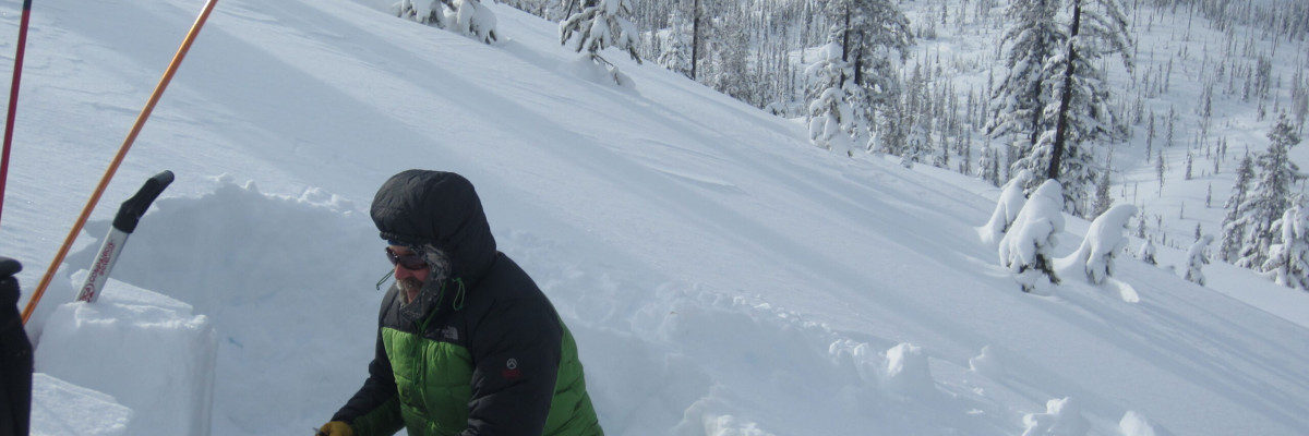
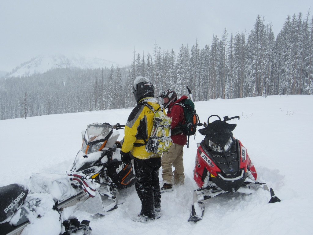
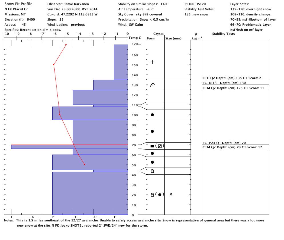
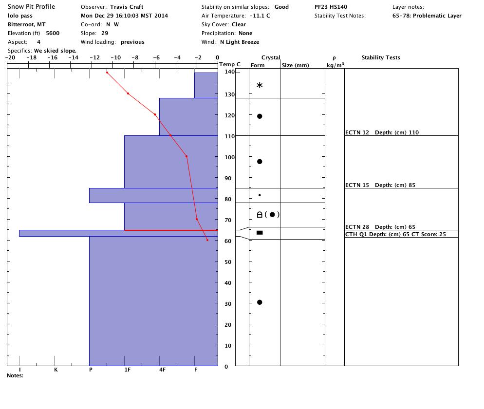
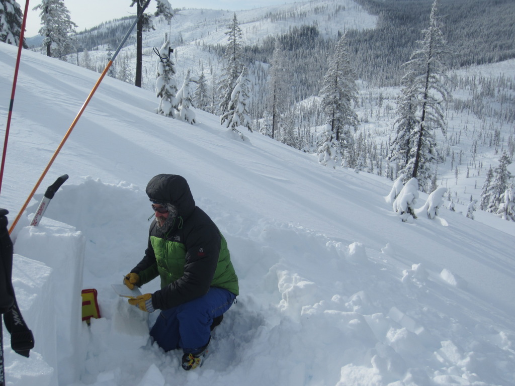
Curt Friede, owner of Kurt’s Polaris, tried to get Steve and I into the north fork of Placid Creek (near Seeley Lake) on Sunday. Four snowmobilers had been caught in an avalanche in the area on Saturday. We were thwarted by 24 inches of new snow that fell Saturday night (and our riding skills) to get where the avalanche occurred; but from information gathered, it looks like the avalanche ran on the early season facets and an old melt freeze crust. The facets are still around; failing with high strength, but high energy, in snow stability tests (see Placid profile below).

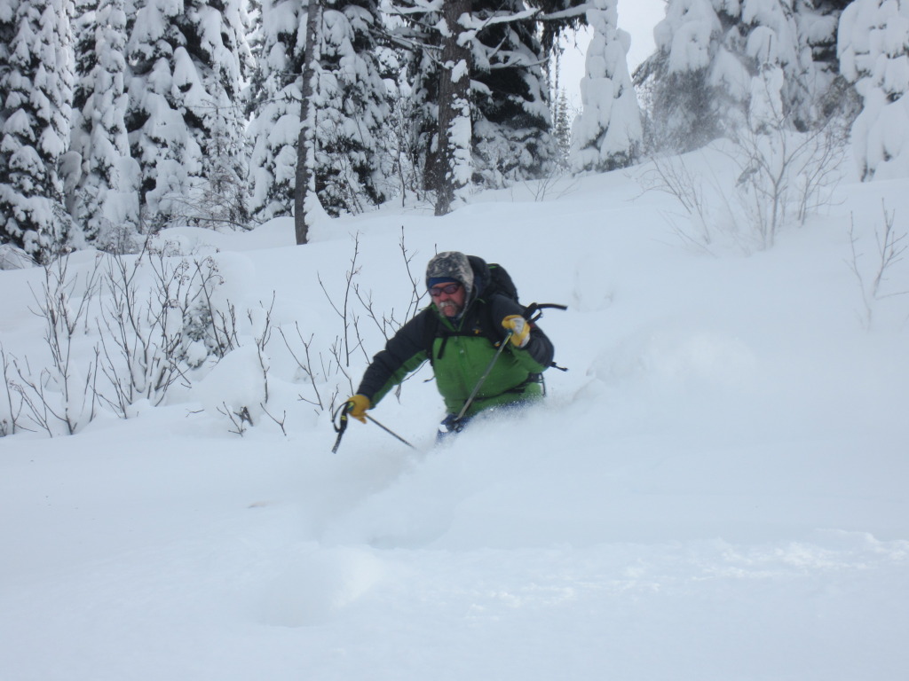
Yesterday, the snow near Lolo Pass looked fairly stable at lower elevations (< 6000 ft.); but the surface snow readily sluffs on steeper slopes (>35 degrees). No problem, unless it pushes you into an undesirable place (trees, rocks, cliffs, etc.).

So there you have it, wind slabs are the primary problem with loose snow sluffs and the possibility of a deep failure hanging out there; all on the steeper terrain. The snow looks inviting; tread carefully.

The North Fork of the Jocko Snotel recorded 24 inches of snow in a 24 hour period from Saturday to Sunday. I would expect the snow to be less stable in the southern Missions and southern Swans.

Weather Forecast and Avalanche Outlook

Cold temperatures are predicted to last into Wednesday. The avalanche danger will remain the same until these temperatures warm. Dry conditions should dominate later in the week and allow inversions to build, which will warm up the mountain temperatures. The warming temperatures will help decrease the avalanche danger.

Steve will issue the next advisory on January 2, 2015. Ski and ride safe; have a fun and safe New Year holiday.

Public observations can be important to the avalanche advisory and to riders and skiers.  If you would like to send us snow observations use our public observations form or e-mail us at  [email protected] .

READ FULL ADVISORY  

Problem 1 - Wind slabs

  • TYPE

    wind-slabs

    Wind Slabs

    Release of a cohesive layer of snow (a slab) formed by the wind.  Wind typically erodes snow from the upwind sides of terrain features and deposits snow on the downwind side.  Wind slabs are often smooth and rounded and sometimes sound hollow, and can range from soft to hard. Wind slabs that form over a persistent weak layer (surface hoar, depth hoar, or near-surface facets) may be termed Persistent Slabs or may develop into Persistent Slabs.

  • SIZE

    4-5

    2 (Large)

    The potential size of avalanche resulting from this problem.

  • LIKELIHOOD

    Likelihood-5

    Likely

    The likelihood of an avalanche resulting from this problem.

  • ADDED DANGER

    Increased Slope Danger

    Increased/Added Danger

    There is an increased risk of avalanches on these slopes:

    N - North
    NE - Northeast
    E - East
    SE - Southeast
    S - South
    SW - Southwest
    W - West
    NW - Northwest

The weekend’s storms provided plenty of snow for the wind to move around. The winds have blown out of the southwest to the northeast for the last four days, so a wind slab could lurk on any aspect.

Problem 2 - loose surface snow

  • TYPE

    loose-dry

    Loose Dry

    Release of wet unconsolidated snow or slush. These avalanches typically occur within layers of wet snow near the surface of the snowpack, but they may quickly gouge into lower snowpack layers. Like Loose-Dry Avalanches,they start at a point and entrain snow as they move downhill, forming a fan-shaped avalanche. They generally move slowly, but can contain enough mass to cause significant damage to trees, cars or buildings. Other names for loose-wet avalanches include point-release avalanches or sluffs. Loose-wet avalanches can trigger slab avalanches that break into deeper snow layers.

  • SIZE

    3-4

    1-2 (Small-Large)

    The potential size of avalanche resulting from this problem.

  • LIKELIHOOD

    Likelihood-5

    Likely

    The likelihood of an avalanche resulting from this problem.

  • ADDED DANGER

    Increased Slope Danger

    Increased/Added Danger

    There is an increased risk of avalanches on these slopes:

    N - North
    NE - Northeast
    E - East
    SE - Southeast
    S - South
    SW - Southwest
    W - West
    NW - Northwest

Loose, cold surface snow is likely to move on steep (>35 degree) slopes. Not a problem unless it forces you into a hazard (rocks, trees, cliffs).

Problem 3 - Early season facets

  • TYPE

    persistent-slabs

    Persistent Slabs

    Release of a cohesive layer of soft to hard snow (a slab) in the middle to upper snowpack, when the bond to an underlying persistent weak layer breaks.  Persistent layers include: surface hoar, depth hoar, near-surface facets, or faceted snow. Persistent weak layers can continue to produce avalanches for days, weeks or even months, making them especially dangerous and tricky. As additional snow and wind events build a thicker slab on top of the persistent weak layer, this avalanche problem may develop into a Persistent, Deep-Slab.

  • SIZE

    5-6

    2-3 (Large)

    The potential size of avalanche resulting from this problem.

  • LIKELIHOOD

    Likelihood-3

    Possible

    The likelihood of an avalanche resulting from this problem.

  • ADDED DANGER

    Increased Slope Danger

    Increased/Added Danger

    There is an increased risk of avalanches on these slopes:

    N - North
    NE - Northeast
    E - East
    SE - Southeast
    S - South
    SW - Southwest
    W - West
    NW - Northwest

Early season facets are still showing up in stability tests. These facets are likely the weak layer that failed in an avalanche that caught four snowmobilers near Seeley lake on  Saturday.

Snow pit and pictures from 12/28  and 12/29/14

FORECAST & OUTLOOK

Cold temperatures are predicted to last into Wednesday. The avalanche danger will remain the same until these temperatures warm. Dry conditions should dominate the week and allow inversions to build, which will warm up the mountain temperatures. The warming temperatures will help decrease the avalanche danger.

This information is the sole responsibility of the Forest Service and does not apply to operating ski areas. The avalanche danger rating expires at midnight tonight but the information can help you make a more informed decision regarding travel in avalanche terrain for the next few days.

Our advisory area includes National Forest System lands in the Bitterroot Mountains from Lost Trail Pass north to Granite Pass, the Rattlesnake Mountains north of Missoula and the Southern Swan and Mission Mountains near Seeley Lake, MT. Avalanche information for the Lookout Pass/St. Regis Basin area is available from the Idaho Panhandle Avalanche Center.