Posted:
Jan 27, 2015 @ 6:13 am

The avalanche danger in the west central Montana backcountry is rated at moderate. Above 6000 feet, human triggered avalanches are possible on slopes 35 degrees and steeper. Although warm temperatures have helped settle the snowpack; stability tests show the possibility of slab avalanches and wet, loose avalanche activity will increase in the afternoon with rising temperatures. Your use of caution should rise along with those temperatures in the afternoon.

Good morning, this is Dudley Improta with the West Central Montana Avalanche Center’s advisory for January 27, 2015. This danger rating does not pertain to operating ski areas, is the sole responsibility of the U. S. Forest Service and expires at midnight tonight (1/27/15).

Weather and Snowpack Discussion

Mountain winds are out of the west at 18 to 24 mph this morning. Temperatures above 6ooo feet are generally in the upper 30’s to low 40’s F. Expect another warm, mostly sunny day with the high elevation temperatures reaching near 50 F again.

I really wanted to call low danger, I really did. My pit scores from yesterday and observations through the weekend would just not let it happen. Earlier this year Steve said we have a tricky snowpack; I put it another way Friday – things have been less than definitive. I don’t know who said this; maybe I did – “odd weather equals odd avalanche conditions”.

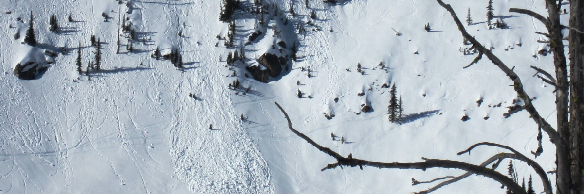
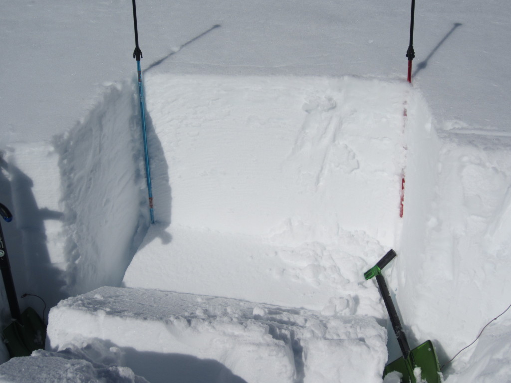
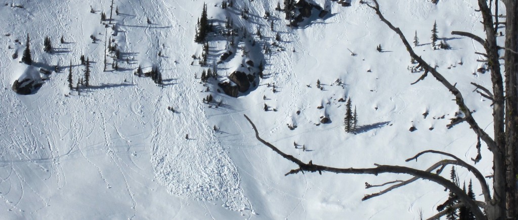
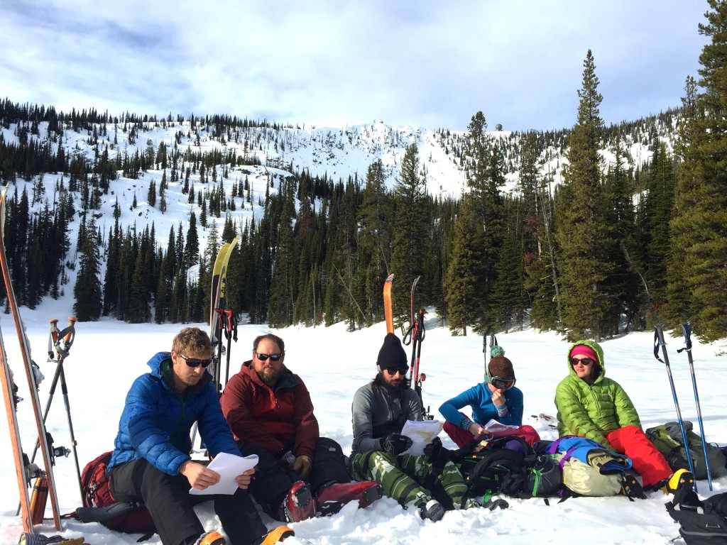
We had high elevation rain this weekend from Lost Trail Pass to Lolo Pass and from Hoodoo Pass to the southern Swans. It wasn’t a ton of rain and it didn’t seem to penetrate the snow very deep. Rain and melt-freeze crusts have formed on all aspects. Besides the obvious loose, wet snow movement in the heat of the day; we’re still seeing evidence of possible slab releases. Yesterday in the Rattlesnakes we had stability tests propagate on sunny ESE and shaded N slopes (see pictures and more numbers below).

Skiers in the southern Swans were not getting the propagation in their tests this weekend but were seeing weak layers about 14 inches from the surface. Observations from Elk Meadows noted collapsing before and after the rain but no avalanche activity or energetic snowpit scores (see public obs).

The weather is awesome for travelling and lots of folks are getting out. Snotel sites are showing 6 to 8 inches of settlement across the advisory area since Friday. But, we’re getting some interesting stability test scores and a couple of red flags like whumphing and collapsing noises.

If you’re choosing to recreate on slopes 35 degrees and steeper; take time to dig into the snowpack 2 or 3 feet to check for an instability. And, of course, only expose one person at a time to any avalanche hazard.

Weather and Avalanche Outlook

High pressure will continue through today. Temperatures in the high terrain will continue to be above normal. A slight disturbance could produce some precipitation this evening into Wednesday, but no significant snow is forecast for west central Montana. I would expect the avalanche danger to remain the same for the next few days.

A free 2-night avalanche awareness program begins this evening at 6pm in the North Underground Lecture Hall on the UM campus.

I will issue the next regularly scheduled advisory on Friday,  January 30.

Ride and ski safe.


READ FULL ADVISORY  

Problem 1 - Loose Wet Slides

  • TYPE

    loose-wet

    Loose Wet

    Release of wet unconsolidated snow or slush. These avalanches typically occur within layers of wet snow near the surface of the snowpack, but they may quickly gouge into lower snowpack layers. Like Loose-Dry Avalanches,they start at a point and entrain snow as they move downhill, forming a fan-shaped avalanche. They generally move slowly, but can contain enough mass to cause significant damage to trees, cars or buildings. Other names for loose-wet avalanches include point-release avalanches or sluffs. Loose-wet avalanches can trigger slab avalanches that break into deeper snow layers.

  • SIZE

    2-3

    1 (Small)

    The potential size of avalanche resulting from this problem.

  • LIKELIHOOD

    Likelihood-5

    Likely

    The likelihood of an avalanche resulting from this problem.

  • ADDED DANGER

    Increased Slope Danger

    Increased/Added Danger

    There is an increased risk of avalanches on these slopes:

    E - East
    SE - Southeast
    S - South
    SW - Southwest
    W - West

Natural and triggered loose wet slides are likely; particularly in the afternoon.

Problem 2 - Slab Avalanches

  • TYPE

    storm-slabs

    Storm Slabs

    Release of a soft cohesive layer (a slab) of new snow which breaks within the storm snow or on the old snow surface. Storm-slab problems typically last between a few hours and few days. Storm-slabs that form over a persistent weak layer (surface hoar, depth hoar, or near-surface facets) may be termed Persistent Slabs or may develop into Persistent Slabs.

  • SIZE

    4-5

    2 (Large)

    The potential size of avalanche resulting from this problem.

  • LIKELIHOOD

    Likelihood-3

    Possible

    The likelihood of an avalanche resulting from this problem.

  • ADDED DANGER

    Increased Slope Danger

    Increased/Added Danger

    There is an increased risk of avalanches on these slopes:

    N - North
    NE - Northeast
    E - East
    SE - Southeast
    NW - Northwest

Stability tests are still showing the possibility of slab avalanches; particularly on colder aspects with northerly or easterly exposures.

Problem 3 - Cornices

  • TYPE

    cornices

    Cornices / Cornice Fall

    Release of an overhanging mass of snow that forms as the wind moves snow over a sharp terrain feature, such as a ridge, and deposits snow on the down-wind side. They range from small wind lips of soft snow to large overhangs of hard snow that are 30 feet (~10 meters) or taller. They can break off the terrain suddenly and pull back onto the ridge top and catch people by surprise even on the flat ground above the slope. Even small cornices can have enough mass to be destructive and deadly. Cornice fall can entrain loose surface snow or trigger slab avalanches.

  • SIZE

    4-5

    2 (Large)

    The potential size of avalanche resulting from this problem.

  • LIKELIHOOD

    Likelihood-3

    Possible

    The likelihood of an avalanche resulting from this problem.

  • ADDED DANGER

    Increased Slope Danger

    Increased/Added Danger

    There is an increased risk of avalanches on these slopes:

    N - North
    NE - Northeast
    E - East
    SE - Southeast
    S - South

With temperatures reaching 50 degrees F up to 8000 feet; cornice failure is a real possibility. Be extra cautious around cornice formations; particularly in the afternoon.

Pits, obs and classes from the last week

FORECAST & OUTLOOK

High pressure will continue through today. Temperatures in the high terrain will continue to be above normal. A slight disturbance could produce some precipitation this evening into Wednesday, but no significant snow is forecast for west central Montana. I would expect the avalanche danger to remain the same for the next few days.

This information is the sole responsibility of the Forest Service and does not apply to operating ski areas. The avalanche danger rating expires at midnight tonight but the information can help you make a more informed decision regarding travel in avalanche terrain for the next few days.

Our advisory area includes National Forest System lands in the Bitterroot Mountains from Lost Trail Pass north to Granite Pass, the Rattlesnake Mountains north of Missoula and the Southern Swan and Mission Mountains near Seeley Lake, MT. Avalanche information for the Lookout Pass/St. Regis Basin area is available from the Idaho Panhandle Avalanche Center.