
At all locations above 6000 feet in the west central Montana backcountry, the avalanche danger is MODERATE on terrain steeper than 35 degrees. Heightened avalanche conditions exist on recently wind loaded steep terrain and in areas where weak sugary snow is capped by a hard crust that formed a week ago.
The avalanche danger is LOW elsewhere in the advisory area.
Good morning, this is Steve Karkanen with the West Central Montana Avalanche Center’s backcountry avalanche advisory for February 6, 2015. This danger rating does not apply to operating ski areas, is the sole responsibility of the U.S. Forest Service and expires at midnight tonight (2/6).
Snow and Weather
Mountain temperatures are in the upper thirties this morning with winds in the 30mph range. SNOTEL stations report under .5″ of SWE or about an inch of new snow in the past 24 hours.
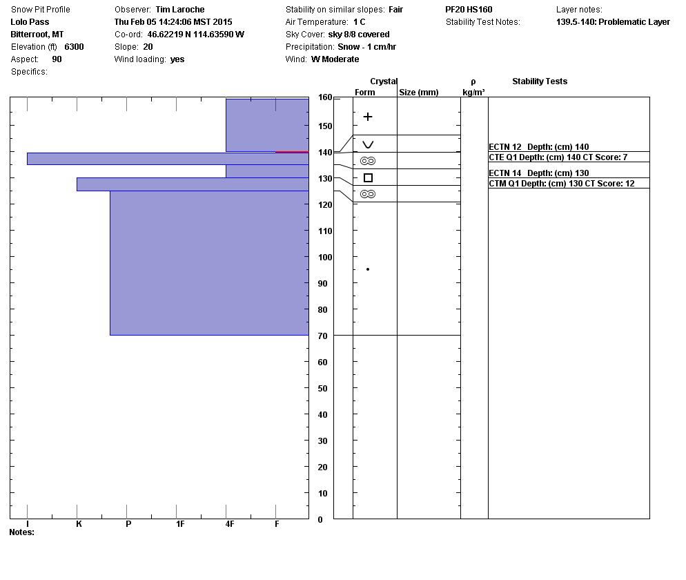
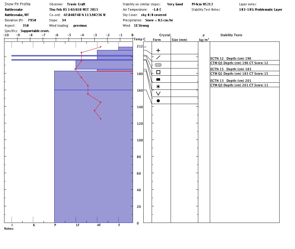
Locations above 6000 feet received several inches of snow the past 48 hours coupled with ridge top winds close to 40mph. These W-SW winds created sensitive wind slabs on high elevation lee terrain on Thursday. These are relatively small but will remain sensitive and become more problematic as they get bigger with this weekends storm.
The most recent buried surface hoar layer we’ve been talking about has gained considerable strength during the past few days of moderate temperatures and is no longer displaying signs of propagation. It’s still there, it fails cleanly in compression testing and I expect that it will again be reactive during the next big loading event, which will conveniently be this weekend.
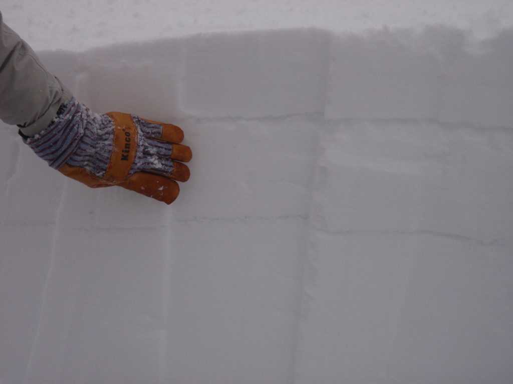
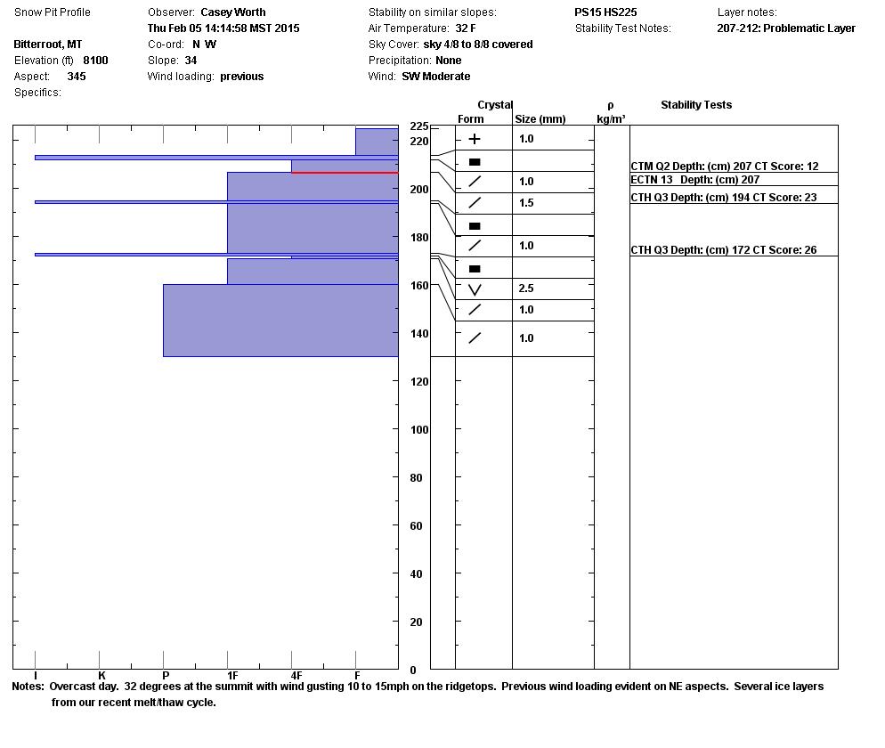
It’s worth taking the time to look for it. The photo below is a good example of what you are looking for; a weak layer of snow under an ice/melt freeze crust about a foot deep. Colder, shaded aspects are holding this instability longer than aspects on the south half of the compass.
Weather and Avalanche Forecast
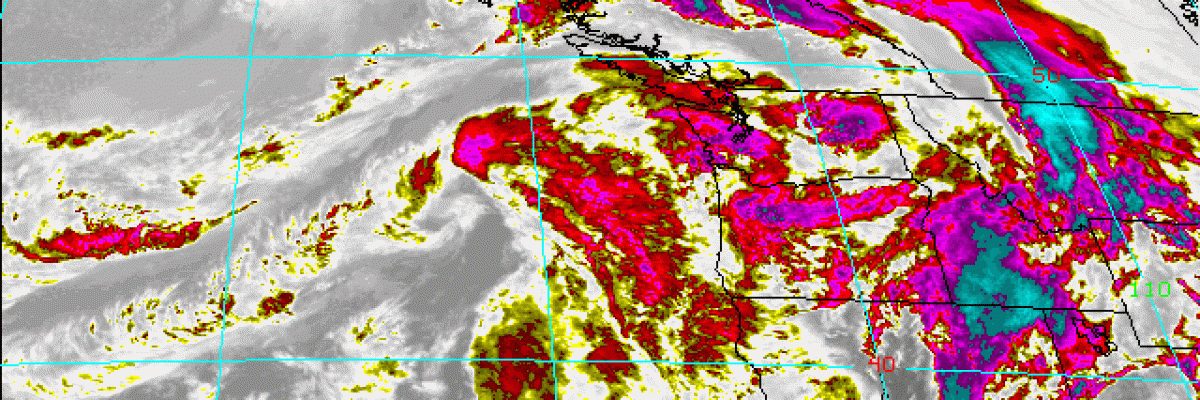
The Missoula Office of the National Weather Service is forecasting a significant moisture event this weekend.
We can expect mostly rain below 6000 feet, a mix of rain and snow to 7000 feet and up to a foot of high moisture content snow above 7000 feet. SWE’s may range from 1.5 inches to 3 inches by Sunday. Wind gusts to 50mph from the W-SW will redistribute any available snow onto leeward terrain. Many aspects will be cross-loaded during this event.
The avalanche danger will increase through the course of this storm then diminish after a couple of days. The most dangerous terrain will be on the lee side of the highest exposed peaks and ridges.
Below 6000 feet, our snowpack has already had a lot of rain and melt water pass through it so I don’t expect anything more than messy wet conditions and point release avalanches in areas that received snow this week.
It’s looking like another strong high pressure ridge returns to the Northern Rockies early next week.


