Posted:
Feb 10, 2015 @ 6:42 am

The avalanche danger in the west central Montana backcountry is rated at moderate. Loose, wet slides are the main problem; but it may be possible to trigger a slab avalanche on slopes steeper than 35 degrees above 7000 feet.

Good morning this is Travis Craft with the West Central Montana Avalanche Center’s advisory for February 10, 2015.  The danger rating does not apply to operating ski areas, is the sole responsibility of the U.S. Forest Service and expires at midnight.

Avalanche and Weather Discussion

This morning we are under a winter weather advisory. Mountain temperatures are hovering around the freezing mark with west,  northwest winds blowing 20mph and gusting to 30mph.

The advisory area had rain up to 7000 feet, with wet snow at higher elevations, on Saturday and Monday. We had a brief high-pressure window on Sunday.   Temperatures have remained unseasonably warm in the mountains.

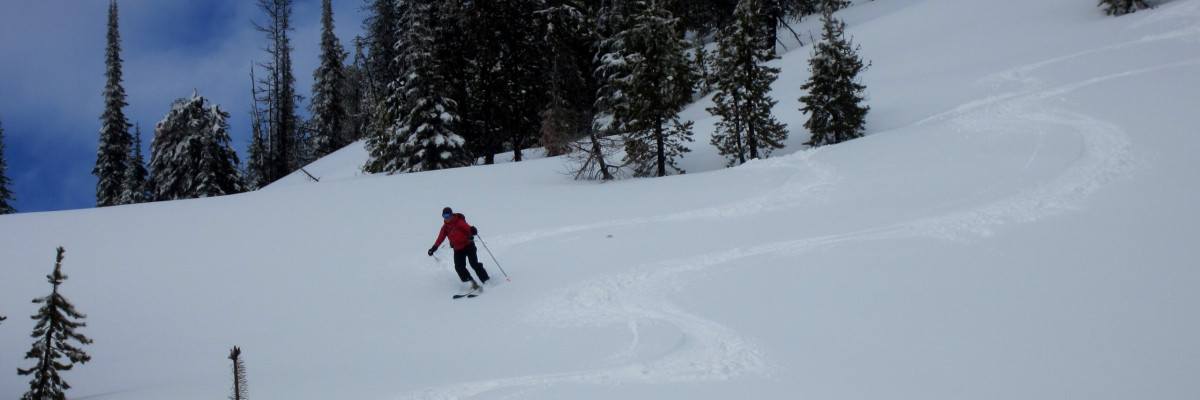
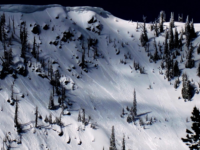
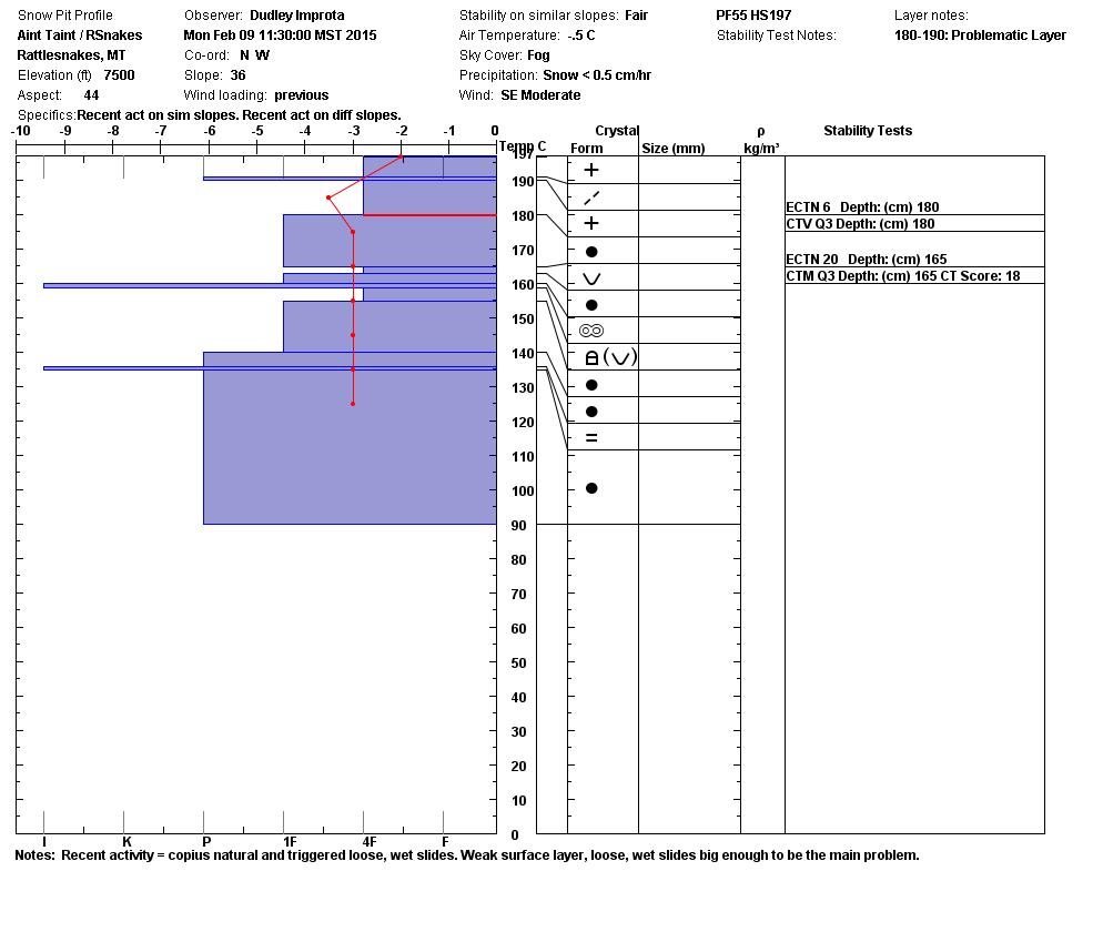
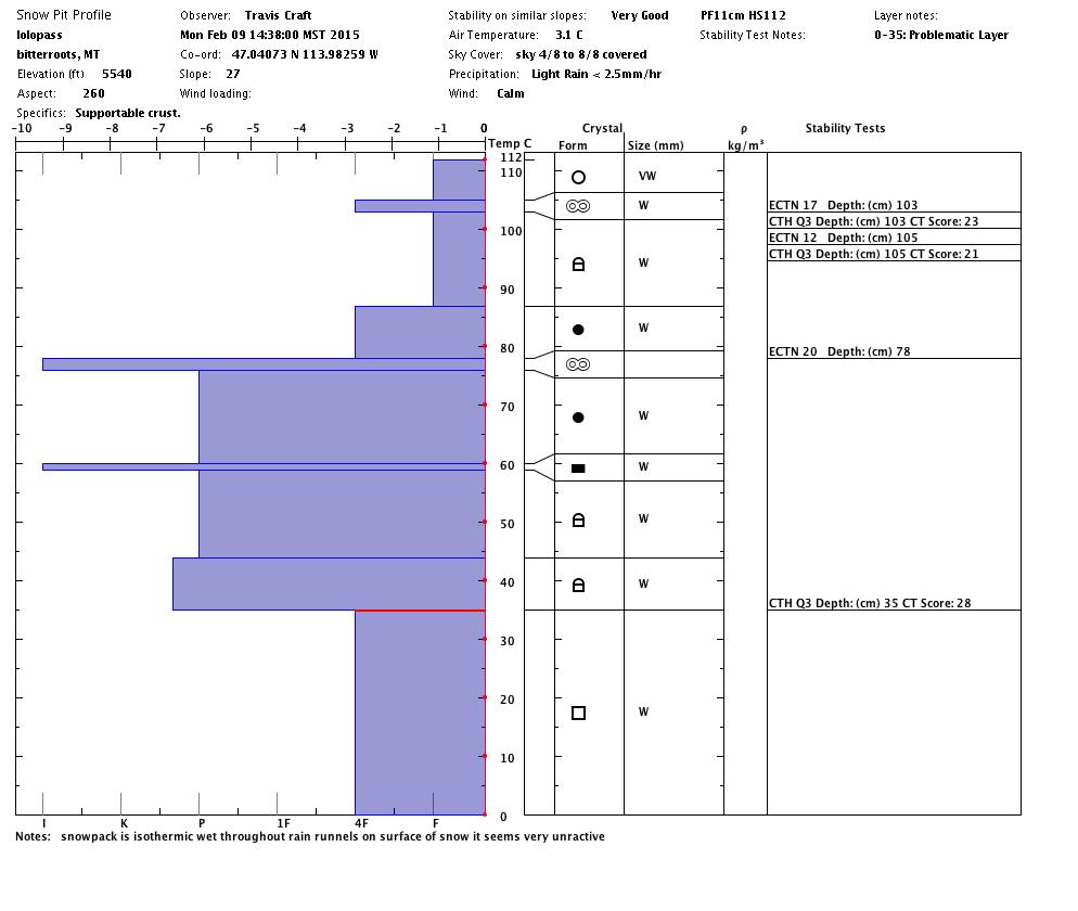
Dudley was in the Rattlesnake yesterday and reported lots of natural and triggered loose, wet snow slides. I observed similar slides at Lolo Pass.  Steve and Tim were in the southern Swans and thought big wet sluffs are also the main concern.  Loose slides could be a problem if you cannot get out of one and it carries you into a terrain trap.

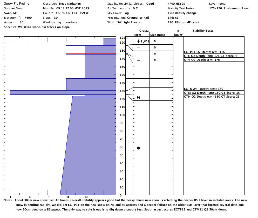
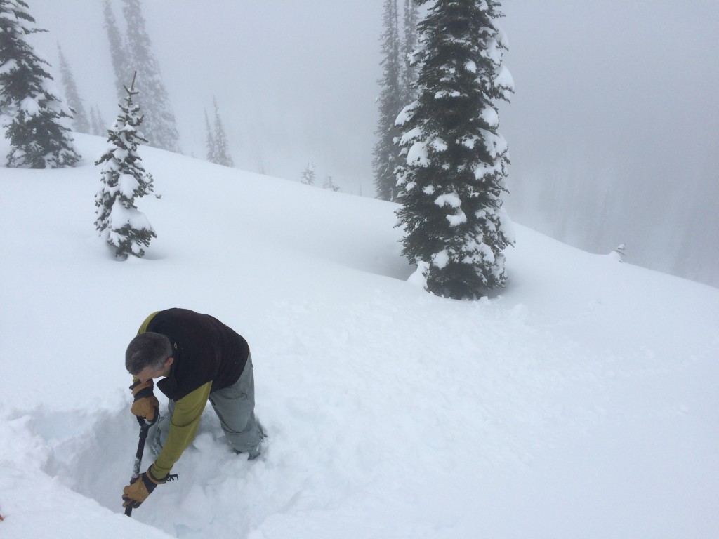
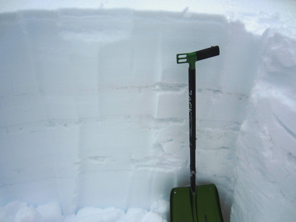
Steve and Tim did get propagation on a deep faceted layer buried 50cm into the snowpack in the Swans. We saw this same deep layer propagating in the Rattlesnakes Sunday. There is a public observation that reported the same failure in the central Bitterroot. This is a problem that requires you dig a pit to identify it.

The distribution of this layer varies throughout the advisory area. If I were going to recreate on a slope 35 plus degrees above 7000ft, I would take 5 minutes and dig a pit to see if that layer is there.


Weather and Avalanche Outlook

Snow is expected through this evening.  This snow is being deposited on an already weak surface. I expect the avalanche danger to rise throughout the day. Look for weak layers on steep slopes and expect loose, wet snow slides. High pressure is forecast to build in after today.

Logan King will issue the next regularly scheduled advisory on Friday, February 13. Yep, Friday the 13th.


READ FULL ADVISORY  

Problem 1 - Loose, wet slides

  • TYPE

    loose-wet

    Loose Wet

    Release of wet unconsolidated snow or slush. These avalanches typically occur within layers of wet snow near the surface of the snowpack, but they may quickly gouge into lower snowpack layers. Like Loose-Dry Avalanches,they start at a point and entrain snow as they move downhill, forming a fan-shaped avalanche. They generally move slowly, but can contain enough mass to cause significant damage to trees, cars or buildings. Other names for loose-wet avalanches include point-release avalanches or sluffs. Loose-wet avalanches can trigger slab avalanches that break into deeper snow layers.

  • SIZE

    3-4

    1-2 (Small-Large)

    The potential size of avalanche resulting from this problem.

  • LIKELIHOOD

    Likelihood-5

    Likely

    The likelihood of an avalanche resulting from this problem.

  • IMAGE

Loose, wet snow slides are moving naturally and can be triggered on steep slopes (>35 degrees)

Problem 2 - persistent slabs / wet slabs

  • TYPE

    wet-slabs

    Wet Slabs

    Release of a cohesive layer of snow (a slab) that is generally moist or wet when the flow of liquid water weakens the bond between the slab and the surface below (snow or ground). They often occur during prolonged warming events and/or rain-on-snow events. Wet slabs can be very destructive.

  • SIZE

    4-5

    2 (Large)

    The potential size of avalanche resulting from this problem.

  • LIKELIHOOD

    Likelihood-2

    Unlikely/Possible

    The likelihood of an avalanche resulting from this problem.

  • IMAGE

Some stability testing is still showing old buried surface hoar layers reacting.  You should  look for this weakness on any steep slope (>35 degrees).

VIDEO

Tim gets an ECTP 15 on a deep layer in the southern Swans.

Pit profiles from yesterday (2/9/15). Photos from yesterday and the weekend.

FORECAST & OUTLOOK

Snow is expected though this evening.  This snow is being deposited on an already weak surface. I expect the avalanche danger to rise throughout the day (Tuesday). Look for weak layers on steep slopes and expect loose, wet snow slides. High pressure is forecast to build in after today.

The next regularly scheduled advisory will be issued Friday, February 13. Yep, Friday the 13th.

This information is the sole responsibility of the Forest Service and does not apply to operating ski areas. The avalanche danger rating expires at midnight tonight but the information can help you make a more informed decision regarding travel in avalanche terrain for the next few days.

Our advisory area includes National Forest System lands in the Bitterroot Mountains from Lost Trail Pass north to Granite Pass, the Rattlesnake Mountains north of Missoula and the Southern Swan and Mission Mountains near Seeley Lake, MT. Avalanche information for the Lookout Pass/St. Regis Basin area is available from the Idaho Panhandle Avalanche Center.