Posted:
Mar 13, 2015 @ 7:20 am

The avalanche danger in the west central Montana Backcountry is rated Moderate today on open slopes steeper than 35 degrees that have not frozen overnight. The avalanche problem on these slopes is that it is possible to trigger a loose wet release. The avalanche danger is rated  Low on all other terrain in the advisory area.

Good morning, this is Travis Craft with the West Central Montana Avalanche Center’s advisory for March 13, 2015.  The danger rating does not apply to operating ski areas, is the sole responsibility of the U.S. Forest Service and expires at midnight tonight.

Avalanche and Weather Discussion

This morning mountain temperatures are below freezing in all of the advisory area except Hoodoo Basin and Sleeping Women Snotels.We have accumulated trace amounts of snow and rain in the last 24 hours. The winds are 15 mph and gusting 20 mph out of the NW.

The main avalanche concern is on open slopes >35 degrees that have not frozen overnight; it is possible to trigger loose wet releases.  On slopes that did not freeze, the top 40 cm of the snowpack is rotten and triggering a loose wet slide is possible. With the forecasted high temperatures for today if the slope you are recreating on produces pinwheels or rollerballs it is time to change aspect. Pay attention to these bull’s-eye clues from the warming snowpack.

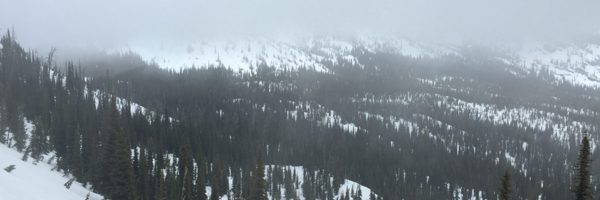
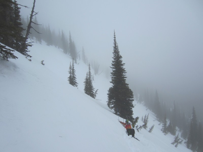
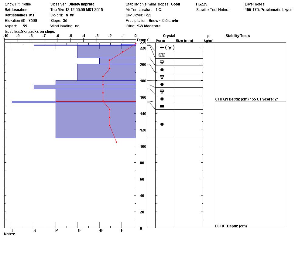
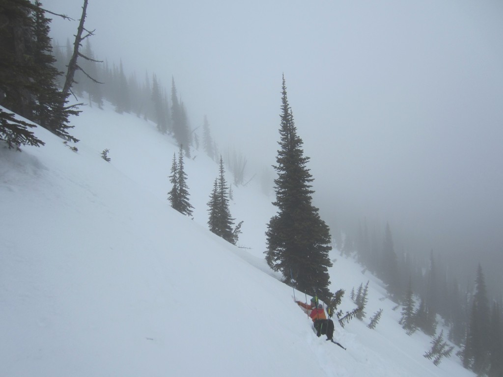
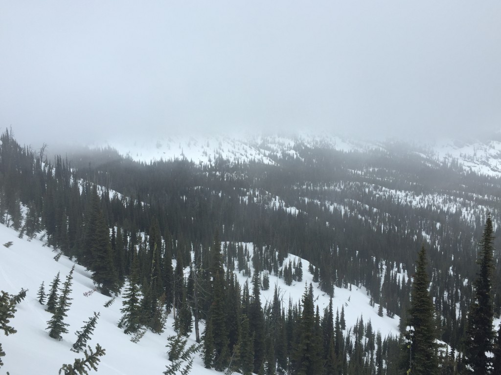
Dudley and I toured in the Rattlesnake yesterday, we had poor visibility with a variety of snow conditions. There was ice on windward slopes and rotten snow on leeward aspects at 7500 feet. The main concern we encountered was loose wet releases on unfrozen slopes. The deep persistent layer was reactive in compression tests but did not propagate in our ECT.

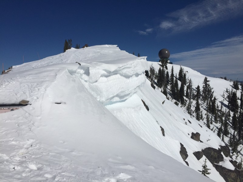
Tim was in the Lolo Pass area and his main avalanche problem was loose wet slides on steep slopes >35 degrees. The spring-like conditions are warming cornices, so be aware of cornice failures.

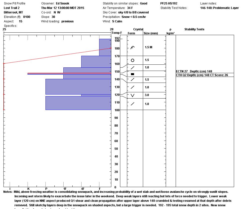
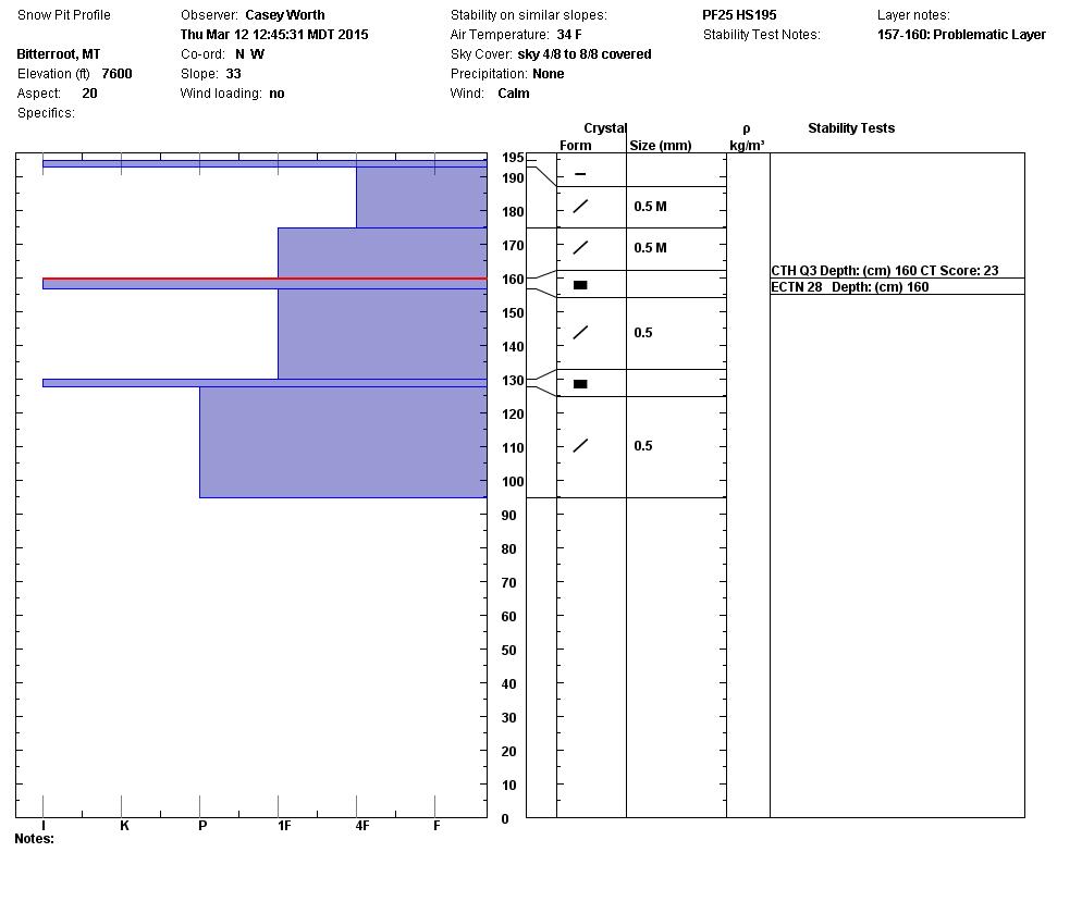
Ed and Casey were in the Lost Trail backcountry and had similar pit results on the  persistent weak layer 35 cm into the snowpack.  This layer failed in compression tests but had no propagation in ECT’s. The main concern is that on slopes that have not frozen overnight or that have warmed in the afternoon, it is possible to trigger a loose wet release.

When recreating in the backcountry on steep slopes look for the bull’s-eye clues: pinwheels, rollerballs and punching through the top layers of the snowpack. These are signs of instabilities in a warming snowpack and it is time to change aspects.

Weather and Avalanche Outlook

This weekend the high pressure is going to be replaced by a warm wet system which is forecasted to bring large amounts of precipitation.  The weather models call for rain in the mountains of up to 2 inches. If these events happens then the avalanche danger will rapidly increase with the addition of rain or large amounts of heavy wet snow.

Steve Karkanen will issue the next regularly scheduled advisory on Monday, March 16.


READ FULL ADVISORY  

Problem 1 - Unfrozen Steep Slopes

  • TYPE

    loose-wet

    Loose Wet

    Release of wet unconsolidated snow or slush. These avalanches typically occur within layers of wet snow near the surface of the snowpack, but they may quickly gouge into lower snowpack layers. Like Loose-Dry Avalanches,they start at a point and entrain snow as they move downhill, forming a fan-shaped avalanche. They generally move slowly, but can contain enough mass to cause significant damage to trees, cars or buildings. Other names for loose-wet avalanches include point-release avalanches or sluffs. Loose-wet avalanches can trigger slab avalanches that break into deeper snow layers.

  • SIZE

    3-4

    1-2 (Small-Large)

    The potential size of avalanche resulting from this problem.

  • LIKELIHOOD

    Likelihood-5

    Likely

    The likelihood of an avalanche resulting from this problem.

  • IMAGE

On slopes which have not frozen overnight it is possible to trigger a loose wet slide. Dudley and I were able to get some large pin wheels to release on these slopes yesterday in the Rattlesnake.

Problem 2 - Warming Temperatures

  • TYPE

    cornices

    Cornices / Cornice Fall

    Release of an overhanging mass of snow that forms as the wind moves snow over a sharp terrain feature, such as a ridge, and deposits snow on the down-wind side. They range from small wind lips of soft snow to large overhangs of hard snow that are 30 feet (~10 meters) or taller. They can break off the terrain suddenly and pull back onto the ridge top and catch people by surprise even on the flat ground above the slope. Even small cornices can have enough mass to be destructive and deadly. Cornice fall can entrain loose surface snow or trigger slab avalanches.

  • SIZE

    4-5

    2 (Large)

    The potential size of avalanche resulting from this problem.

  • LIKELIHOOD

    Likelihood-1

    Unlikely

    The likelihood of an avalanche resulting from this problem.

  • IMAGE

Spring and warming temperatures will weaken cornices. So pay attention to time the of day and your proximity to cornices.

Friday The 13th

FORECAST & OUTLOOK

This weekend the high pressure is going to be replaced by a warm wet system which is forecasted to bring large amounts of precipitation. The weather models call for rain in the mountains of up to 2 inches. If these events happens then the avalanche danger will rapidly increase with the addition of rain or large amounts of heavy wet snow.

This information is the sole responsibility of the Forest Service and does not apply to operating ski areas. The avalanche danger rating expires at midnight tonight but the information can help you make a more informed decision regarding travel in avalanche terrain for the next few days.

Our advisory area includes National Forest System lands in the Bitterroot Mountains from Lost Trail Pass north to Granite Pass, the Rattlesnake Mountains north of Missoula and the Southern Swan and Mission Mountains near Seeley Lake, MT. Avalanche information for the Lookout Pass/St. Regis Basin area is available from the Idaho Panhandle Avalanche Center.