
The avalanche danger is rated Considerable in the west central Montana backcountry above 6000ft. We have a very weak snowpack structure in the advisory area. Human triggered avalanches are likely. Dangerous avalanche conditions exist.
Good morning, this is Travis Craft with the West Central Montana Avalanche Center’s avalanche advisory for December 12, 2015. We are now into our regular advisory schedule. This danger rating does not apply to operating ski areas, expires at midnight tonight (Dec.12) and is the sole responsibility of the U. S. Forest Service.
Weather and Snowpack Discussion
This morning mountain temperatures are in the mid and upper 20’s and winds are light with gusts of 10 mph out of the South-South-West. We picked up 1 inch of snow on throughout the advisory area.This morning scattered snow showers will move through the area dropping minimal amounts of snow. A potent weather system is forecasted to enter our area tonight and bring with it a large accumulation of snow and high winds which will rapidly increase the avalanche hazard in the backcountry.
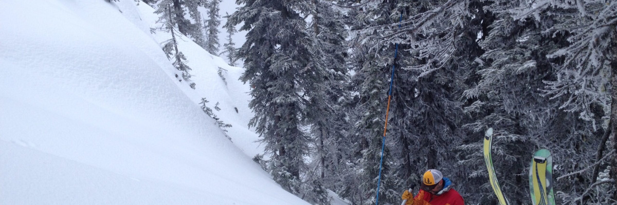
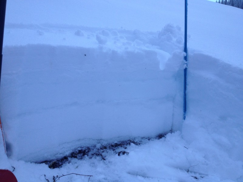
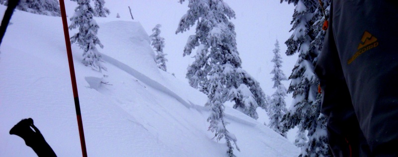
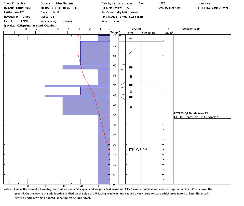
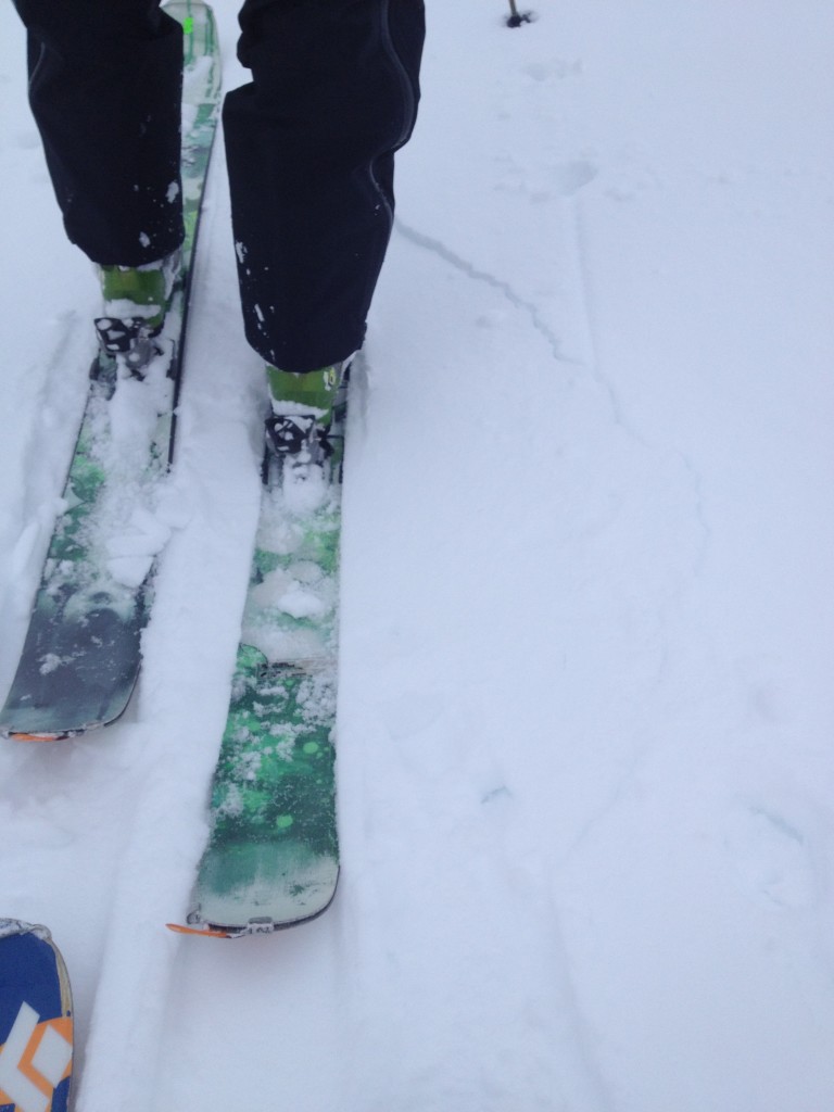
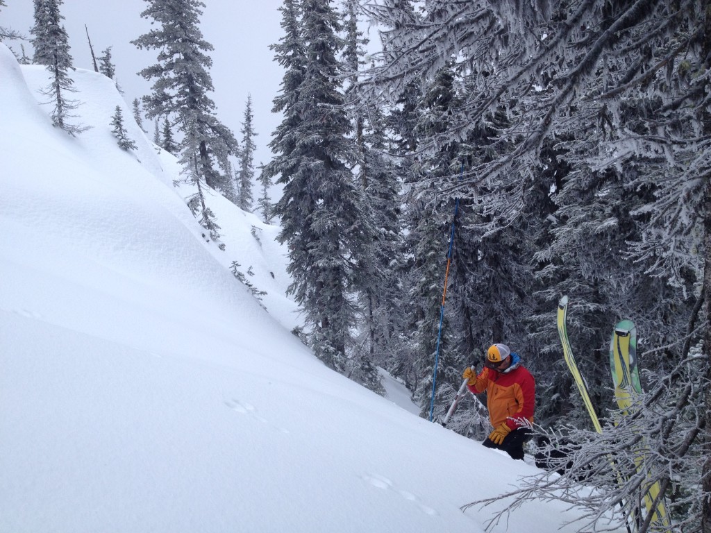
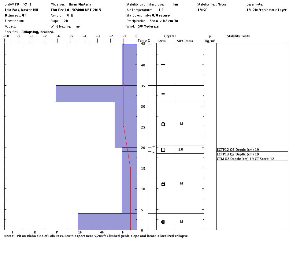
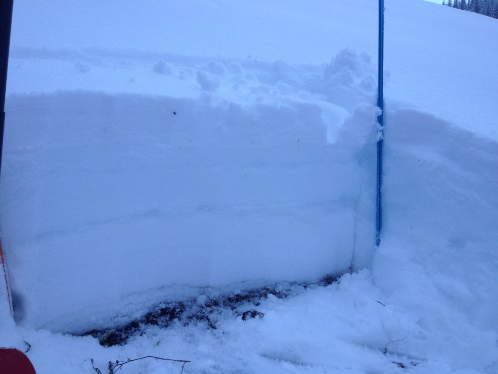
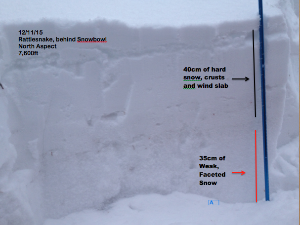
The main problem we have in the advisory area is a persistent weak layer consisting of facets that formed during the early season freeze above 6000 feet. These facets have created a very weak snowpack structure.(profile1)(profile2)(video) We have facets in the bottom of the snowpack that formed below a crust and to the ground with a well consolidated slab on top.(pit) When touring and getting off our skis we are sinking all the way to the ground. We are also getting whumpfinging and collapsing, as well as, shooting cracks from our skis when touring throughout our advisory area.(pic) In our ECT’s in the Rattlesnake and Lolo Pass we are seeing propagation on this layer of facets. In one of the tests on an East aspect at 7600 feet, this layer propagated and failed while isolating the column. All of these are significant signs of instability which tell us that we should not enter into avalanche terrain. With all of these signs of instability, terrain should be carefully evaluated as to what is above you and if you are connected to steeper terrain where you could remotely trigger an avalanche. Runout zones should be avoided.
The second problem is that wind slabs have formed on leeward slopes sitting on this weak structure. The high winds that accompanied the last storm created wind slabs on these leeward slopes, which are sensitive to triggers. All wind loaded slopes should be treated as suspect due to the poor structure of the snowpack.
Weather Forecast and Avalanche Outlook
With the poor snow structure and and more snow in the forecast, any significant new loading will dramatically increase the instabilities in this weak snowpack. Significant wind may accompany this storm so leeward slopes will also have an increased avalanche hazard. With these two factors I would expect the avalanche danger to increase rapidly. We will be in the field this weekend evaluating the snowpack and will issue the next advisory on Tuesday, December 14, 2015. If you are out, please send us some public observations. We are now publishing three advisories a week: Tuesdays, Thursdays and Saturdays. Our beacon park at Lolo Pass is also up and running.


