Posted:
Dec 24, 2015 @ 6:32 am

The avalanche danger is rated CONSIDERABLE in the west central Montana backcountry. Human-triggered avalanches are likely. Careful snowpack evaluation, cautious route-finding and conservative decision making are essential.

Good morning, this is Travis Craft with the West Central Montana Avalanche Center’s avalanche advisory for December 24, 2015. This danger rating does not apply to operating ski areas, expires at midnight tonight (Dec.24) and is the sole responsibility of the U.S. Forest Service.

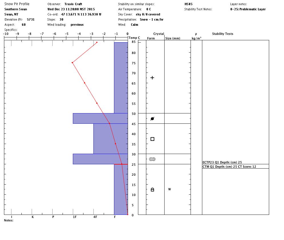
Weather and Snowpack

Mountain temperatures are ranging from 12 F to the low 20’s F.  Winds are light with gusts 7 mph out of the South.  The advisory area received between 2 and 7 inches of new snow in the last 24 hours.

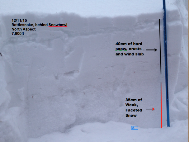
The primary avalanche problem is the persistent “Thanksgiving slab”.  This slab is becoming more reactive with the new loading.  Steve and I found the facets in the Seeley Lake area and they propagated in our stability tests(pit). Dudley was in the Rattlesnake and had similar failures on the basal facets. This layer can be found on shaded aspects and in shallow snowpacks. The only way to find this layer is to dig into the snowpack.  This is a spooky problem and the only red flag is found in the pit.

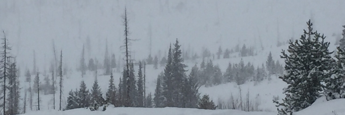
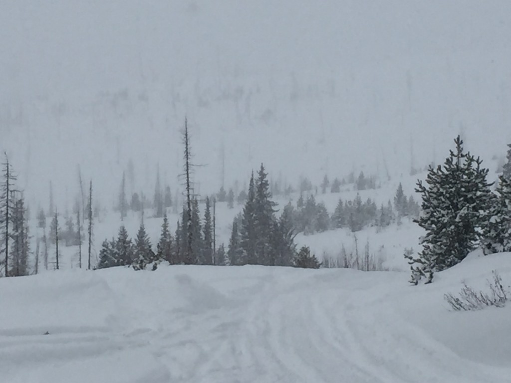
The second problem is loose dry avalanches or storm slab avalanches. Depending on how much snow was deposited by the storm cycle, either can occur.  In the southern Missions we saw a storm slab and in the Rattlesnake which received less snow, Dudley saw loose dry avalanches.

In the advisory area, we have found the “Thanksgiving slab” on many different aspects and at all elevations.  In some areas we have had some bullseye data (collapsing or whumpfing), but in most situations the only red flag is in our snow pits. You need to dig to find this clue to instability. Conservative decision making is must.

Weather and Avalanche Outlook

The forecast continues to call for light to moderate accumulations of snow for today and tonight. I would expect the avalanche danger to stay at considerable with this forecast.

Ski and ride safe.  I will issue the next advisory on Saturday, December 26.

Happy holidays!

READ FULL ADVISORY  

Problem 1 - Persistent Slab

  • TYPE

    persistent-slabs

    Persistent Slabs

    Release of a cohesive layer of soft to hard snow (a slab) in the middle to upper snowpack, when the bond to an underlying persistent weak layer breaks.  Persistent layers include: surface hoar, depth hoar, near-surface facets, or faceted snow. Persistent weak layers can continue to produce avalanches for days, weeks or even months, making them especially dangerous and tricky. As additional snow and wind events build a thicker slab on top of the persistent weak layer, this avalanche problem may develop into a Persistent, Deep-Slab.

  • SIZE

    4-5

    2 (Large)

    The potential size of avalanche resulting from this problem.

  • LIKELIHOOD

    Likelihood-3

    Possible

    The likelihood of an avalanche resulting from this problem.

  • IMAGE

This slab is failing on the basal facets formed during the Thanksgiving cold snap.  The only way to find the weak layer is to dig down and find them.

Problem 2 - Loose Dry

  • TYPE

    loose-dry

    Loose Dry

    Release of wet unconsolidated snow or slush. These avalanches typically occur within layers of wet snow near the surface of the snowpack, but they may quickly gouge into lower snowpack layers. Like Loose-Dry Avalanches,they start at a point and entrain snow as they move downhill, forming a fan-shaped avalanche. They generally move slowly, but can contain enough mass to cause significant damage to trees, cars or buildings. Other names for loose-wet avalanches include point-release avalanches or sluffs. Loose-wet avalanches can trigger slab avalanches that break into deeper snow layers.

  • SIZE

    2-3

    1 (Small)

    The potential size of avalanche resulting from this problem.

  • LIKELIHOOD

    Likelihood-6

    Likely/Very Likely

    The likelihood of an avalanche resulting from this problem.

Loose dry avalanches are likely to be triggered.

Problem 3 - Storm Slab

  • TYPE

    storm-slabs

    Storm Slabs

    Release of a soft cohesive layer (a slab) of new snow which breaks within the storm snow or on the old snow surface. Storm-slab problems typically last between a few hours and few days. Storm-slabs that form over a persistent weak layer (surface hoar, depth hoar, or near-surface facets) may be termed Persistent Slabs or may develop into Persistent Slabs.

  • SIZE

    2-3

    1 (Small)

    The potential size of avalanche resulting from this problem.

  • LIKELIHOOD

    Likelihood-4

    Possible/Likely

    The likelihood of an avalanche resulting from this problem.

A storm slab has developed in regions of the advisory area that received more snow.

FORECAST & OUTLOOK

Light to moderate snow accumulations throughout the advisory area today and tonight.

This information is the sole responsibility of the Forest Service and does not apply to operating ski areas. The avalanche danger rating expires at midnight tonight but the information can help you make a more informed decision regarding travel in avalanche terrain for the next few days.

Our advisory area includes National Forest System lands in the Bitterroot Mountains from Lost Trail Pass north to Granite Pass, the Rattlesnake Mountains north of Missoula and the Southern Swan and Mission Mountains near Seeley Lake, MT. Avalanche information for the Lookout Pass/St. Regis Basin area is available from the Idaho Panhandle Avalanche Center.