Posted:
Dec 31, 2015 @ 6:31 am

The current avalanche danger is MODERATE in the west central Montana backcountry. Human triggered avalanches are possible. Heightened avalanche conditions exist in isolated terrain.

Good morning, this is Travis Craft with the West Central Montana Avalanche Center’s avalanche advisory for December 31, 2015. This danger rating does not apply to operating ski areas, expires at midnight tonight (Dec.31) and is the sole responsibility of the U.S. Forest Service.

Weather and Snowpack

A high pressure system is moving into our advisory area later today.  Winds are 6 mph with gusts of 13 out of the NNW.  The region received trace amounts of new snow.  Temperatures are 7 to 10 degrees F in the mountains.

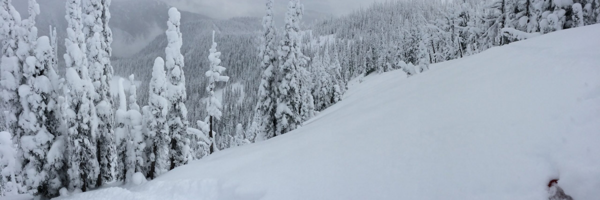
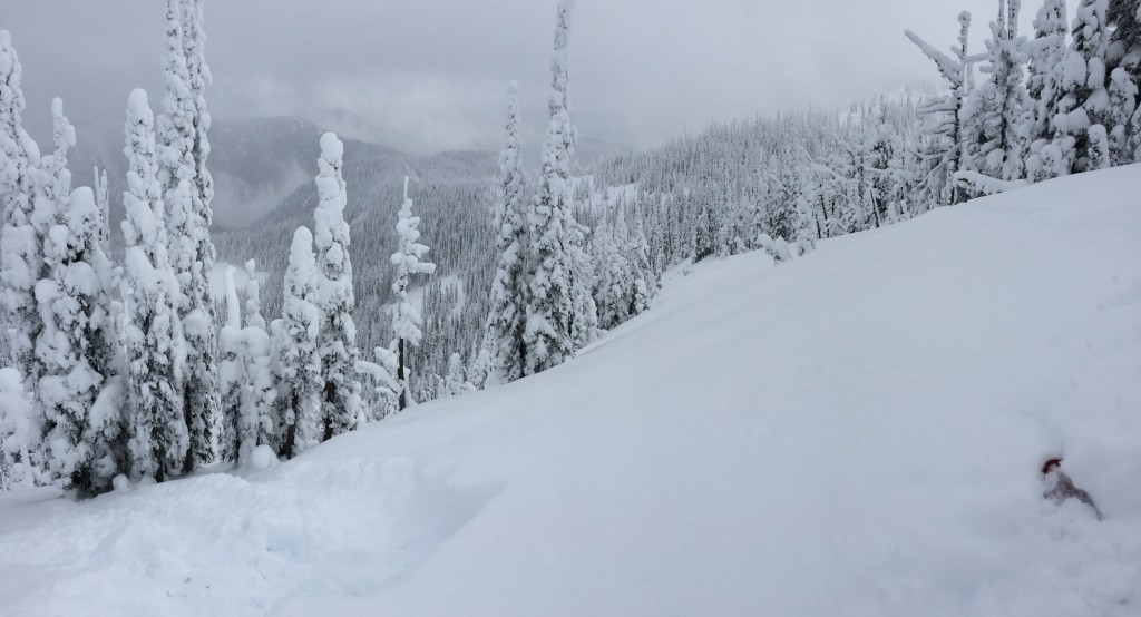
Dudley and I toured near Lost Trail Pass yesterday and Steve was in the Rattlesnake.  We all observed a healing snowpack.  Dudley and I observed large surface hoar growth in the  Bitterroots.

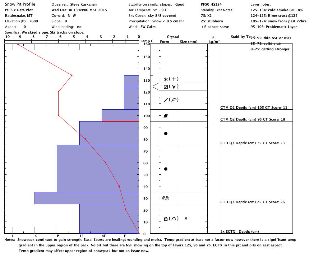
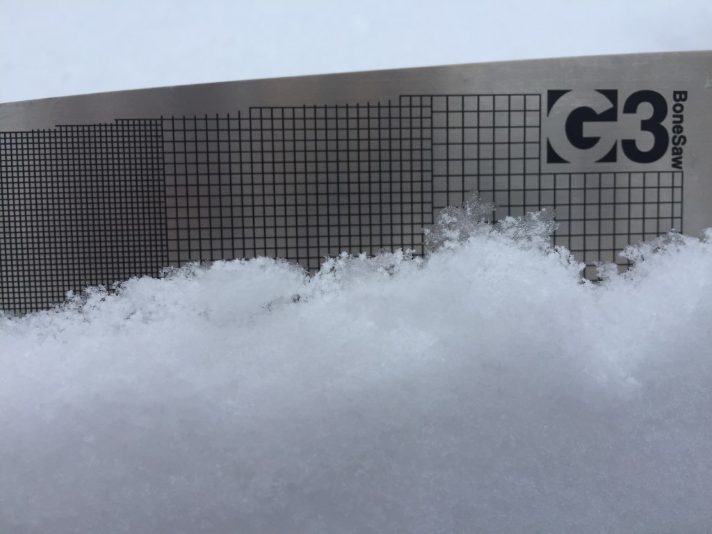
The primary avalanche problem is the persistent slab which is failing on basal facets.  This weak layer is unreactive in deeper snowpacks ( > 100 cm).  In shallower snowpacks (<100 cm) it can be triggered.  Terrain evaluation is key,  avoid likely trigger points (rock outcrops, tree clusters, and wind scoured ridges) that have a shallower snowpack.  This layer is giving us no bullseye data like collapsing or whumphing.  The only way to assess this layer is to dig and see if it gives unstable results in your pit tests.

The second problem is dry loose snow avalanches.  In the Rattlesnake and the southern Bitterroots, on slopes >35 degrees, natural releases were observed.  These are not a problem unless they take you into a terrain trap (trees, cliffs, and gullies).

The third avalanche problem is a wind slab that formed in the last storm.  These are on leeward slopes at elevations above 7000 feet.  These are hard to trigger because they are very stiff.  Look for wind slabs on ridgelines and cross loaded slopes.

Avalanche and Weather Outlook

The advisory area should have light accumulations of snow this morning.  This afternoon, a high pressure system moves in and becomes the dominant force through the weekend.  I would expect the avalanche danger to stay the same with these conditions.  We observed surface hoar in the southern Bitterroots.  This will be the next weak layer once it is buried.

Ski and ride safe.  We have a new beacon park set up in Seeley Lake area by the Driftriders warming hut.  The other beacon parks are located at the top of Snowbowl, the top of chair 2 at Lost Trail, and Lolo Pass near the visitors center.  Logan King will issue the next advisory on January 02, 2016. Happy New Year!


READ FULL ADVISORY  

Problem 1 - Persistent Slab

  • TYPE

    persistent-slabs

    Persistent Slabs

    Release of a cohesive layer of soft to hard snow (a slab) in the middle to upper snowpack, when the bond to an underlying persistent weak layer breaks.  Persistent layers include: surface hoar, depth hoar, near-surface facets, or faceted snow. Persistent weak layers can continue to produce avalanches for days, weeks or even months, making them especially dangerous and tricky. As additional snow and wind events build a thicker slab on top of the persistent weak layer, this avalanche problem may develop into a Persistent, Deep-Slab.

  • SIZE

    4-5

    2 (Large)

    The potential size of avalanche resulting from this problem.

  • LIKELIHOOD

    Likelihood-2

    Unlikely/Possible

    The likelihood of an avalanche resulting from this problem.

The basal facets are healing. They are not reactive in deep snowpacks over 100 cm, but will propagate in shallower snowpacks.  Terrain evaluation is key, look for areas on slopes that could be a likely trigger point (rock outcrops, tree clusters, and wind scoured ridges).  These areas will have a shallower snowpack and be places that you can initiate the weak layer to cause a slab avalanche.

Problem 2 - Loose Dry

  • TYPE

    loose-dry

    Loose Dry

    Release of wet unconsolidated snow or slush. These avalanches typically occur within layers of wet snow near the surface of the snowpack, but they may quickly gouge into lower snowpack layers. Like Loose-Dry Avalanches,they start at a point and entrain snow as they move downhill, forming a fan-shaped avalanche. They generally move slowly, but can contain enough mass to cause significant damage to trees, cars or buildings. Other names for loose-wet avalanches include point-release avalanches or sluffs. Loose-wet avalanches can trigger slab avalanches that break into deeper snow layers.

  • SIZE

    1-2

    < 1 (Small)

    The potential size of avalanche resulting from this problem.

  • LIKELIHOOD

    Likelihood-3

    Possible

    The likelihood of an avalanche resulting from this problem.

On steeper terrain >35 degrees we saw some small natural releases of dry loose avalanches.  These are not a problem unless they take you into a terrain trap (trees, cliffs, and gullies).

Problem 3 - Wind Slabs

  • TYPE

    wind-slabs

    Wind Slabs

    Release of a cohesive layer of snow (a slab) formed by the wind.  Wind typically erodes snow from the upwind sides of terrain features and deposits snow on the downwind side.  Wind slabs are often smooth and rounded and sometimes sound hollow, and can range from soft to hard. Wind slabs that form over a persistent weak layer (surface hoar, depth hoar, or near-surface facets) may be termed Persistent Slabs or may develop into Persistent Slabs.

  • SIZE

    2-3

    1 (Small)

    The potential size of avalanche resulting from this problem.

  • LIKELIHOOD

    Likelihood-1

    Unlikely

    The likelihood of an avalanche resulting from this problem.

These wind slabs are found on lee terrain and are very stubborn to trigger.  Look at the terrain and be aware of cross loaded gullies and wind loaded ridge tops.

FORECAST & OUTLOOK

High pressure moves in today.

This information is the sole responsibility of the Forest Service and does not apply to operating ski areas. The avalanche danger rating expires at midnight tonight but the information can help you make a more informed decision regarding travel in avalanche terrain for the next few days.

Our advisory area includes National Forest System lands in the Bitterroot Mountains from Lost Trail Pass north to Granite Pass, the Rattlesnake Mountains north of Missoula and the Southern Swan and Mission Mountains near Seeley Lake, MT. Avalanche information for the Lookout Pass/St. Regis Basin area is available from the Idaho Panhandle Avalanche Center.