Posted:
Jan 5, 2016 @ 6:45 am

The current avalanche danger is Low in the west central Montana backcountry.  Conditions are generally safe but it is possible to find unstable snow in isolated areas particularly on shaded terrain steeper than 35 degrees above 7000 feet.  There is always some chance of triggering an avalanche if you recreate or travel on slopes 35 degrees and steeper.

Good morning, this is Travis Craft with the West Central Montana Avalanche Center’s avalanche advisory for January 05, 2016. This danger rating does not apply to operating ski areas, expires at midnight tonight (Jan.05) and is the sole responsibility of the U.S. Forest Service.

Weather and Snowpack

Today mountain temperatures are in the high 20’s or above freezing.  Winds are 9 mph with gusts of 14 mph out of the East.  The advisory area has received no new snow.

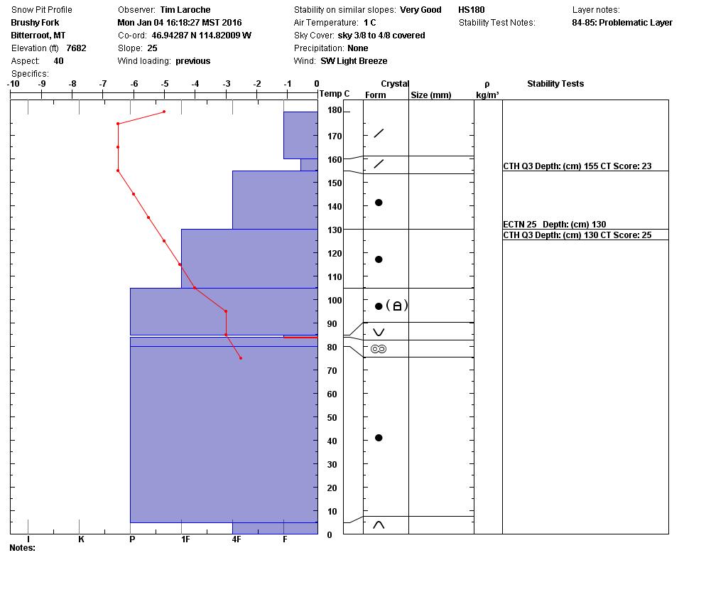
The mild temperatures above 6000 feet have helped to stabilize our snowpack.  Low hazard means that conditions are relatively safe.  Specific terrain has lingering instabilities.  Shaded steep slopes above 7000 feet are where we are finding the Thanksgiving facets to still show some signs of instability.  I would recommend that you dig a pit and look for this layer.  On Monday in the Rattlesnake we found this layer was reactive on a shaded steep slope.  The Rattlesnake is the only area that we are getting any signs of instability on the basal facets.  There is always some chance of triggering an avalanche if you recreate or travel on slopes 35 degrees and steeper.

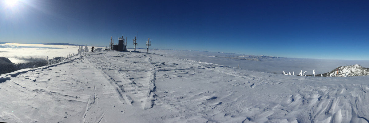
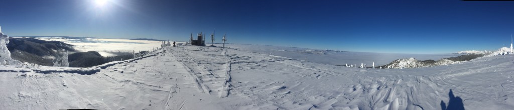
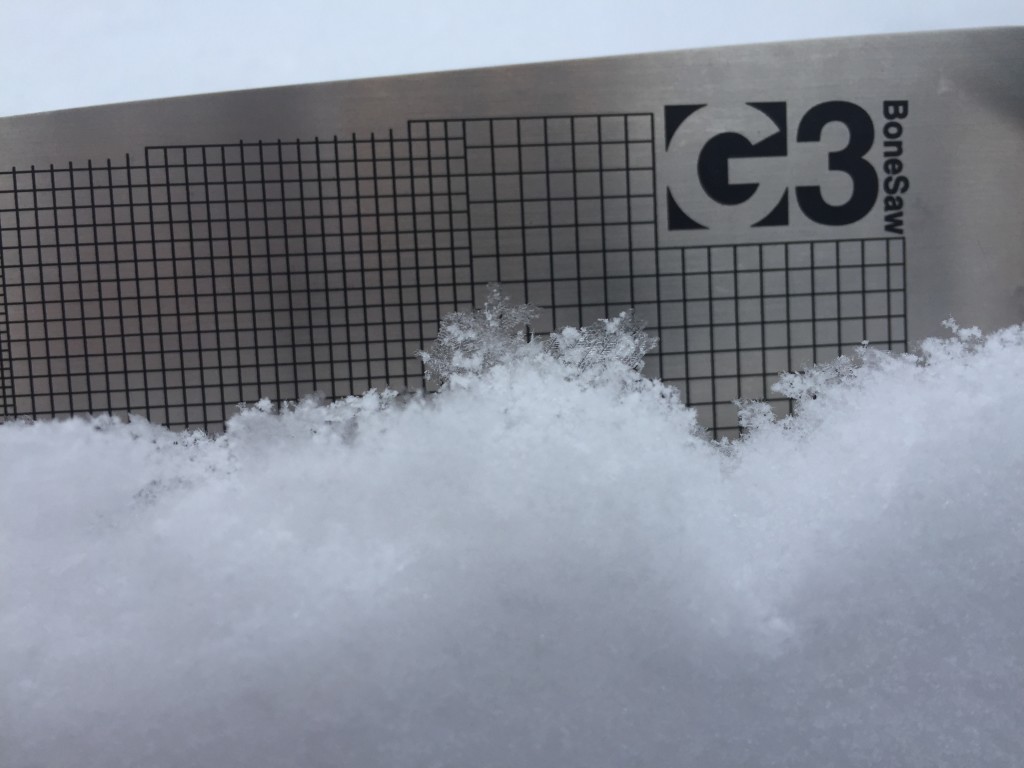
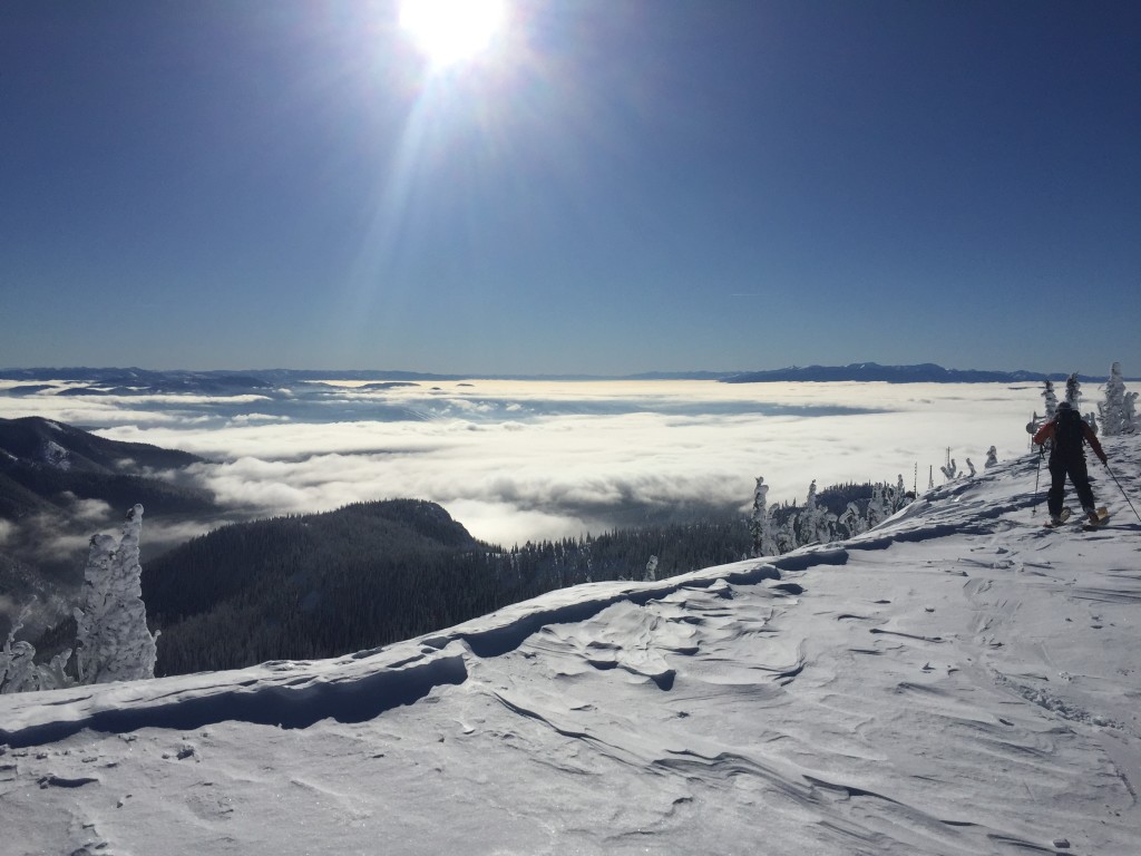
Tim and I toured in the northern Bitterroots yesterday and found a well bonded snowpack.  The weather was above freezing and mild above 7000 feet.  We found some isolated pockets of wind slabs, Steve found a similar problem in the Rattlesnake.  With the warmer temperatures we saw trees shedding snow and on sun exposed slopes, a melt freeze crust.  Steve reported finding a melt freeze crust too.  Tim and I found pockets of surface hoar where the sun and wind had not beaten it down.  These new surfaces will be our future layers of concern with the addition of new snow.

Avalanche and Weather Outlook

This weather flow will continue with strong inversions.  Some mountain locations are above freezing this morning.  There is a chance of a disturbance to come in today and drop a small amount of new snow.  With this weather pattern I would expect the avalanche danger to stay the same.  With a  warming surface snowpack look for clues such as rollerballs, they are signs that loose wet avalanches could be triggered.

I will issue the next advisory on January 07.  Ski and ride safe.


READ FULL ADVISORY  

Problem 1 - Persistent Slab

  • TYPE

    persistent-slabs

    Persistent Slabs

    Release of a cohesive layer of soft to hard snow (a slab) in the middle to upper snowpack, when the bond to an underlying persistent weak layer breaks.  Persistent layers include: surface hoar, depth hoar, near-surface facets, or faceted snow. Persistent weak layers can continue to produce avalanches for days, weeks or even months, making them especially dangerous and tricky. As additional snow and wind events build a thicker slab on top of the persistent weak layer, this avalanche problem may develop into a Persistent, Deep-Slab.

  • SIZE

    3-4

    1-2 (Small-Large)

    The potential size of avalanche resulting from this problem.

  • LIKELIHOOD

    Likelihood-1

    Unlikely

    The likelihood of an avalanche resulting from this problem.

On shaded slopes greater than 35 degree the basal facets can be reactive.  Dig into the slope you are choosing to recreate on and see if this layer is reactive in your pit.

Problem 2 - Wind Slabs

  • TYPE

    wind-slabs

    Wind Slabs

    Release of a cohesive layer of snow (a slab) formed by the wind.  Wind typically erodes snow from the upwind sides of terrain features and deposits snow on the downwind side.  Wind slabs are often smooth and rounded and sometimes sound hollow, and can range from soft to hard. Wind slabs that form over a persistent weak layer (surface hoar, depth hoar, or near-surface facets) may be termed Persistent Slabs or may develop into Persistent Slabs.

  • SIZE

    1-2

    < 1 (Small)

    The potential size of avalanche resulting from this problem.

  • LIKELIHOOD

    Likelihood-1

    Unlikely

    The likelihood of an avalanche resulting from this problem.

Small pockets of wind slabs.  These are located on leeward terrain.

Problem 3 - Loose Wet

  • TYPE

    loose-wet

    Loose Wet

    Release of wet unconsolidated snow or slush. These avalanches typically occur within layers of wet snow near the surface of the snowpack, but they may quickly gouge into lower snowpack layers. Like Loose-Dry Avalanches,they start at a point and entrain snow as they move downhill, forming a fan-shaped avalanche. They generally move slowly, but can contain enough mass to cause significant damage to trees, cars or buildings. Other names for loose-wet avalanches include point-release avalanches or sluffs. Loose-wet avalanches can trigger slab avalanches that break into deeper snow layers.

  • SIZE

    1-2

    < 1 (Small)

    The potential size of avalanche resulting from this problem.

  • LIKELIHOOD

    Likelihood-1

    Unlikely

    The likelihood of an avalanche resulting from this problem.

  • ADDED DANGER

    Increased Slope Danger

    Increased/Added Danger

    There is an increased risk of avalanches on these slopes:

    S - South

With afternoon warm temperatures on sun exposed slopes there could be a chance of triggering a loose wet avalanche.  These are small and manageable unless they take you into a terrain trap (trees, gullies,and cliffs).

VIDEO

FORECAST & OUTLOOK

Strong valley inversions.

This information is the sole responsibility of the Forest Service and does not apply to operating ski areas. The avalanche danger rating expires at midnight tonight but the information can help you make a more informed decision regarding travel in avalanche terrain for the next few days.

Our advisory area includes National Forest System lands in the Bitterroot Mountains from Lost Trail Pass north to Granite Pass, the Rattlesnake Mountains north of Missoula and the Southern Swan and Mission Mountains near Seeley Lake, MT. Avalanche information for the Lookout Pass/St. Regis Basin area is available from the Idaho Panhandle Avalanche Center.