Posted:
Feb 11, 2016 @ 6:41 am

The current avalanche danger is LOW in the west central Montana backcountry this morning and will increase to moderate in the afternoon.  With rising temperatures and peak solar radiation, steep rocky slopes will have the ability to produce loose wet avalanches in the afternoon.

Good morning, this is Travis Craft with the West Central Montana Avalanche Center’s avalanche advisory for February 11, 2016.  This danger rating does not apply to operating ski areas, expires at midnight tonight and is the sole responsibility of the U.S. Forest Service.

Weather and Snowpack

Today mountain temperatures are  27 F above 7800 ft and all other sites at lower elevations are above freezing.   All sites below 7800 ft never got below 32 F in the last 24 hours. Winds are 8 mph with gusts of 14 mph out of the WSW.  The advisory area has received no new snow overnight.

Overall the snowpack has settled and we are now in springlike conditions.  The avalanche problems are due to solar radiation and rising temperatures throughout the day (Diurnal Fluctuations).  The way to manage these types of problems is to move from a sunny aspect to a shadier one throughout the day.

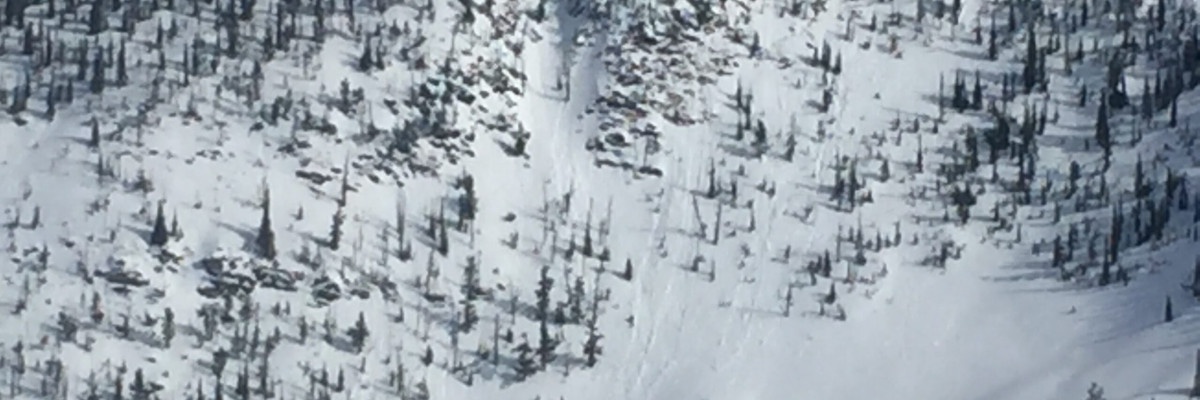
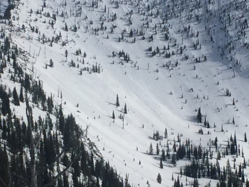
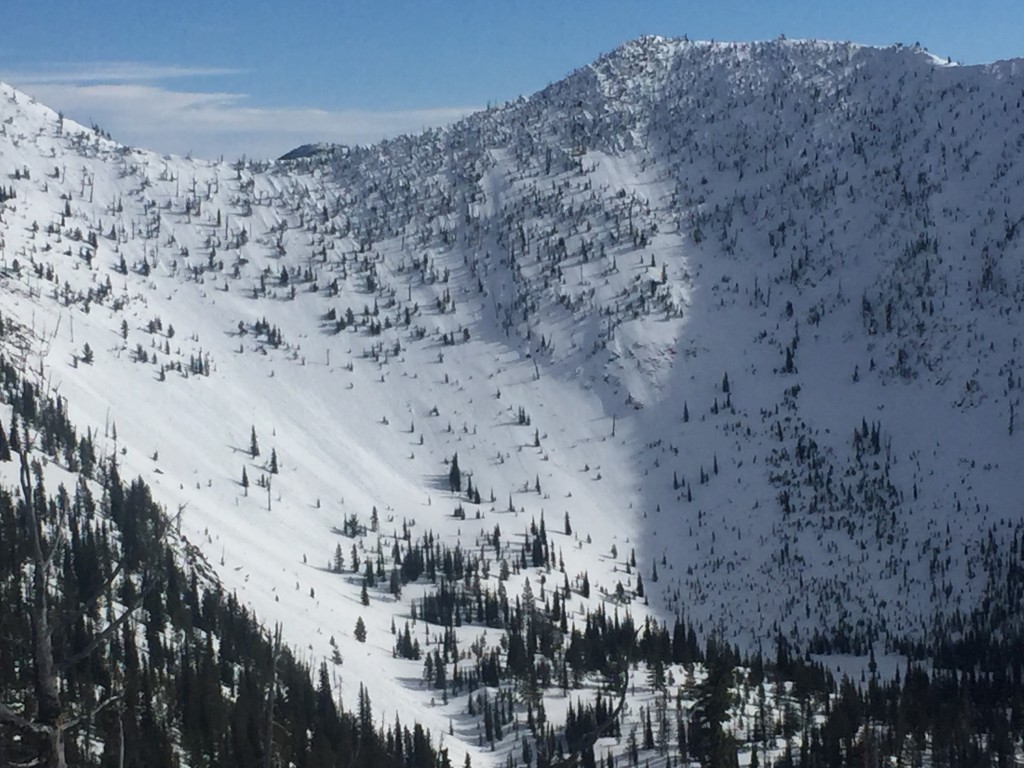
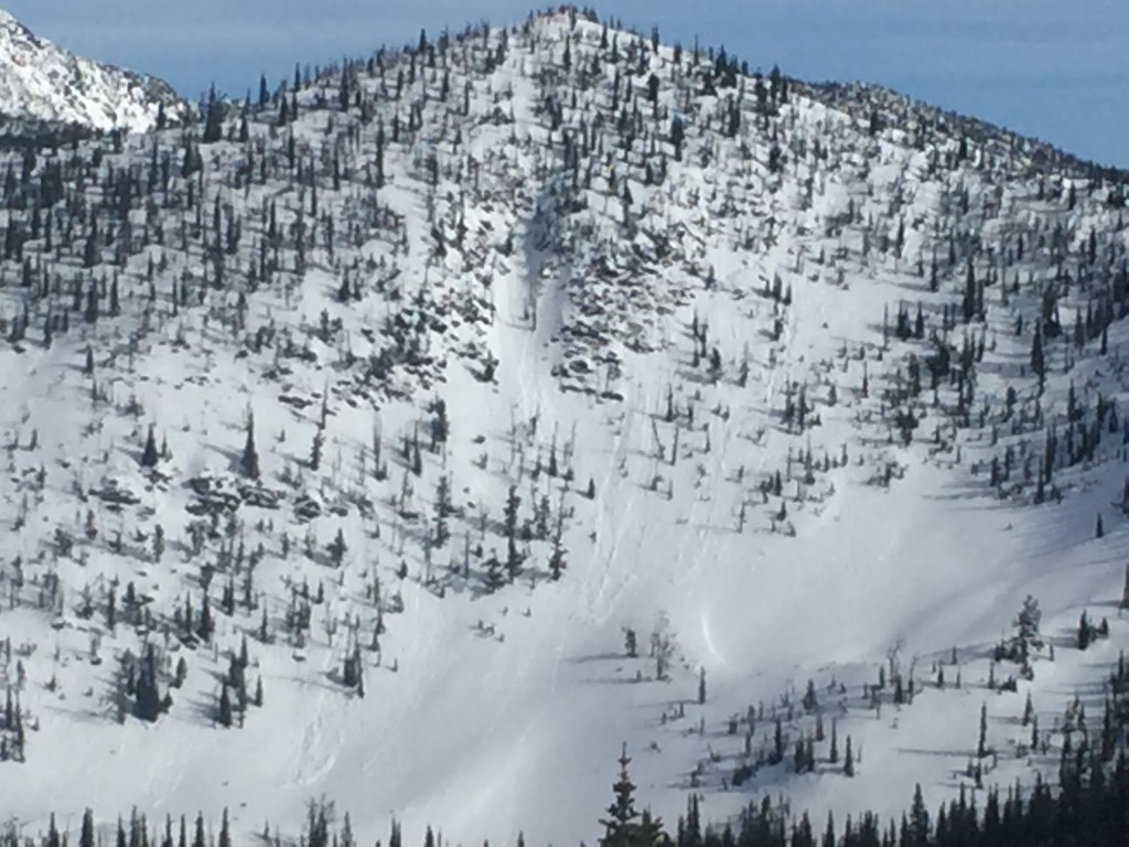
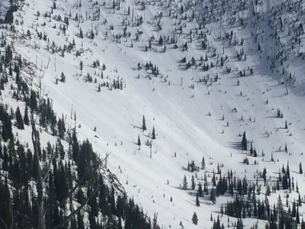
Tim and I toured in the Rattlesnake yesterday and observed loose wet avalanches on steep rocky slopes caused by Monday’s and yesterday’s warm temperatures and solar radiation.   The primary avalanche problem today is loose wet avalanches in the afternoon.  These are generally not a problem unless they knock you off your feet and take you into a terrain trap (cliff,  tree, or gully).  If the aspect you are recreating on has pinwheels or rollerballs on it change aspects to shadier one.

The second avalanche problem is cornice failure.  The cornices were built up last week from the wind.  The warmer temperatures and sun have weakened cornices so give them a wide berth and treat them with respect.

Weather and Avalanche Outlook

We are entering a weather change later today into tonight.  We could see some scattered showers with rain to 6000 ft.  Friday and Saturday a cold front enters the area and drops the snow line to below 5000 ft. The avalanche danger will stay the same.  The key factor to manage loose wet avalanches is aspect.  If the aspect you are on has pinwheels or rollerballs change to a shadier one.

Ski and ride safe.  I will issue the next advisory on Saturday.


READ FULL ADVISORY  

Problem 1 - Loose Wet

  • TYPE

    loose-wet

    Loose Wet

    Release of wet unconsolidated snow or slush. These avalanches typically occur within layers of wet snow near the surface of the snowpack, but they may quickly gouge into lower snowpack layers. Like Loose-Dry Avalanches,they start at a point and entrain snow as they move downhill, forming a fan-shaped avalanche. They generally move slowly, but can contain enough mass to cause significant damage to trees, cars or buildings. Other names for loose-wet avalanches include point-release avalanches or sluffs. Loose-wet avalanches can trigger slab avalanches that break into deeper snow layers.

  • SIZE

    2-3

    1 (Small)

    The potential size of avalanche resulting from this problem.

  • LIKELIHOOD

    Likelihood-5

    Likely

    The likelihood of an avalanche resulting from this problem.

  • IMAGE

Steep rocky slopes during peak solar radiation will have the ability to produce small loose wet avalanches in the afternoon.

Problem 2 - Cornice

  • TYPE

    cornices

    Cornices / Cornice Fall

    Release of an overhanging mass of snow that forms as the wind moves snow over a sharp terrain feature, such as a ridge, and deposits snow on the down-wind side. They range from small wind lips of soft snow to large overhangs of hard snow that are 30 feet (~10 meters) or taller. They can break off the terrain suddenly and pull back onto the ridge top and catch people by surprise even on the flat ground above the slope. Even small cornices can have enough mass to be destructive and deadly. Cornice fall can entrain loose surface snow or trigger slab avalanches.

  • SIZE

    3-4

    1-2 (Small-Large)

    The potential size of avalanche resulting from this problem.

  • LIKELIHOOD

    Likelihood-1

    Unlikely

    The likelihood of an avalanche resulting from this problem.

Cornices are weakening with the warm temperatures.  Treat them with respect and give them a wide berth.

FORECAST & OUTLOOK

Sunny then possible rain tonight to 6000 ft.

This information is the sole responsibility of the Forest Service and does not apply to operating ski areas. The avalanche danger rating expires at midnight tonight but the information can help you make a more informed decision regarding travel in avalanche terrain for the next few days.

Our advisory area includes National Forest System lands in the Bitterroot Mountains from Lost Trail Pass north to Granite Pass, the Rattlesnake Mountains north of Missoula and the Southern Swan and Mission Mountains near Seeley Lake, MT. Avalanche information for the Lookout Pass/St. Regis Basin area is available from the Idaho Panhandle Avalanche Center.