Posted:
Mar 12, 2016 @ 6:45 am

The current avalanche danger is MODERATE for the west central Montana backcountry. Mild temperatures and a load of new dense snow will make human triggered avalanches possible on specific terrain features.

Good morning, this is Logan King with the West Central Montana Avalanche Center’s avalanche advisory for Saturday, March 12,  2016. This danger rating does not apply to operating ski areas, expires at midnight tonight and is the sole responsibility of the U.S. Forest Service.

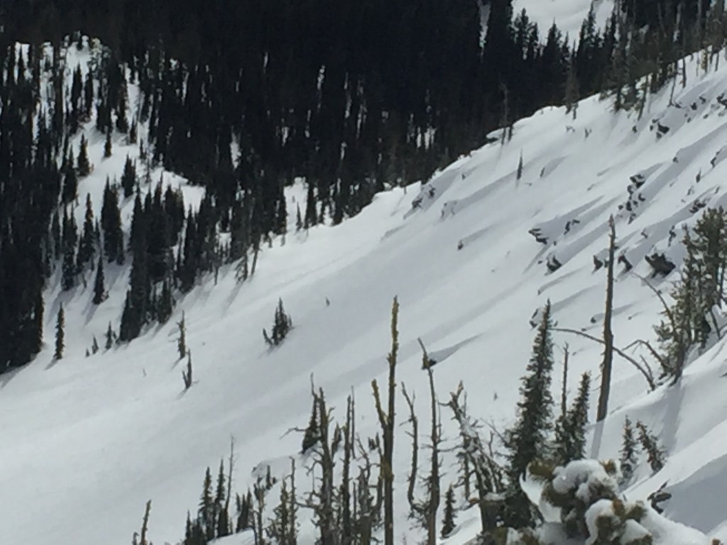
Weather and Snowpack

Precipitation over night was limited to 1-2 inches of snow in the southern Bitterroots. However since mid-week the advisory area received about an inch of SWE, providing a stout load mainly to the southern portion of the region. Mountain temperatures this morning are above freezing and the winds are currently 5 mph gusting to 17 mph from the SSE at Point 6, and 15 mph gusting to 21 mph  from the S at Deer Mountain further south.

Nick and Geoff toured near Lost Trail Pass on Thursday and found a new load of warm wet snow sitting on colder lower density snow. Travis and I were in the rattlesnake Yesterday and also found a modest new load of warm snow along with mild temperatures and significant solar radiation. The primary concern today will be loose wet slides in steep or heavily solar affected terrain. Avoid terrain traps and plan routes accordingly to avoid slopes that are receiving abundant solar radiation and warming.

Persistent slabs continue to be the secondary avalanche concern as we found layers of facets in the Rattlesnake and at Lost Trail that were failing readily in compression test but were failing to propagate. Although the persistent slabs are not propagating a new load of heavy snow may bring us to the tipping point that results in slab releases of the persistent weak layers. Dig pits on representative slopes to determine if persistent weak layers are present and if they may be reactive and reevaluate slopes as the load changes throughout the day.

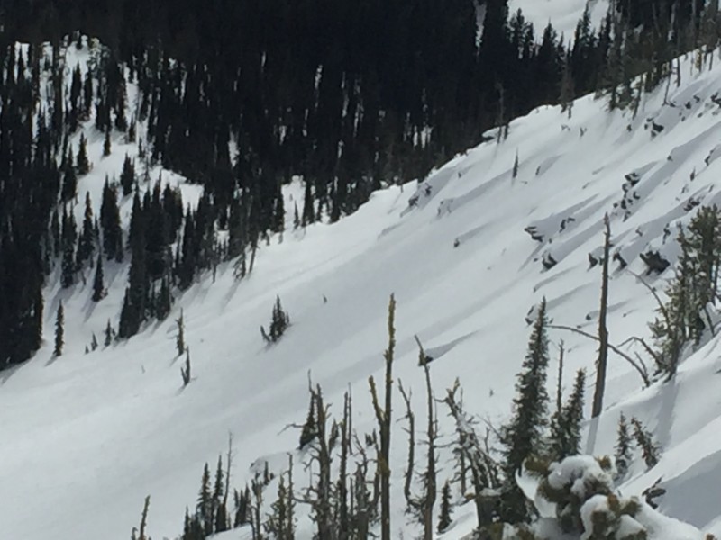
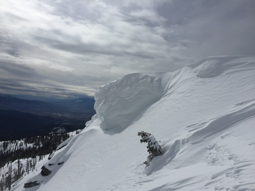
Lastly strong winds continue to be the norm for the advisory area, windslabs are small but widespread and can best be described as “pockety”. Carefully evaluate terrain for signs of wind deposition and be leery of cornices as well. The varied but strong winds have made some double cornices and pockets of wind slabs can be found on nearly all aspects.

Weather and Avalanche Outlook

The wet pattern that is currently moving through the area is expected to continue brining light snow and rain today with a cold front entering the area late Sunday.  Current conditions will leave snow lines high until the passage of the cold front later this weekend. Avalanche hazard will remain the same but keep in mind that avalanche activity will peak today in the afternoon with high solar radiation and warm temperatures.

The next advisory will be issued on Tuesday, if you get out please share your observations on our public observations page.

READ FULL ADVISORY  

Problem 1 - Loose Wet

  • TYPE

    loose-wet

    Loose Wet

    Release of wet unconsolidated snow or slush. These avalanches typically occur within layers of wet snow near the surface of the snowpack, but they may quickly gouge into lower snowpack layers. Like Loose-Dry Avalanches,they start at a point and entrain snow as they move downhill, forming a fan-shaped avalanche. They generally move slowly, but can contain enough mass to cause significant damage to trees, cars or buildings. Other names for loose-wet avalanches include point-release avalanches or sluffs. Loose-wet avalanches can trigger slab avalanches that break into deeper snow layers.

  • SIZE

    2-3

    1 (Small)

    The potential size of avalanche resulting from this problem.

  • LIKELIHOOD

    Likelihood-3

    Possible

    The likelihood of an avalanche resulting from this problem.

  • IMAGE

Wet loose slide activity will increase throughout the day as solar radiation peaks and temperatures climb.

Problem 2 - Persistent

  • TYPE

    persistent-slabs

    Persistent Slabs

    Release of a cohesive layer of soft to hard snow (a slab) in the middle to upper snowpack, when the bond to an underlying persistent weak layer breaks.  Persistent layers include: surface hoar, depth hoar, near-surface facets, or faceted snow. Persistent weak layers can continue to produce avalanches for days, weeks or even months, making them especially dangerous and tricky. As additional snow and wind events build a thicker slab on top of the persistent weak layer, this avalanche problem may develop into a Persistent, Deep-Slab.

  • SIZE

    3-4

    1-2 (Small-Large)

    The potential size of avalanche resulting from this problem.

  • LIKELIHOOD

    Likelihood-1

    Unlikely

    The likelihood of an avalanche resulting from this problem.

Persistent weak layers are reactive in compression tests but are not propagating very readily.

Problem 3 - Windslabs

  • TYPE

    wind-slabs

    Wind Slabs

    Release of a cohesive layer of snow (a slab) formed by the wind.  Wind typically erodes snow from the upwind sides of terrain features and deposits snow on the downwind side.  Wind slabs are often smooth and rounded and sometimes sound hollow, and can range from soft to hard. Wind slabs that form over a persistent weak layer (surface hoar, depth hoar, or near-surface facets) may be termed Persistent Slabs or may develop into Persistent Slabs.

  • SIZE

    2-3

    1 (Small)

    The potential size of avalanche resulting from this problem.

  • LIKELIHOOD

    Likelihood-2

    Unlikely/Possible

    The likelihood of an avalanche resulting from this problem.

  • IMAGE

Small pockets of windslabs will be found in isolated terrain above 7,000ft.

FORECAST & OUTLOOK

Light snow showers are expected today, snow totals will be modest with the best chance of significant snow coming Sunday as a cold front moves through the region.

This information is the sole responsibility of the Forest Service and does not apply to operating ski areas. The avalanche danger rating expires at midnight tonight but the information can help you make a more informed decision regarding travel in avalanche terrain for the next few days.

Our advisory area includes National Forest System lands in the Bitterroot Mountains from Lost Trail Pass north to Granite Pass, the Rattlesnake Mountains north of Missoula and the Southern Swan and Mission Mountains near Seeley Lake, MT. Avalanche information for the Lookout Pass/St. Regis Basin area is available from the Idaho Panhandle Avalanche Center.