Posted:
Mar 31, 2016 @ 6:15 am

The current avalanche danger is Moderate for the west central Montana backcountry. Small human triggered avalanches in specific areas and larger avalanches in isolated terrain are possible. 

Good morning,  this is Logan King with the West Central Montana Avalanche Center’s avalanche advisory for Thursday, March 31st, 2016. This danger rating does not apply to operating ski areas, expires at midnight tonight and is the sole responsibility of the U.S. Forest Service.

Weather and Snowpack

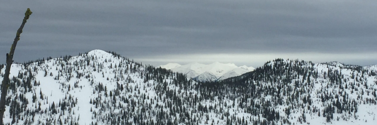
A Canadian cold front is working its way into the region and will bring cooler temperatures and light snow before warming for the weekend. As of 5am this morning a trace to 2 inches of snow have been recorded in the advisory area. Winds at Point 6 are currently 18 gusting to 29 from the north and mountain temperatures are hovering just above freezing.

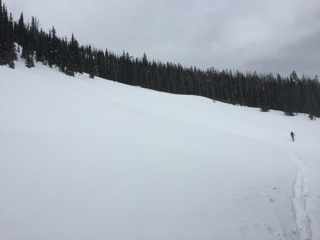
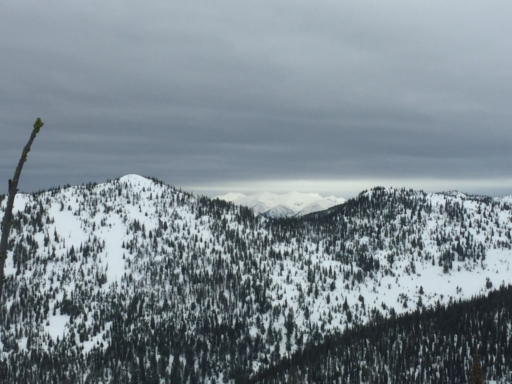
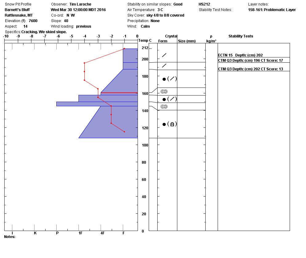
Tim and I were in the Rattlesnake yesterday and found favorable skiing conditions on shaded aspects with all other aspects developing a new surface crust. We also found the primary avalanche concern to be windslabs. The windslabs are small and thin but can be found on all aspects above 6,500ft as strong winds were seen out of the E for the last few days and prevailing winds were from the W prior to that. Carefully evaluate terrain for signs of wind effect to determine if windslabs are present and reactive.

The secondary avalanche concern will be loose snow avalanches, which will be fairly widespread on steep terrain (>35degres). The loose snow will be dry on shaded aspects and wet on solar affected aspects. Carefully assess the consequences of even a small slide and avoid terrain traps.

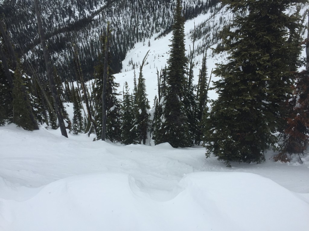
Lastly there is still a concern over persistent slabs. Earlier this week near Lolo facets above a crust were propagating on Eastern aspects and Tim and I found them on a SE aspect in the Rattlesnake yesterday. They were not propagating in the Rattlesnake but were producing nice Q1 sheers. The facets seem to be most prominent on solar affected aspects and will be reactive in isolated areas so dig and do stability tests to determine if they are present and readily propagating. 

Weather and Avalanche Outlook

As the Canadian cold front moves through the region sparse light snow will be seen periodically. Following the cold front temperatures will climb again and conditions look to be high and dry for the weekend. With no significant changes in the forecast, avalanche hazard will remain the same through today. As warm sunny weather sets in conditions may change rapidly leading into the weekend and wet slabs and cornice failures may become a concern.

Ski and ride safe, the next regularly scheduled advisory will be issued on Saturday.

READ FULL ADVISORY  

Problem 1 - Windslabs

  • TYPE

    wind-slabs

    Wind Slabs

    Release of a cohesive layer of snow (a slab) formed by the wind.  Wind typically erodes snow from the upwind sides of terrain features and deposits snow on the downwind side.  Wind slabs are often smooth and rounded and sometimes sound hollow, and can range from soft to hard. Wind slabs that form over a persistent weak layer (surface hoar, depth hoar, or near-surface facets) may be termed Persistent Slabs or may develop into Persistent Slabs.

  • SIZE

    2-3

    1 (Small)

    The potential size of avalanche resulting from this problem.

  • LIKELIHOOD

    Likelihood-3

    Possible

    The likelihood of an avalanche resulting from this problem.

Small shallow windslabs can be found in isolated areas on all aspects above 6,500ft.

Problem 2 - Loose Snow

  • TYPE

    loose-wet

    Loose Wet

    Release of wet unconsolidated snow or slush. These avalanches typically occur within layers of wet snow near the surface of the snowpack, but they may quickly gouge into lower snowpack layers. Like Loose-Dry Avalanches,they start at a point and entrain snow as they move downhill, forming a fan-shaped avalanche. They generally move slowly, but can contain enough mass to cause significant damage to trees, cars or buildings. Other names for loose-wet avalanches include point-release avalanches or sluffs. Loose-wet avalanches can trigger slab avalanches that break into deeper snow layers.

  • SIZE

    1-2

    < 1 (Small)

    The potential size of avalanche resulting from this problem.

  • LIKELIHOOD

    Likelihood-3

    Possible

    The likelihood of an avalanche resulting from this problem.

Small loose wet on solar affected and small loose dry on shaded aspects on terrain steeper than 35 degrees.

Problem 3 - Persistent Slabs

  • TYPE

    persistent-slabs

    Persistent Slabs

    Release of a cohesive layer of soft to hard snow (a slab) in the middle to upper snowpack, when the bond to an underlying persistent weak layer breaks.  Persistent layers include: surface hoar, depth hoar, near-surface facets, or faceted snow. Persistent weak layers can continue to produce avalanches for days, weeks or even months, making them especially dangerous and tricky. As additional snow and wind events build a thicker slab on top of the persistent weak layer, this avalanche problem may develop into a Persistent, Deep-Slab.

  • SIZE

    3-4

    1-2 (Small-Large)

    The potential size of avalanche resulting from this problem.

  • LIKELIHOOD

    Likelihood-1

    Unlikely

    The likelihood of an avalanche resulting from this problem.

  • ADDED DANGER

    Increased Slope Danger

    Increased/Added Danger

    There is an increased risk of avalanches on these slopes:

    E - East
    SE - Southeast
    S - South
    SW - Southwest
    W - West

Facets above crusts continue to give Q1 sheers but are not propagating as readily.

FORECAST & OUTLOOK

  • Danger Trend

    same

    Same Danger

  • Area Forecast

    Light snow

Light snow today giving way to warm dry conditions that will persist through the weekend.

This information is the sole responsibility of the Forest Service and does not apply to operating ski areas. The avalanche danger rating expires at midnight tonight but the information can help you make a more informed decision regarding travel in avalanche terrain for the next few days.

Our advisory area includes National Forest System lands in the Bitterroot Mountains from Lost Trail Pass north to Granite Pass, the Rattlesnake Mountains north of Missoula and the Southern Swan and Mission Mountains near Seeley Lake, MT. Avalanche information for the Lookout Pass/St. Regis Basin area is available from the Idaho Panhandle Avalanche Center.