Posted:
Apr 9, 2016 @ 6:51 am

Above normal temperatures will increase the avalanche danger this weekend.

At 5 am mountain temperatures are in the 40’s with 14 mph SW winds gusting to 25 mph at Point Six and SW winds at 9 gusts to 14 at Deer Point near Darby, MT.  Mountain temperatures have remained above freezing for about 4 days now.

Good morning, this is Steve Karkanen with late season avalanche information from the West Central Montana Avalanche Center.


Springtime Snow Safety Considerations

Wet, loose snow avalanches can entrain enough snow to cause step down slab avalanches that tend to be more destructive and not survivable. Even small wet snow avalanches can be deadly. Skiers and snowmobilers have died in wet snow avalanches in western MT after getting caught in relatively shallow wet snow avalanches.

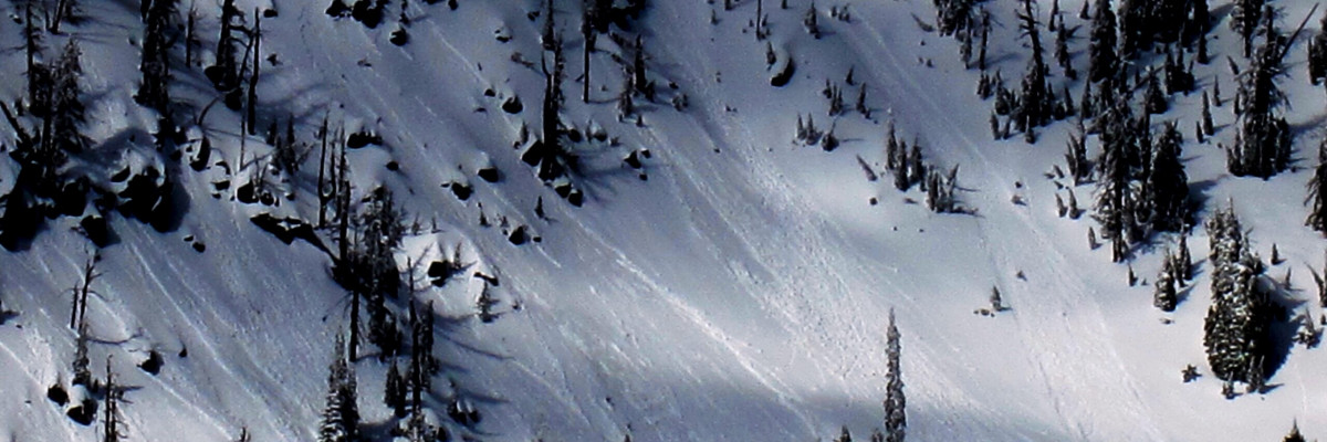
Wet slab avalanches are a troublesome beast so when mountain temperatures remain above freezing for a night or two, don’t trust anything steep and loaded.

Cornices are not only scaring looking, they also fail easily all by themselves when it warms up. A large cornice dropping onto a big slope can trigger large slab avalanches, wet or dry, this time of year. Steer clear of them, they have a nasty reputation for breaking further back than expected when they get this big.

Assess how well new storm snow bonds to the old snow surface.  Many natural avalanches were observed after the last snowfall as soon as the sun hit the slope. Fresh wind slabs can be very sensitive during and for a few days after a storm.

Overall stability conditions are easily monitored by paying attention to the aspect and air temperature.  Move to more shaded northerly terrain as the temperature warms above freezing. Avoid being on or under open steep terrain when you see pinwheels or small point release avalanches peeling off steeper terrain.  When you start punching through to your boot tops move to cooler/shaded areas where the snow is more stable.

When the ski areas are closed, the in-bounds terrain is backcountry terrain and you must plan accordingly.  If you are unsure about a resort’s uphill policy, or where to access public land from a resort, the time-honored Montana tradition is to ask the landowner.

We will continue to post public observations as we receive them and will post updated information if conditions change dramatically.

This will be our last information statement for this season but we will continue to monitor and post any public observations as we receive them. If you get out and see something worth passing along, please send us an email or use the form available on our website at missoulaavalanche.org. The information provided might keep someone out of trouble.

Thanks for another great season and for all the support this year! We couldn’t do it without your financial help and it is deeply appreciated. A special thank you goes out to the dedicated board members of the West Central Montana Avalanche Foundation, our non-profit support organization.

READ FULL ADVISORY  

Problem 1 - Wet Snow Avalanches

  • TYPE

    loose-wet

    Loose Wet

    Release of wet unconsolidated snow or slush. These avalanches typically occur within layers of wet snow near the surface of the snowpack, but they may quickly gouge into lower snowpack layers. Like Loose-Dry Avalanches,they start at a point and entrain snow as they move downhill, forming a fan-shaped avalanche. They generally move slowly, but can contain enough mass to cause significant damage to trees, cars or buildings. Other names for loose-wet avalanches include point-release avalanches or sluffs. Loose-wet avalanches can trigger slab avalanches that break into deeper snow layers.

  • SIZE

    3-4

    1-2 (Small-Large)

    The potential size of avalanche resulting from this problem.

  • LIKELIHOOD

    Likelihood-3

    Possible

    The likelihood of an avalanche resulting from this problem.

  • ADDED DANGER

    Increased Slope Danger

    Increased/Added Danger

    There is an increased risk of avalanches on these slopes:

    N - North
    NE - Northeast
    E - East
    SE - Southeast
    S - South
    SW - Southwest
    W - West
    NW - Northwest

Mountain temperatures have remained above freezing for several days which has weakened the overall snowpack stability on all aspects.

Problem 2 - Dangerous Cornices

  • TYPE

    cornices

    Cornices / Cornice Fall

    Release of an overhanging mass of snow that forms as the wind moves snow over a sharp terrain feature, such as a ridge, and deposits snow on the down-wind side. They range from small wind lips of soft snow to large overhangs of hard snow that are 30 feet (~10 meters) or taller. They can break off the terrain suddenly and pull back onto the ridge top and catch people by surprise even on the flat ground above the slope. Even small cornices can have enough mass to be destructive and deadly. Cornice fall can entrain loose surface snow or trigger slab avalanches.

  • SIZE

    3-4

    1-2 (Small-Large)

    The potential size of avalanche resulting from this problem.

  • LIKELIHOOD

    Likelihood-3

    Possible

    The likelihood of an avalanche resulting from this problem.

  • ADDED DANGER

    Increased Slope Danger

    Increased/Added Danger

    There is an increased risk of avalanches on these slopes:

    NE - Northeast
    E - East
    SE - Southeast

Cornices are huge and can easily fail under the weight of a person or sled. Avoid being on or underneath these boxcars.

FORECAST & OUTLOOK

Missoula Weather is forecasting a dry cold front to move through the area today bring increased wind and a chance for mountain showers.

This information is the sole responsibility of the Forest Service and does not apply to operating ski areas. The avalanche danger rating expires at midnight tonight but the information can help you make a more informed decision regarding travel in avalanche terrain for the next few days.

Our advisory area includes National Forest System lands in the Bitterroot Mountains from Lost Trail Pass north to Granite Pass, the Rattlesnake Mountains north of Missoula and the Southern Swan and Mission Mountains near Seeley Lake, MT. Avalanche information for the Lookout Pass/St. Regis Basin area is available from the Idaho Panhandle Avalanche Center.