
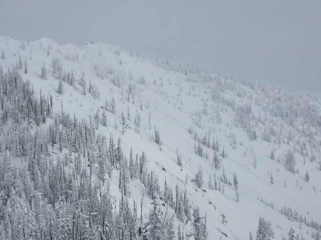
The current avalanche danger is high in the west central Montana backcountry on steep (>30 degrees) wind loaded slopes above 7000 feet. Human triggered avalanches are very likely on these slopes. All other slopes in the advisory area are rated considerable.
Good morning, this is Travis Craft with the West Central Montana Avalanche Center’s avalanche advisory for December 17, 2016. This danger rating does not apply to operating ski areas, expires at midnight tonight and is the sole responsibility of the U.S. Forest Service.
Weather and Snowpack
The Avalanche Warning was terminated yesterday December 16, 2016 at 5pm. Mountain temperatures range from -1 F to -12 F in the region. In the Bitterroot winds are 2 mph with gusts of 4 out of the WSW and Point Six, in the northern part of the advisory area, winds are calm. The forecast area received a trace amount of precipitation in the last 24 hours.
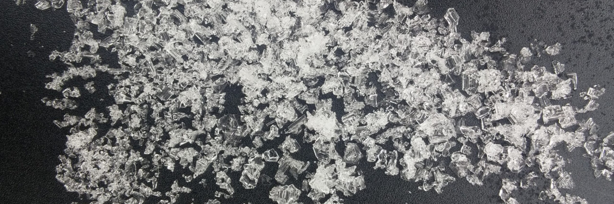
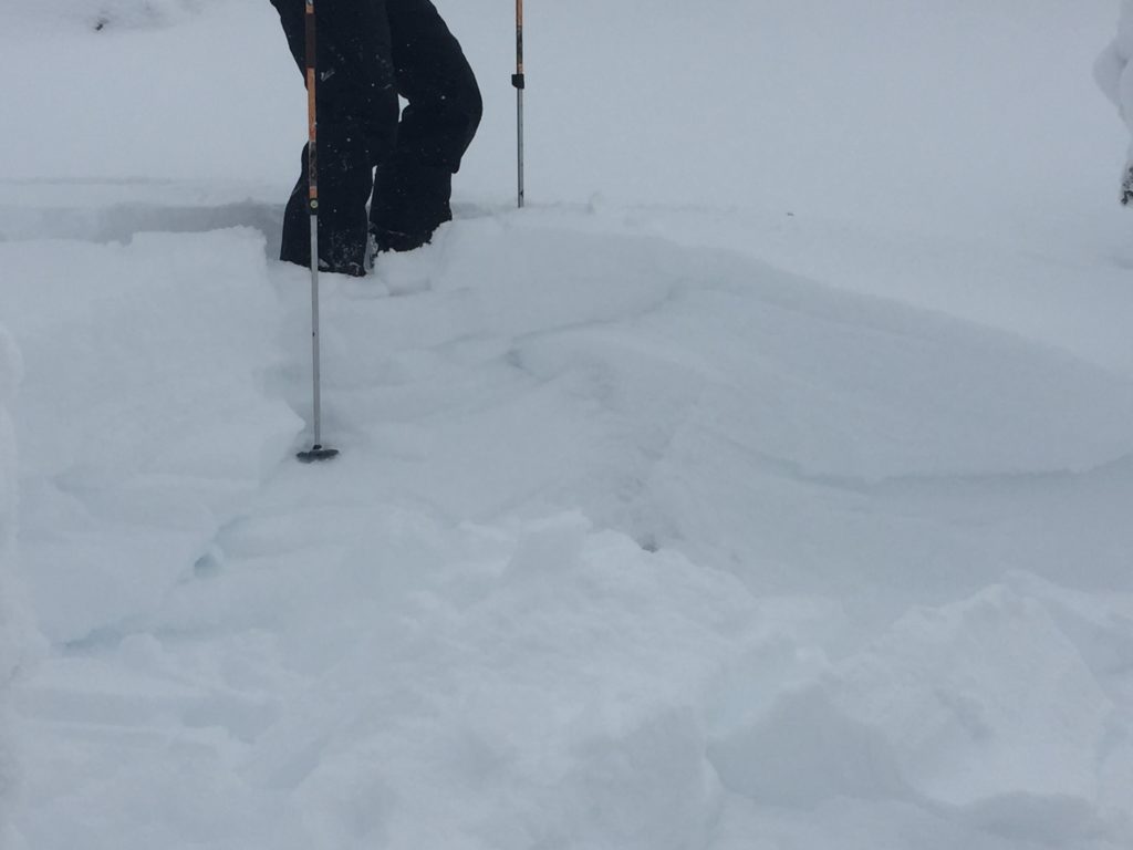
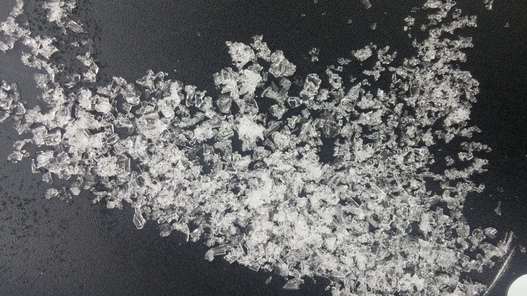
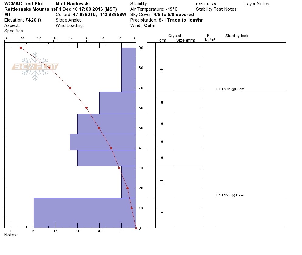
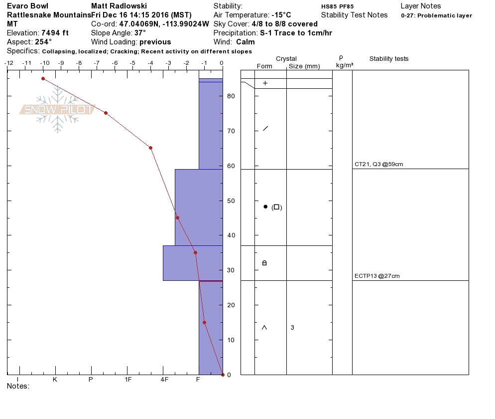
Matt and I toured in the Rattlesnake yesterday. We observed shooting cracks, whumphing, localized collapsing and recent avalanche activity. We were able to get propagation on the basal facets on all aspects. The structure of the snowpack is very poor. The last storm was accompanied by wind which has created a 16 inch wind slab on particular slopes. We observed cross loading on slopes form the wind. These steep (>30 degrees ) wind loaded slopes above 7000 ft are rated as high which means avoid these slopes. The other slopes in the advisory area are rated considerable due to the poor structure of the snowpack. This means careful snowpack evaluation, cautious route-finding and conservative decision-making are essential to recreate today.
The first avalanche problem are wind slabs. Windslabs have been deposited on leeward terrain on a very poor snowpack structure. We also observed some slopes to be cross loaded. Wind loaded slopes today are rated HIGH.
The second avalanche problem is the persistent slab releasing on the basal facets near the ground. This layer is distributed on all aspects above 7000 ft and is very reactive. The pertinent clues to instability alone point to widespread instability: shooting cracks, whumphing, localized collapsing and recent avalanche activity. The facets propagated on all aspects yesterday. The avalanche hazard is considerable on all slopes above 7000 ft. This means careful snowpack evaluation, cautious route-finding and conservative decision-making are essential to recreate today.
Overall, do not enter complex terrain. Keep the terrain low angle and very simple. The snowpack is touchy right now.
Avalanche and Weather Outlook
The next system is expected in our area Monday. We have forecasted cold negative temperatures for the next couple of days. The poor snowpack structure will stay with us with the predicted temperatures. Wind is also forecasted for the area and there is a lot of light snow available for transport to create wind slabs on the poor snowpack structure. The avalanche danger will remain the same with these conditions. Avoid all wind loaded steep slopes above 7000ft.
I will issue the next advisory on Tuesday, December 20, 2016. If you are out recreating in the backcountry, please send us your observations, these are very helpful in producing the advisory.
Ski and ride safe.


