Posted:
Dec 27, 2016 @ 6:46 am

The current avalanche danger is MODERATE for the West Central Montana backcountry, human triggered avalanches are possible on specific terrain. Careful evaluation of terrain, weather, and snowpack will be critical as conditions change throughout the day today.

Good morning, this is Logan King with the West Central Montana Avalanche Center’s avalanche advisory for Tuesday, December 27th, 2016. This danger rating does not apply to operating ski areas, expires at midnight tonight and is the sole responsibility of the U.S. Forest Service.

Weather and Snowpack

Over the weekend 6-10 inches of low density snow fell across the advisory area. Winds remained calm through Sunday morning but have climbed back up and are currently gusting into the 20’s from the south. A trace to 3 inches of new snow accumulated overnight and mountain temperatures are currently in the teens.

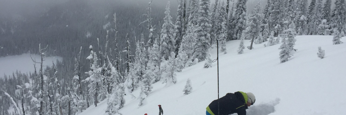
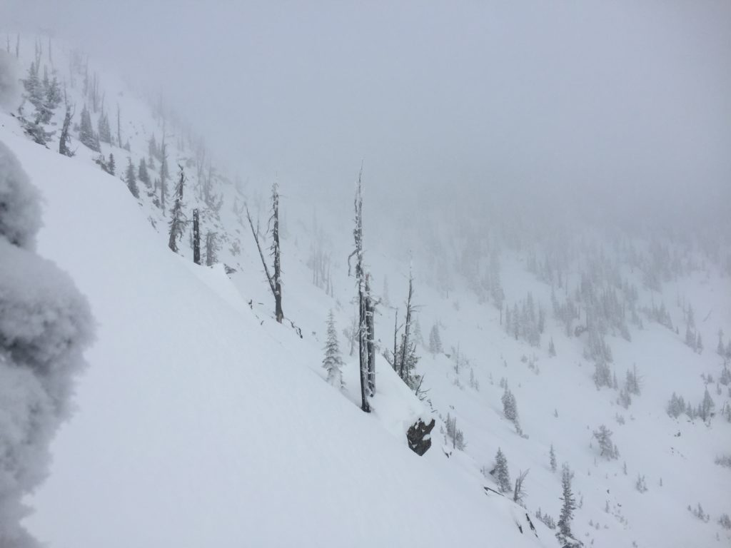
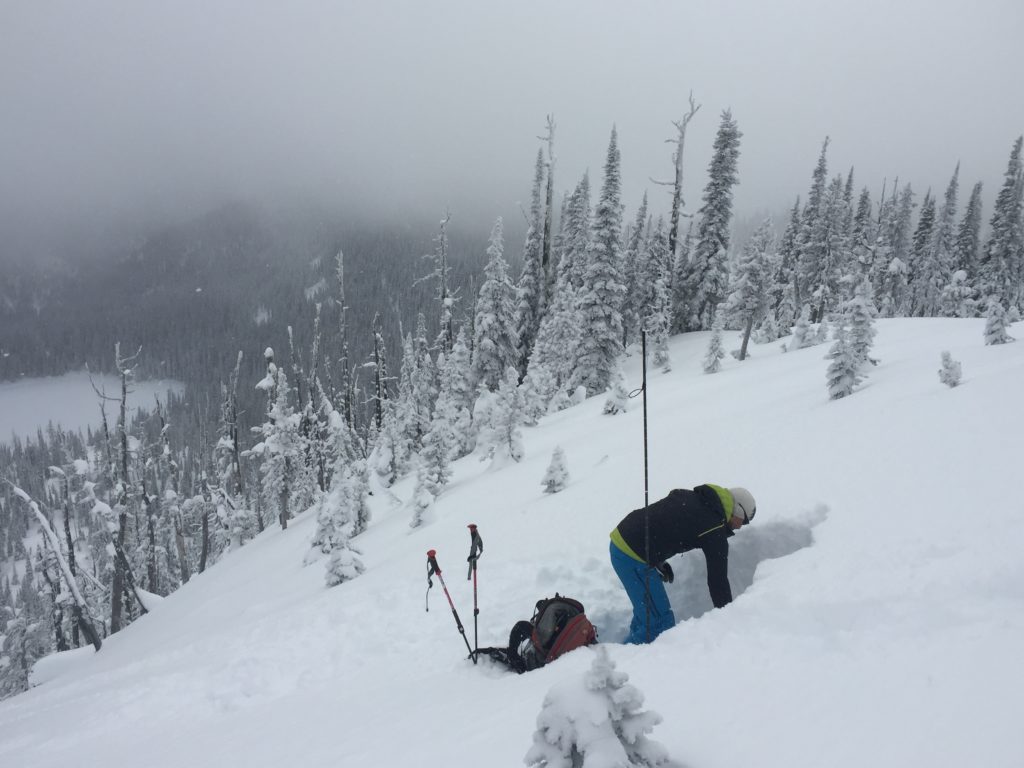
Yesterday Josh and went to the rattlesnake to see how the new snow was bonding to and affecting the snowpack. We found that the primary concern continues to be windslabs. Of greatest concern will be soft windslabs that formed over the weekend sitting on old hard windslabs that provide a good surface for shear. With variable winds that are fairly sustained windslabs will continue to develop on a variety of aspects and will further stress the snowpack. Winds shifted throughout the storm and windslabs can be found on nearly every aspect and cross loading will be problematic. Carefully evaluate slopes for signs of wind affect before you chose to recreate on them.

The persistent slab problem is moving the right direction as depth hoar is gaining strength and is not as reactive. The persistent weak layers will need more time to settle and gain strength before we can stop identifying them as a problem. Facets will continue to be of concern in areas where the snowpack is shallower or stressed from the new load and will require careful evaluation.

Loose snow avalanches are also a concern as the new low density snow will likely be moving on the snow surface in steeper terrain. Be cautious of any terrain traps that will increase the consequences of getting caught in a loose snow or sluff avalanche.

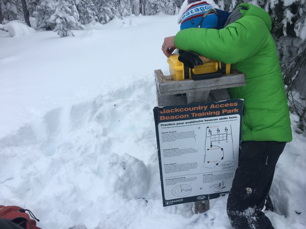
The beacon park at Snowbowl is now operational, so get out and practice with your beacons.

Avalanche and Weather Outlook

Mountain snow and and strong winds looks to develop through today bringing anywhere from 3-12″ inches of snow  by tomorrow. Watch the falling snow as it will add stress to the snowpack and if significant accumulations occur give the snow a few days to settle and adjust to the new load. Snow will continue through tonight and into tomorrow but the bulk of the snow looks to come today and tonight. With good accumulation and winds in the 50+mph range expected in the mountains, avalanche danger will increase significantly in the next 24-48 hours.

The next advisory will be issued on Thursday, December 29th, 2016.

Ski and ride safe.

READ FULL ADVISORY  

Problem 1 - Windslabs

  • TYPE

    wind-slabs

    Wind Slabs

    Release of a cohesive layer of snow (a slab) formed by the wind.  Wind typically erodes snow from the upwind sides of terrain features and deposits snow on the downwind side.  Wind slabs are often smooth and rounded and sometimes sound hollow, and can range from soft to hard. Wind slabs that form over a persistent weak layer (surface hoar, depth hoar, or near-surface facets) may be termed Persistent Slabs or may develop into Persistent Slabs.

  • SIZE

    3-4

    1-2 (Small-Large)

    The potential size of avalanche resulting from this problem.

  • LIKELIHOOD

    Likelihood-3

    Possible

    The likelihood of an avalanche resulting from this problem.

  • ADDED DANGER

    Increased Slope Danger

    Increased/Added Danger

    There is an increased risk of avalanches on these slopes:

    N - North
    NE - Northeast
    E - East
    SE - Southeast
    S - South
    SW - Southwest
    W - West
    NW - Northwest

  • IMAGE

With new snow for transport and moderate variable winds, windslabs will continue to be a concern and can be found on all aspects.

Problem 2 - Persistent Slabs

  • TYPE

    persistent-slabs

    Persistent Slabs

    Release of a cohesive layer of soft to hard snow (a slab) in the middle to upper snowpack, when the bond to an underlying persistent weak layer breaks.  Persistent layers include: surface hoar, depth hoar, near-surface facets, or faceted snow. Persistent weak layers can continue to produce avalanches for days, weeks or even months, making them especially dangerous and tricky. As additional snow and wind events build a thicker slab on top of the persistent weak layer, this avalanche problem may develop into a Persistent, Deep-Slab.

  • SIZE

    3-4

    1-2 (Small-Large)

    The potential size of avalanche resulting from this problem.

  • LIKELIHOOD

    Likelihood-3

    Possible

    The likelihood of an avalanche resulting from this problem.

Facets are getting better and starting to sinter and bond but can be reactive in specific locations across the advisory area.

Problem 3 - Loose Snow Avalanches

  • TYPE

    loose-dry

    Loose Dry

    Release of wet unconsolidated snow or slush. These avalanches typically occur within layers of wet snow near the surface of the snowpack, but they may quickly gouge into lower snowpack layers. Like Loose-Dry Avalanches,they start at a point and entrain snow as they move downhill, forming a fan-shaped avalanche. They generally move slowly, but can contain enough mass to cause significant damage to trees, cars or buildings. Other names for loose-wet avalanches include point-release avalanches or sluffs. Loose-wet avalanches can trigger slab avalanches that break into deeper snow layers.

  • SIZE

    2-3

    1 (Small)

    The potential size of avalanche resulting from this problem.

  • LIKELIHOOD

    Likelihood-5

    Likely

    The likelihood of an avalanche resulting from this problem.

  • IMAGE

Loose snow or sluff avalanches will be likely in steep terian that received new dry snow.

VIDEO

FORECAST & OUTLOOK

Another system will work it’s way into the region today bringing with it more snow. Forecasts are calling for up to about 8-12 inches at higher elevation today and are expected to continue into Wednesday as well. If the new load materializes as predicted it will stress the snowpack and the avalanche danger will increase.

This information is the sole responsibility of the Forest Service and does not apply to operating ski areas. The avalanche danger rating expires at midnight tonight but the information can help you make a more informed decision regarding travel in avalanche terrain for the next few days.

Our advisory area includes National Forest System lands in the Bitterroot Mountains from Lost Trail Pass north to Granite Pass, the Rattlesnake Mountains north of Missoula and the Southern Swan and Mission Mountains near Seeley Lake, MT. Avalanche information for the Lookout Pass/St. Regis Basin area is available from the Idaho Panhandle Avalanche Center.