Posted:
Jan 10, 2017 @ 6:46 am

The current avalanche danger is considerable in the West Central Montana backcountry. Human triggered avalanches are likely and have the potential to be large. Careful evaluation of conditions will be required to recreate safely in the backcountry today. 

Good morning, this is Logan King with the West Central Montana Avalanche Center’s avalanche advisory for Tuesday January 10th, 2017.  This danger rating does not apply to operating ski areas, expires at midnight tonight and is the sole responsibility of the U.S. Forest Service.

Weather and Snowpack

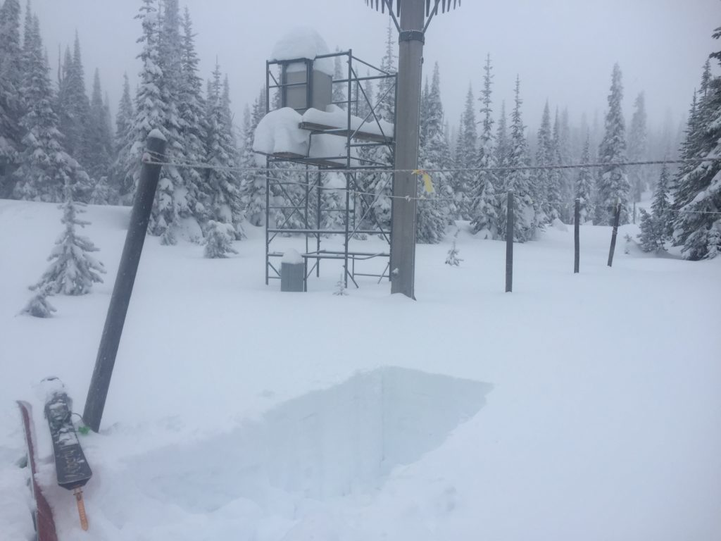
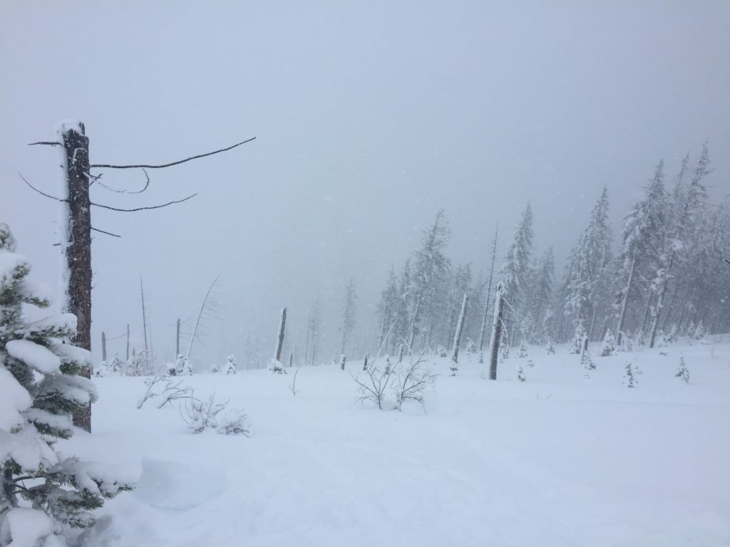
A warm and wet system has brought a significant new load to the region since Saturday night. Temperatures have cooled and currently range from 16-20 fahrenheit. Winds have been moderate to strong over the last 24hours but this morning have settled down. Point 6 is recording a shift from the west to the WSW and wind speeds of 7mph gusting to 13mph. Over night and additional 1-6 inches of snow accumulated across the region. The new snow has added up to a half inch of SWE since yesterday. Many sites across the advisory area have seen well over and inch of SWE since Saturday night. 

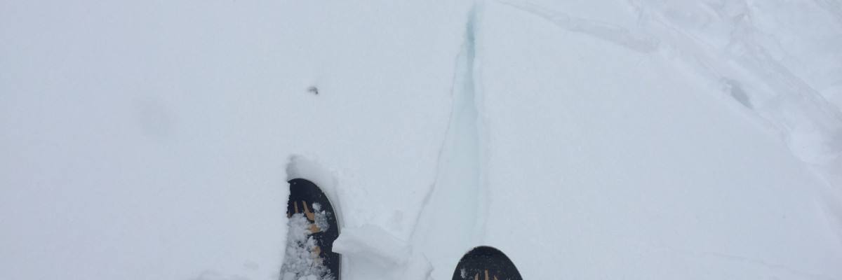
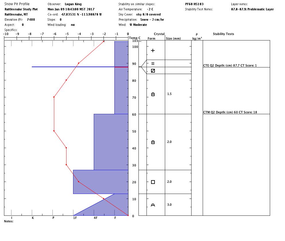
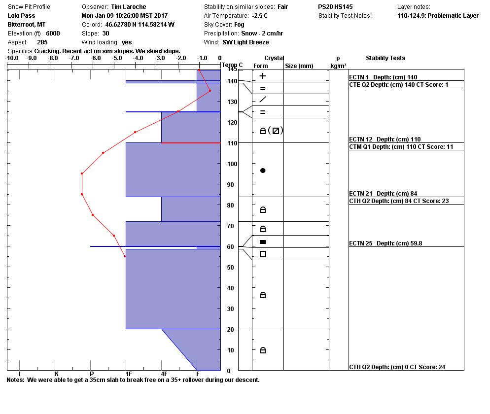
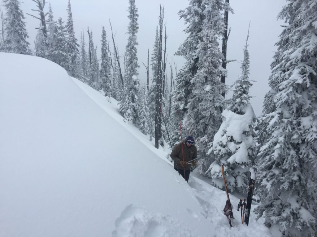
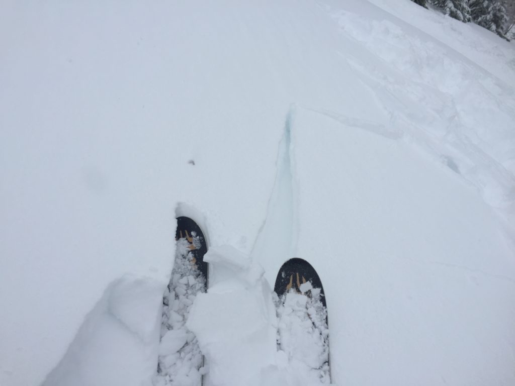
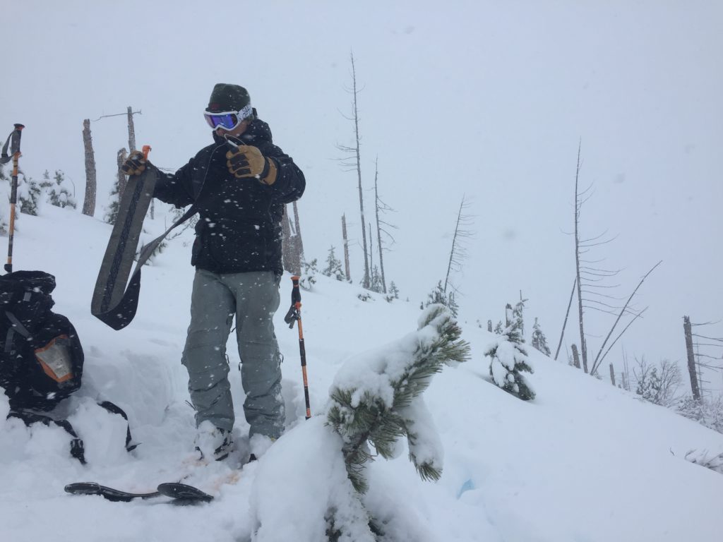
Yesterday Travis and Tim were up at Lolo pass and I was in the Rattlesnake. We both found a crust with near surface facets below it that was failing and propagating readily. With the formation of the near surface facets and the new load of heavy snow, this layer will make persistent slabs the primary concern today. Buried surface hoar will still be found in isolated pockets and the basal facets will still be susceptible to step down avalanches. With multiple persistent weak layers take the time to carefully evaluate the snow before recreating in avalanche terrain. 

Winds were active yesterday and predominantly from the west creating windslabs that are sensitive to triggers. Winds intensifying and shifting directions later today coupled with even more snow available for transport, will result in windslab develop on a multitude of aspects. Keep in mind that wind is very good at moving snow and a significant windslab can develop quickly. 

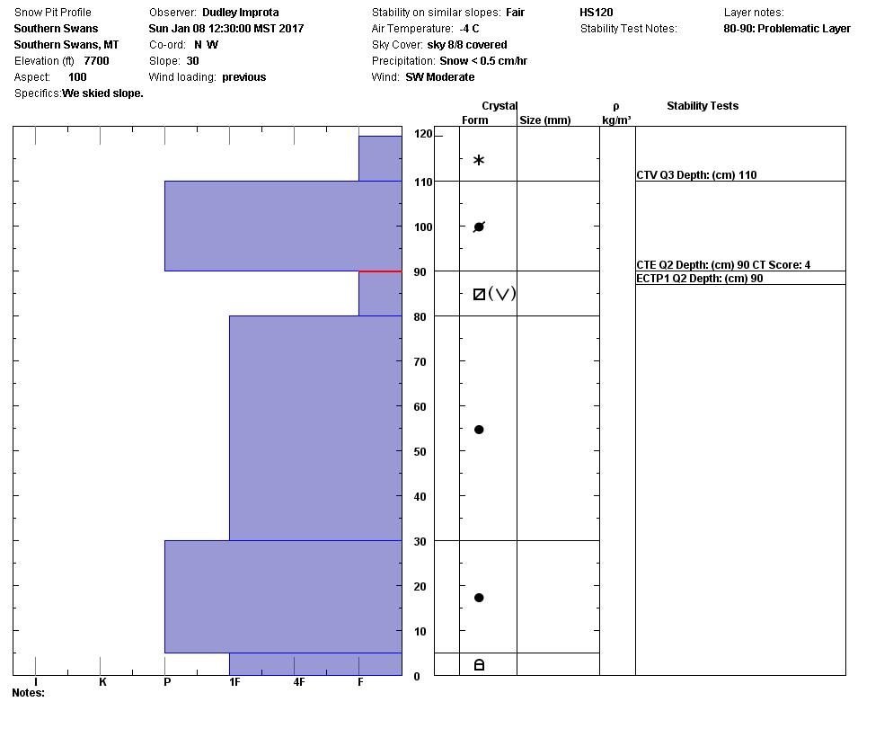
Storm slabs will be the third concern today, the active weather system over the last few days would suggest that storm slabs are present (video). We were not seeing much reactivity in the storm slab yesterday but it was failing on a density change in the Southern Swans over the weekend. Snow was variable last night and in areas that received a greater load the potential for storm slab activity will increase.

Avalanche and Weather Outlook.

Light snow is expected today and into tonight bringing an additional 2-3 inches of snow. Winds look to increase in intensity again today and shift tonight and into tomorrow as an arctic air mass spills over the divide giving way to a calm and cold period lasting through friday. Time will be needed before the snowpack can adjust to the load that has accumulated over the last few days and the avalanche danger will not change today. 

If you get out in the backcountry please feel free to share your observations on the public observations page. Travis will issue the next regular advisory on Thursday.

Ski and ride safe.

READ FULL ADVISORY  

Problem 1 - Persistent Slabs-Near Surface Facets

  • TYPE

    persistent-slabs

    Persistent Slabs

    Release of a cohesive layer of soft to hard snow (a slab) in the middle to upper snowpack, when the bond to an underlying persistent weak layer breaks.  Persistent layers include: surface hoar, depth hoar, near-surface facets, or faceted snow. Persistent weak layers can continue to produce avalanches for days, weeks or even months, making them especially dangerous and tricky. As additional snow and wind events build a thicker slab on top of the persistent weak layer, this avalanche problem may develop into a Persistent, Deep-Slab.

  • SIZE

    3-4

    1-2 (Small-Large)

    The potential size of avalanche resulting from this problem.

  • LIKELIHOOD

    Likelihood-5

    Likely

    The likelihood of an avalanche resulting from this problem.

A layer of near surface facets has formed and was propagating readily in stability tests. Facets at the ground still have the potential to fail under the right conditions.

Problem 2 - Windslabs

  • TYPE

    wind-slabs

    Wind Slabs

    Release of a cohesive layer of snow (a slab) formed by the wind.  Wind typically erodes snow from the upwind sides of terrain features and deposits snow on the downwind side.  Wind slabs are often smooth and rounded and sometimes sound hollow, and can range from soft to hard. Wind slabs that form over a persistent weak layer (surface hoar, depth hoar, or near-surface facets) may be termed Persistent Slabs or may develop into Persistent Slabs.

  • SIZE

    3-4

    1-2 (Small-Large)

    The potential size of avalanche resulting from this problem.

  • LIKELIHOOD

    Likelihood-4

    Possible/Likely

    The likelihood of an avalanche resulting from this problem.

With new snow for transport and active winds, windslabs will be a problem today.

Problem 3 - Storm Slabs

  • TYPE

    storm-slabs

    Storm Slabs

    Release of a soft cohesive layer (a slab) of new snow which breaks within the storm snow or on the old snow surface. Storm-slab problems typically last between a few hours and few days. Storm-slabs that form over a persistent weak layer (surface hoar, depth hoar, or near-surface facets) may be termed Persistent Slabs or may develop into Persistent Slabs.

  • SIZE

    2-3

    1 (Small)

    The potential size of avalanche resulting from this problem.

  • LIKELIHOOD

    Likelihood-4

    Possible/Likely

    The likelihood of an avalanche resulting from this problem.

Some areas have received more snow than others and with a heavy new load with changes in density, storm slabs will have the potential to move today.

VIDEO

Clarification: The date was Monday January 9th and the storm snow was causing a failure on a layer of near surface facets.

FORECAST & OUTLOOK

  • Danger Trend

    same

    Same Danger

  • Area Forecast

    More Snow

Light snow today.

This information is the sole responsibility of the Forest Service and does not apply to operating ski areas. The avalanche danger rating expires at midnight tonight but the information can help you make a more informed decision regarding travel in avalanche terrain for the next few days.

Our advisory area includes National Forest System lands in the Bitterroot Mountains from Lost Trail Pass north to Granite Pass, the Rattlesnake Mountains north of Missoula and the Southern Swan and Mission Mountains near Seeley Lake, MT. Avalanche information for the Lookout Pass/St. Regis Basin area is available from the Idaho Panhandle Avalanche Center.