Posted:
Jan 19, 2017 @ 6:14 am

The current avalanche danger is LOW for the west central Montana backcountry. Human triggered avalanches are still possible in isolated terrain.  If we get more snow then predicted expect the avalanche danger to increase.

Good morning, this is Travis Craft with the West Central Montana Avalanche Center’s avalanche advisory for January 19, 2017. This danger rating does not apply to operating ski areas, expires at midnight tonight and is the sole responsibility of the U.S. Forest Service.

Weather and Snowpack

Mountain temperatures range from 24 F to 35 F in the region. Winds are 13 mph out of the SE in the Bitterroot. Point Six, in the northern part of the advisory area, winds are reading 16 mph with gusts of 24 mph out of the WSW. The forecast area received 0 to 1 inches of new snow in the last 24 hours. The new snow had SWE’s ranging from 0 to .2 inches of water.

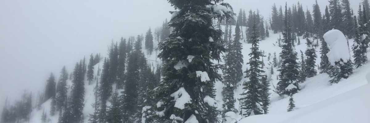
Tim and I took the sleds to the central Bitterroot yesterday, near Elk Meadows.  Logan was in the Rattlesnake.  We observed active snow transport(video).  The warm temperatures have helped to decrease the instabilities in the snowpack.  We all saw small loose wet releases.

The primary concern is small wind slabs.  These formed on leeward terrain and should be relatively shallow due to the limited amount of snow available for transport.

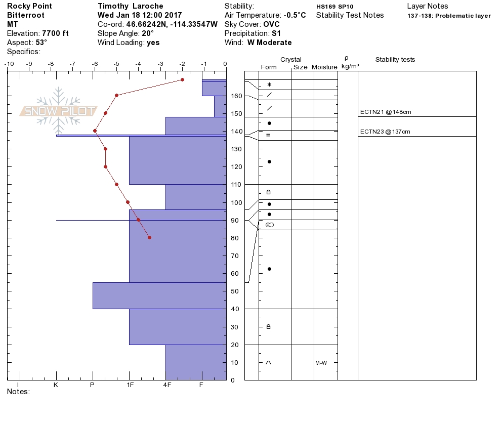
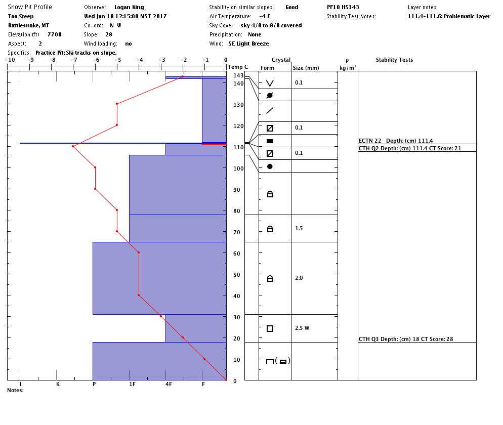
The second avalanche problem is persistent slabs.  There are two layers (1.) 2 feet from the surface of near surface facets and (2.) the basal facets on the ground.  We have not had propagation on the two layers of concern for the past week.  Dig a pit and see if these layers are reactive.  If the mountains receive more heavy wet snow than predicted, expect these layers to become more sensitive to triggers.

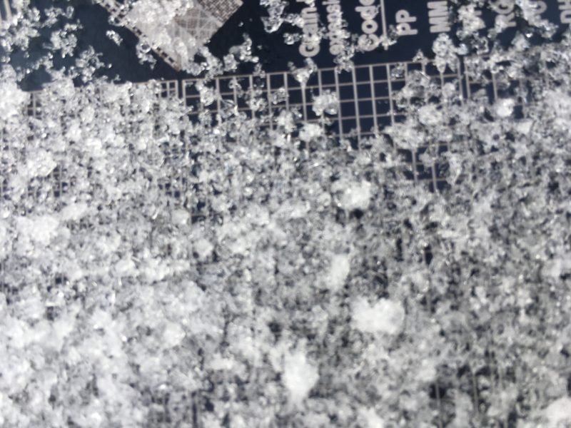
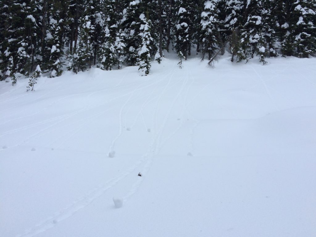
The last avalanche concern is loose wet releases.  We all observed roller balls on slopes later in the day.  These show us the snow surface is getting warm.  If you see rollerballs or small point releases on the slope, move to a more shaded aspect, and avoid terrain traps.

Avalanche and Weather Outlook.

Snow accumulations are predicted to be low, less than an inch.  Warm temperatures will continue through tonight, and then a cold air mass will move in.  The avalanche danger will remain the same with these conditions. If we get a large new load of snow on the layers, expect the avalanche danger to increase.

We have been getting a lot of public observations, thank you. If you are out in the backcountry, please send us what you saw, these are very helpful in producing the advisory.

Logan will issue the next advisory on Saturday, January 21, 2017.

Ski and ride safe.


READ FULL ADVISORY  

Problem 1 - Wind Slabs

  • TYPE

    wind-slabs

    Wind Slabs

    Release of a cohesive layer of snow (a slab) formed by the wind.  Wind typically erodes snow from the upwind sides of terrain features and deposits snow on the downwind side.  Wind slabs are often smooth and rounded and sometimes sound hollow, and can range from soft to hard. Wind slabs that form over a persistent weak layer (surface hoar, depth hoar, or near-surface facets) may be termed Persistent Slabs or may develop into Persistent Slabs.

  • SIZE

    2-3

    1 (Small)

    The potential size of avalanche resulting from this problem.

  • LIKELIHOOD

    Likelihood-2

    Unlikely/Possible

    The likelihood of an avalanche resulting from this problem.

  • IMAGE

Little snow available for transport.  Look for wind slabs on leeward terrain.

Problem 2 - Persistent Slabs

  • TYPE

    persistent-slabs

    Persistent Slabs

    Release of a cohesive layer of soft to hard snow (a slab) in the middle to upper snowpack, when the bond to an underlying persistent weak layer breaks.  Persistent layers include: surface hoar, depth hoar, near-surface facets, or faceted snow. Persistent weak layers can continue to produce avalanches for days, weeks or even months, making them especially dangerous and tricky. As additional snow and wind events build a thicker slab on top of the persistent weak layer, this avalanche problem may develop into a Persistent, Deep-Slab.

  • SIZE

    3-4

    1-2 (Small-Large)

    The potential size of avalanche resulting from this problem.

  • LIKELIHOOD

    Likelihood-2

    Unlikely/Possible

    The likelihood of an avalanche resulting from this problem.

  • IMAGE

Dig a pit before committing to any steep terrain. These layers are no longer propagating in ECT’s.

Two layers of concern:

1. A Layer of near surface facets below a crust 30 cm from the surface.

2. The basal facets on the ground.

Problem 3 - Loose Wet

  • TYPE

    loose-wet

    Loose Wet

    Release of wet unconsolidated snow or slush. These avalanches typically occur within layers of wet snow near the surface of the snowpack, but they may quickly gouge into lower snowpack layers. Like Loose-Dry Avalanches,they start at a point and entrain snow as they move downhill, forming a fan-shaped avalanche. They generally move slowly, but can contain enough mass to cause significant damage to trees, cars or buildings. Other names for loose-wet avalanches include point-release avalanches or sluffs. Loose-wet avalanches can trigger slab avalanches that break into deeper snow layers.

  • SIZE

    2-3

    1 (Small)

    The potential size of avalanche resulting from this problem.

  • LIKELIHOOD

    Likelihood-2

    Unlikely/Possible

    The likelihood of an avalanche resulting from this problem.

  • IMAGE

Loose wet releases observed with the warmer temperatures.

VIDEO

Central Bitterroot 01/18/2017

Observations 01/18/2017

FORECAST & OUTLOOK

Snow accumulations are predicted to be low, less than an inch. Warm temperatures will continue through tonight, and then a cold air mass will move in. The avalanche danger will remain the same with these conditions. If we get a large new load of snow on the layers expect the avalanche danger to increase.

This information is the sole responsibility of the Forest Service and does not apply to operating ski areas. The avalanche danger rating expires at midnight tonight but the information can help you make a more informed decision regarding travel in avalanche terrain for the next few days.

Our advisory area includes National Forest System lands in the Bitterroot Mountains from Lost Trail Pass north to Granite Pass, the Rattlesnake Mountains north of Missoula and the Southern Swan and Mission Mountains near Seeley Lake, MT. Avalanche information for the Lookout Pass/St. Regis Basin area is available from the Idaho Panhandle Avalanche Center.