Posted:
Feb 14, 2017 @ 7:07 am

The current avalanche danger is Considerable on steep( >30 degrees) wind loaded slopes above 7000 ft for the west central Montana backcountry. All other slopes above 7000 ft are moderate.  Below 7000 ft all slopes arelow in the morning and will rise to moderate in the afternoon.

Good morning, this is Travis Craft with the West Central Montana Avalanche Center’s avalanche advisory for February 14, 2017. This danger rating does not apply to operating ski areas, expires at midnight tonight and is the sole responsibility of the U.S. Forest Service.

Weather and Snowpack

Mountain temperatures range from 17 F to 32 F in the region. Winds are 3 mph with gusts of 4 mph out of the S in the Bitterroot. Point Six, in the northern part of the advisory area, winds are reading 11 mph with gusts of 16 mph out of the NNW.  No new snow in the last 24 hours.  Some remote stations are reporting and others are offline.

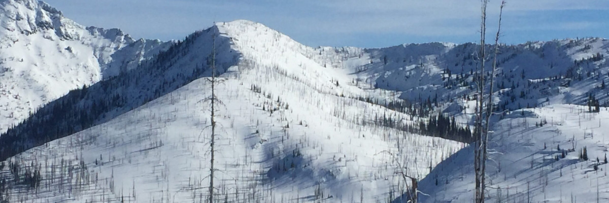
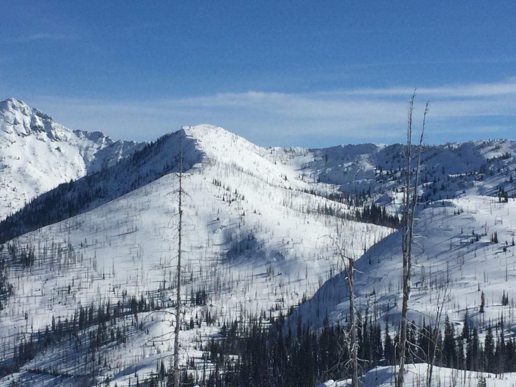
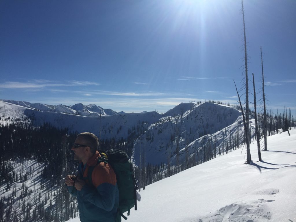
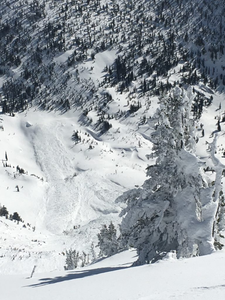
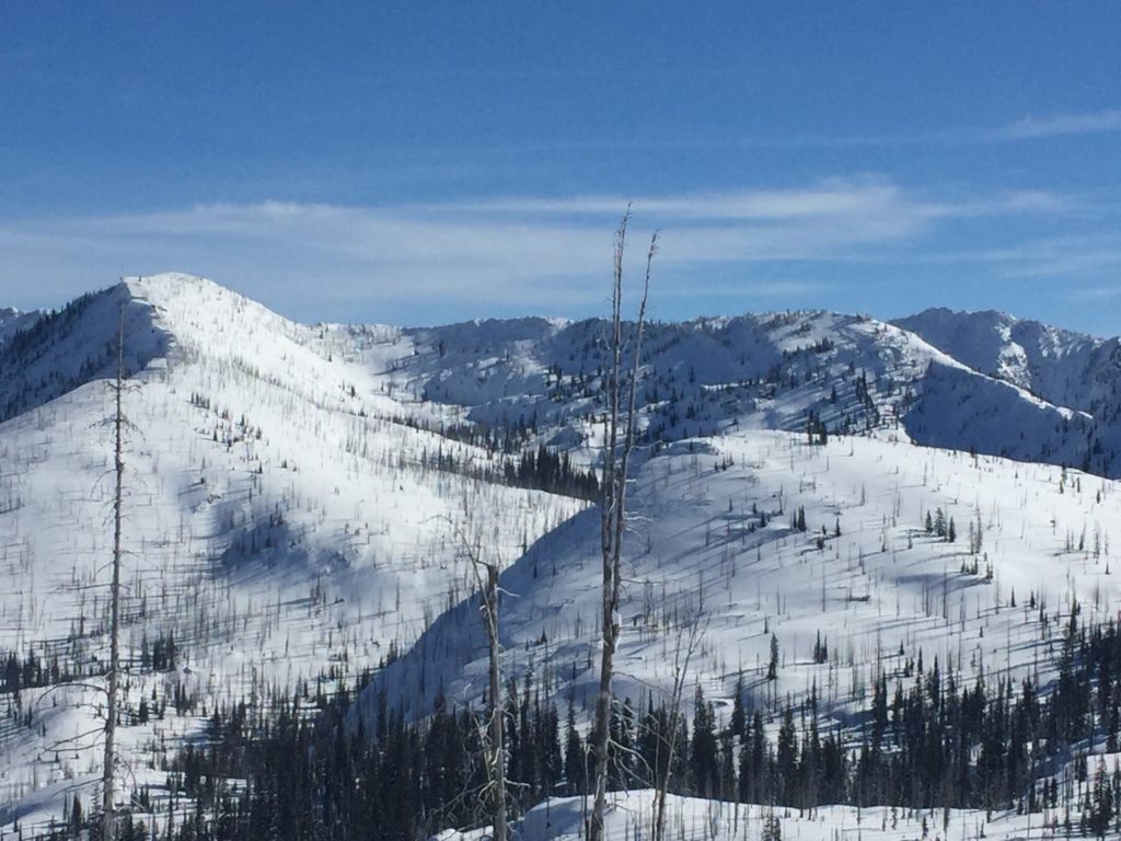
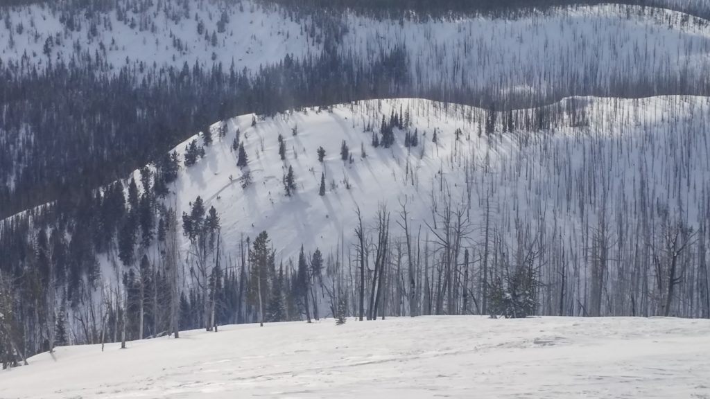
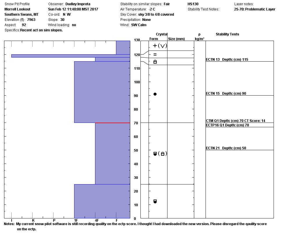
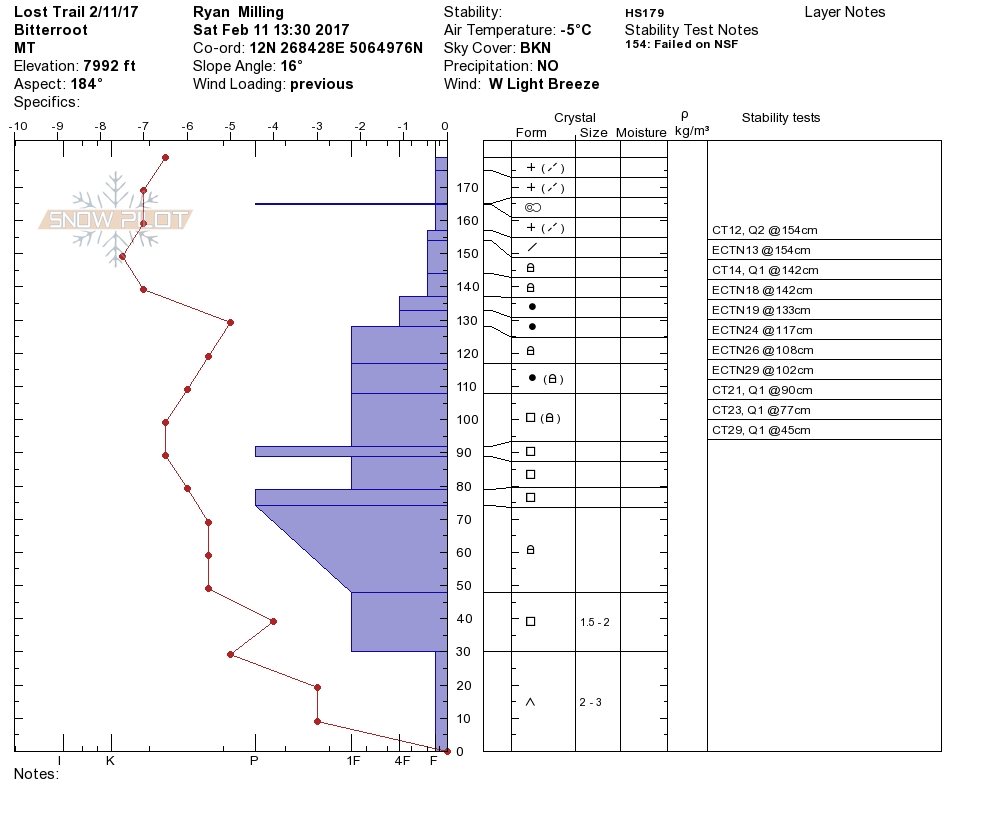
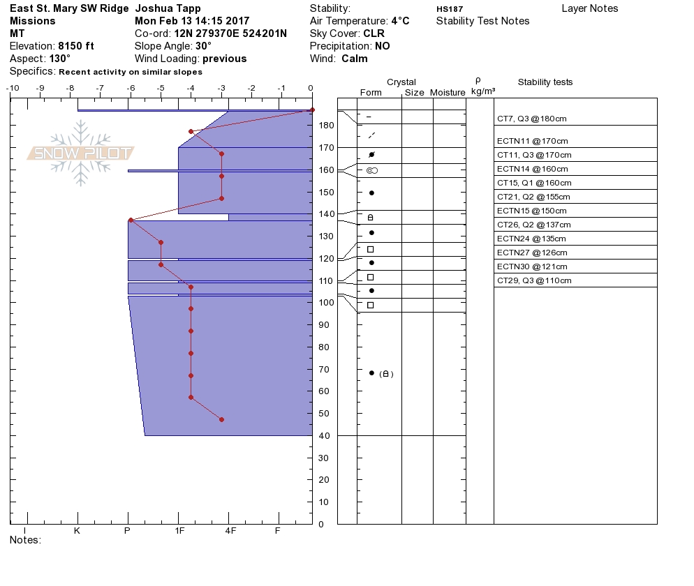
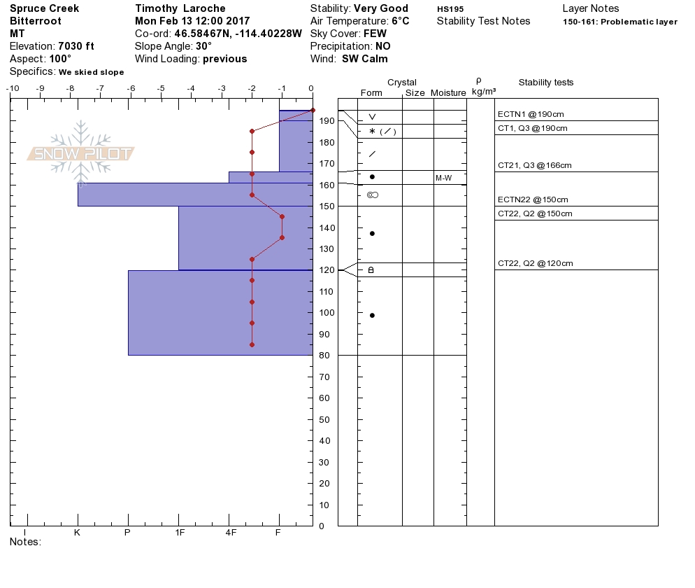
The past storm caused a natural avalanche cycle through the west central Montana backcountry.  There were many reports of natural crowns from the southern Bitterroot to the southern Swan that happened Wednesday through Friday.  Tim and I were in the central Bitterroot yesterday.  Josh, Matt, and Ryan were at Lost Trail Pass teaching a level-one avalanche course over the weekend.  Dudley was at Yurtski in the southern Swan also teaching.  Josh and Ryan had a day off yesterday and went to the Missions just north of our advisory area.  We all saw evidence of the natural avalanche cycle.  We saw wind scoured and loaded slopes at elevations above 7000 ft.  We all experienced the inversion yesterday and noted roller balls were releasing naturally in the afternoon on sun exposed slopes.  Dudley got propagation in multiple snow pits on different aspects in the southern Swan above 7000 ft.  Josh and Matt got propagation in pits at Lost Trail above 7000 ft.  Tim and I did not get propagation in our pit at 7000 ft in the central Bitterroot.  Ryan and Josh saw wind loaded slopes and natural debris in the Missions just North of our advisory area, above 7000 ft.(Here is the Link to Trip Report).

The primary avalanche problem is wind slabs above 7000 ft.  These slabs are on leeward terrain.  They will be sensitive to human triggers.

The second avalanche concern is persistent slabs.  There are many weak layers in our snow pack.  Before committing to any steep terrain assess the layers in the snowpack by digging a pit.  These weak layers are at all elevations.

The last avalanche problem is loose wet releases in the afternoon on sun exposed slopes.  The temperature will rise throughout the day, pay attention to roller balls.  When the roller balls appear it is time to change aspects to a shadier one.

Avalanche and Weather Outlook

The region will be dominated by high pressure the next two days.  There will be a strong inversion.  Make sure that the snow pack has refrozen by checking the remote weather stations to get a gauge of mountain temperatures.  If mountain temperatures do not get below freezing overnight, be cautious when traveling on these slopes.  With the predicted conditions, the avalanche danger will rise in the afternoon on sun exposed slopes.

If you are out in the backcountry, please send us your observations, these are very helpful in producing the advisory. Logan will issue the next advisory on February 16, 2017.

Ski and ride safe.

READ FULL ADVISORY  

Problem 1 - Wind Slabs

  • TYPE

    wind-slabs

    Wind Slabs

    Release of a cohesive layer of snow (a slab) formed by the wind.  Wind typically erodes snow from the upwind sides of terrain features and deposits snow on the downwind side.  Wind slabs are often smooth and rounded and sometimes sound hollow, and can range from soft to hard. Wind slabs that form over a persistent weak layer (surface hoar, depth hoar, or near-surface facets) may be termed Persistent Slabs or may develop into Persistent Slabs.

  • SIZE

    3-4

    1-2 (Small-Large)

    The potential size of avalanche resulting from this problem.

  • LIKELIHOOD

    Likelihood-5

    Likely

    The likelihood of an avalanche resulting from this problem.

Wind slabs have been deposited on leeward slopes above 7000 ft.

Problem 2 - Persistent Slabs

  • TYPE

    persistent-slabs

    Persistent Slabs

    Release of a cohesive layer of soft to hard snow (a slab) in the middle to upper snowpack, when the bond to an underlying persistent weak layer breaks.  Persistent layers include: surface hoar, depth hoar, near-surface facets, or faceted snow. Persistent weak layers can continue to produce avalanches for days, weeks or even months, making them especially dangerous and tricky. As additional snow and wind events build a thicker slab on top of the persistent weak layer, this avalanche problem may develop into a Persistent, Deep-Slab.

  • SIZE

    3-4

    1-2 (Small-Large)

    The potential size of avalanche resulting from this problem.

  • LIKELIHOOD

    Likelihood-3

    Possible

    The likelihood of an avalanche resulting from this problem.

  • ADDED DANGER

    Increased Slope Danger

    Increased/Added Danger

    There is an increased risk of avalanches on these slopes:

    N - North
    NE - Northeast
    E - East
    SE - Southeast
    S - South
    SW - Southwest
    W - West
    NW - Northwest

There are weak layers in our snow pack.  Dig a pit to assess these layers.

Problem 3 - Loose Wet

  • TYPE

    loose-wet

    Loose Wet

    Release of wet unconsolidated snow or slush. These avalanches typically occur within layers of wet snow near the surface of the snowpack, but they may quickly gouge into lower snowpack layers. Like Loose-Dry Avalanches,they start at a point and entrain snow as they move downhill, forming a fan-shaped avalanche. They generally move slowly, but can contain enough mass to cause significant damage to trees, cars or buildings. Other names for loose-wet avalanches include point-release avalanches or sluffs. Loose-wet avalanches can trigger slab avalanches that break into deeper snow layers.

  • SIZE

    2-3

    1 (Small)

    The potential size of avalanche resulting from this problem.

  • LIKELIHOOD

    Likelihood-3

    Possible

    The likelihood of an avalanche resulting from this problem.

  • ADDED DANGER

    Increased Slope Danger

    Increased/Added Danger

    There is an increased risk of avalanches on these slopes:

    E - East
    SE - Southeast
    S - South
    SW - Southwest
    W - West

With warming temperatures there will be wet activity on sun exposed slopes.  If you see roller balls on a slope it is time to change aspects to a shadier one.

VIDEO

Josh on day off, Mission fail.  This is just North of our advisory area in the Missions.  Shows the new wind slabs and the avalanche cycle we had from Wednesday-Friday.

Observations 02/13/2017

FORECAST & OUTLOOK

High pressure will dominate the region until Wednesday.  Strong valley inversions will raise avalanche danger in the afternoon on sun exposed slopes.

This information is the sole responsibility of the Forest Service and does not apply to operating ski areas. The avalanche danger rating expires at midnight tonight but the information can help you make a more informed decision regarding travel in avalanche terrain for the next few days.

Our advisory area includes National Forest System lands in the Bitterroot Mountains from Lost Trail Pass north to Granite Pass, the Rattlesnake Mountains north of Missoula and the Southern Swan and Mission Mountains near Seeley Lake, MT. Avalanche information for the Lookout Pass/St. Regis Basin area is available from the Idaho Panhandle Avalanche Center.