Posted:
Feb 23, 2017 @ 6:25 am

The current avalanche danger is MODERATE in the west central Montana backcountry above 6000 feet. Evaluate snow and terrain carefully; identify features of concern.  Human triggered avalanches are possible. Below 6000 ft the avalanche danger is Low.

Good morning, this is Travis Craft with the West Central Montana Avalanche Center’s avalanche advisory for February 23, 2017.  This danger rating does not apply to operating ski areas, expires at midnight tonight and is the sole responsibility of the U.S. Forest Service.

Weather and Snowpack

Mountain temperatures range from 16 F to 26 F in the region. Winds are 4 mph with gusts of 6 mph out of the N in the Bitterroot. Point Six, in the northern part of the advisory area, winds are reading 9 mph with gusts of 11 mph out of the NE.  The forecast area received 1 to 4 inches of new snow in the last 24 hours. The new snow had SWE’s ranging from .1 to .3 inches of water.

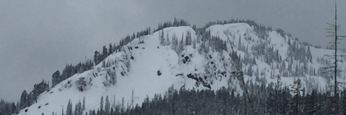
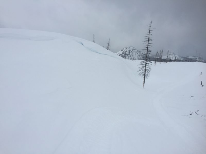
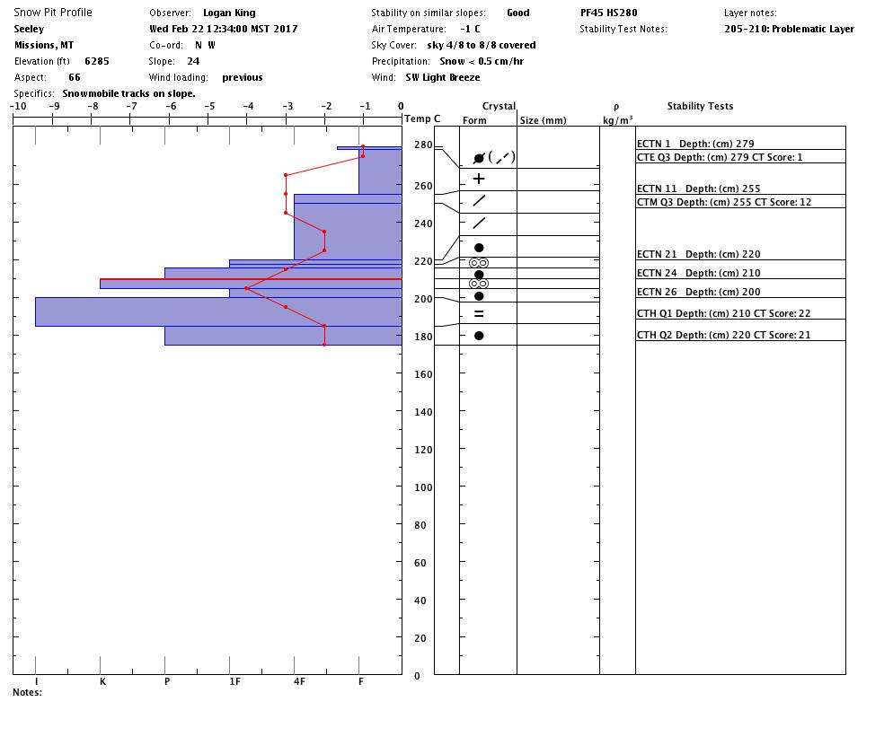
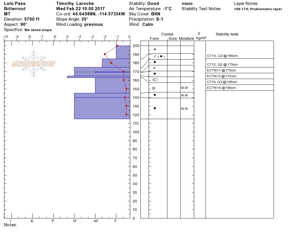
Logan and I took sleds to the southern Missions near Seeley Lake yesterday.  Tim and Greg toured near Lolo Pass. Snowbowl Ski Patrol did mitigation work.  They reported ski cutting had limited results and slabs were stubborn to hand charges.  Logan and I observed evidence of significant wind with the last storm. Leeward terrain was wind loaded.  Tim and Greg found localized cracking on leeward slopes.  The new snow is bonding to the old snow surfaces.  The storm slab from the last storm is settling out.  The near surface facets and buried surface hoar(our persistent weak layers) are becoming less reactive in pit tests(not propagating), and we have not had any recent avalanche activity on these layers.  With valley temperatures reaching below freezing the lower elevation snowpack is less likely to produce loose wet releases.

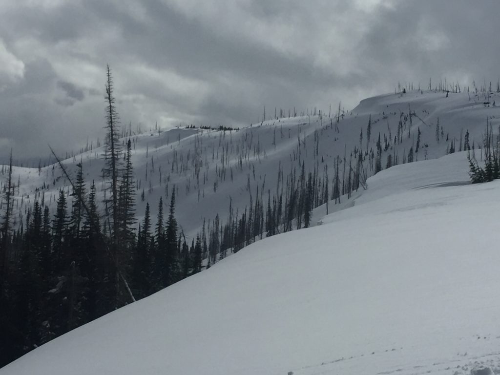
The primary avalanche problem is wind slabs.  Leeward terrain is wind loaded. During the last storm cycle, the winds shifted, look for typical ridgeline loading and for some slopes to have been cross loaded.  Identify these slopes and avoid wind loaded terrain.

Storm slabs are the second avalanche concern today.  The northern part of the advisory area received over 2 feet of new snow in the last 72 hours and the southern part got 16 new inches. These slabs are gaining strength and bonding to the snowpack.

The final avalanche problem is persistent weak layers.  The near surface facets and buried surface hoar are becoming less reactive in pit tests.  Also, these layers have not been present for any natural avalanche activity in the last week.  In the Rattlesnake, these layers have been the most reactive.  These layers are reactive in isolated areas.  Dig a pit before committing to any steep terrain.

Avalanche and Weather Outlook

Valley temperatures should be below freezing, and light flurries for today and Friday.  With these conditions expect the avalanche danger to decrease as the snowpack refreezes in the low elevations and the snowpack adjusts to the new snow above 6000 ft.

If you are out in the backcountry, please send us your observations, these are very helpful in producing the advisory.  I will issue the next advisory on February 25, 2017.

Ski and ride safe.

READ FULL ADVISORY  

Problem 1 - Wind Slabs

  • TYPE

    wind-slabs

    Wind Slabs

    Release of a cohesive layer of snow (a slab) formed by the wind.  Wind typically erodes snow from the upwind sides of terrain features and deposits snow on the downwind side.  Wind slabs are often smooth and rounded and sometimes sound hollow, and can range from soft to hard. Wind slabs that form over a persistent weak layer (surface hoar, depth hoar, or near-surface facets) may be termed Persistent Slabs or may develop into Persistent Slabs.

  • SIZE

    3-4

    1-2 (Small-Large)

    The potential size of avalanche resulting from this problem.

  • LIKELIHOOD

    Likelihood-3

    Possible

    The likelihood of an avalanche resulting from this problem.

  • IMAGE

Wind with the last storm has loaded leeward terrain.

Problem 2 - Storm Slabs

  • TYPE

    storm-slabs

    Storm Slabs

    Release of a soft cohesive layer (a slab) of new snow which breaks within the storm snow or on the old snow surface. Storm-slab problems typically last between a few hours and few days. Storm-slabs that form over a persistent weak layer (surface hoar, depth hoar, or near-surface facets) may be termed Persistent Slabs or may develop into Persistent Slabs.

  • SIZE

    3-4

    1-2 (Small-Large)

    The potential size of avalanche resulting from this problem.

  • LIKELIHOOD

    Likelihood-2

    Unlikely/Possible

    The likelihood of an avalanche resulting from this problem.

  • ADDED DANGER

    Increased Slope Danger

    Increased/Added Danger

    There is an increased risk of avalanches on these slopes:

    N - North
    NE - Northeast
    E - East
    SE - Southeast
    S - South
    SW - Southwest
    W - West
    NW - Northwest

Storm slabs are bonding to the snowpack.

Problem 3 - Persistent Slabs

  • TYPE

    persistent-slabs

    Persistent Slabs

    Release of a cohesive layer of soft to hard snow (a slab) in the middle to upper snowpack, when the bond to an underlying persistent weak layer breaks.  Persistent layers include: surface hoar, depth hoar, near-surface facets, or faceted snow. Persistent weak layers can continue to produce avalanches for days, weeks or even months, making them especially dangerous and tricky. As additional snow and wind events build a thicker slab on top of the persistent weak layer, this avalanche problem may develop into a Persistent, Deep-Slab.

  • SIZE

    4-5

    2 (Large)

    The potential size of avalanche resulting from this problem.

  • LIKELIHOOD

    Likelihood-2

    Unlikely/Possible

    The likelihood of an avalanche resulting from this problem.

  • ADDED DANGER

    Increased Slope Danger

    Increased/Added Danger

    There is an increased risk of avalanches on these slopes:

    N - North
    NE - Northeast
    E - East
    SE - Southeast
    S - South
    SW - Southwest
    W - West
    NW - Northwest

The persistent weak layers are becoming less reactive in pit tests.  Dig a pit before committing to any steep terrain.

VIDEO

Observations 02/22/2017

Observations 02/22/2017

FORECAST & OUTLOOK

Cooler temperatures and light flurries till Friday.

This information is the sole responsibility of the Forest Service and does not apply to operating ski areas. The avalanche danger rating expires at midnight tonight but the information can help you make a more informed decision regarding travel in avalanche terrain for the next few days.

Our advisory area includes National Forest System lands in the Bitterroot Mountains from Lost Trail Pass north to Granite Pass, the Rattlesnake Mountains north of Missoula and the Southern Swan and Mission Mountains near Seeley Lake, MT. Avalanche information for the Lookout Pass/St. Regis Basin area is available from the Idaho Panhandle Avalanche Center.