
The current avalanche danger in the West Central Montana backcountry is considerable on steep wind loaded terrain. Careful snowpack evaluation to identify wind loaded areas will be critical as human triggered avalanches are likely. The avalanche danger on all other terrain is currently moderate.
Good morning, this is Logan King with the West Central Montana Avalanche Center’s avalanche advisory for March 04, 2017. This danger rating does not apply to operating ski areas, expires at midnight tonight and is the sole responsibility of the U.S. Forest Service.
Weather and Snowpack
Mountain temperatures this morning range from 28-33 degrees as another active weather system works its way into West Central Montana. Overnight an additional trace-3 inches of snow fell and added up to .2 inches of SWE. Currently, winds at Point 6 are 17mph gusting to 35mph from the WSW, and at Deer Mountain are 8mph gusting to 14mph from the S.
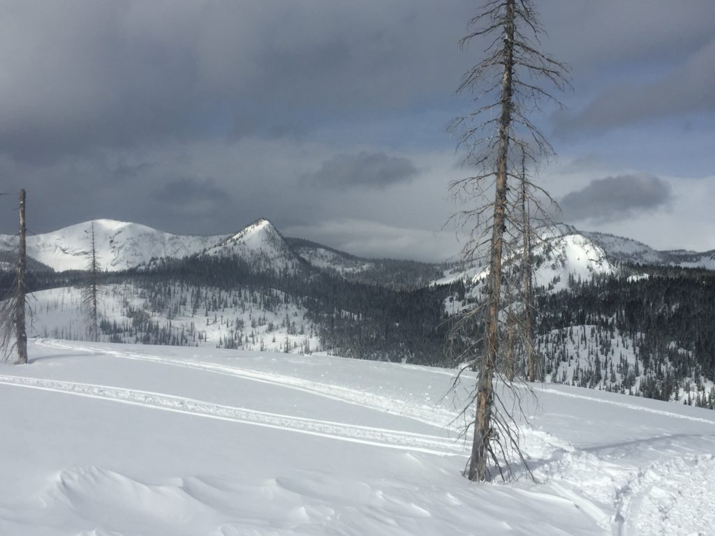
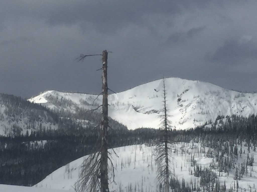
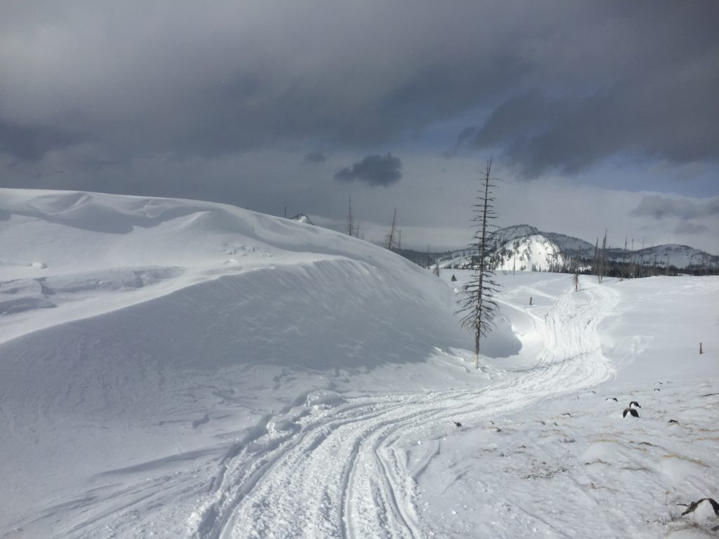
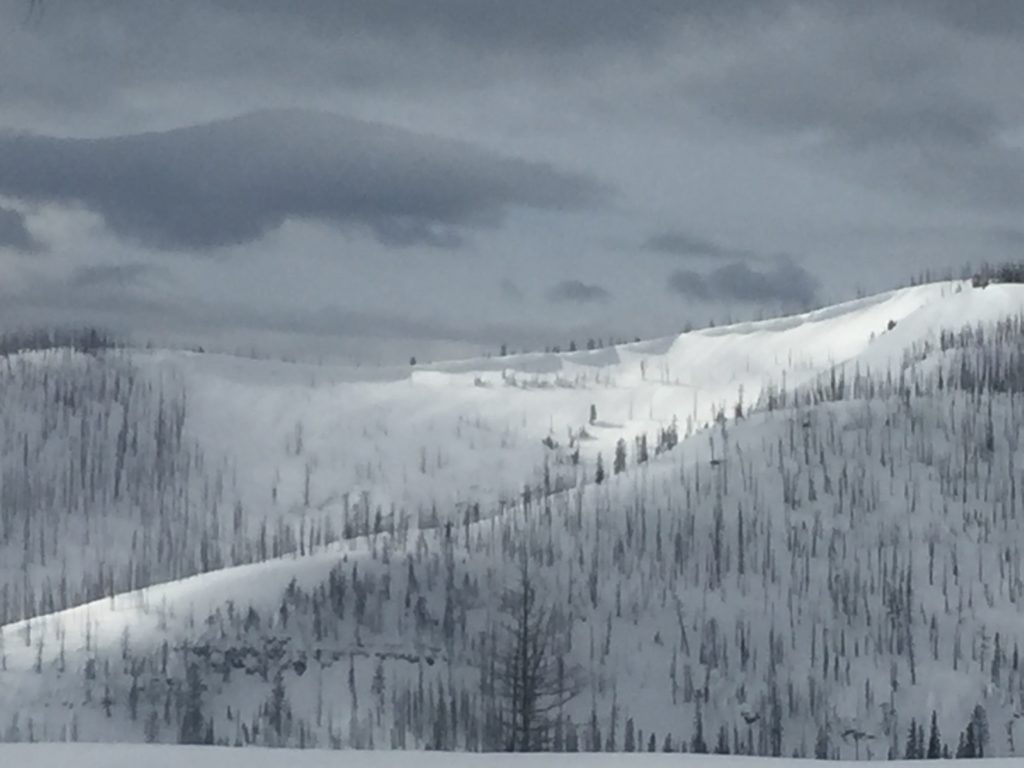
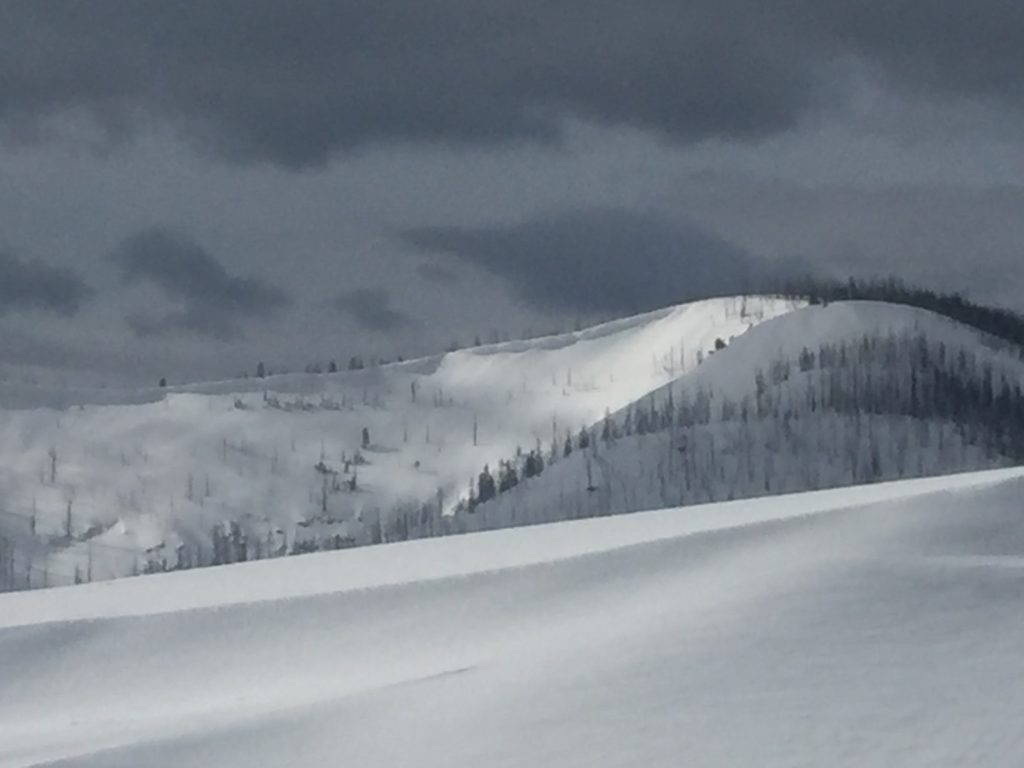
Travis and I rode around Seeley Lake yesterday and found significant signs of wind slab development above 6,000ft. We also saw an old crown and flank from a significant natural wind slab failure in the last 2-3 days. With a large load of light snow for transport and a couple of windy days, wind slabs have grown and will be suspect. Avoid steep terrain over 6,000 ft that shows signs of wind loading.
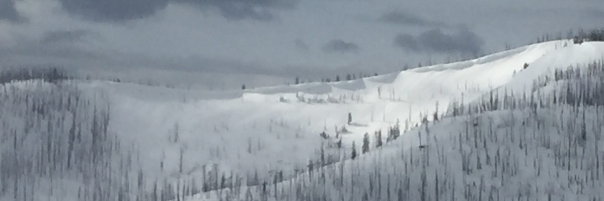
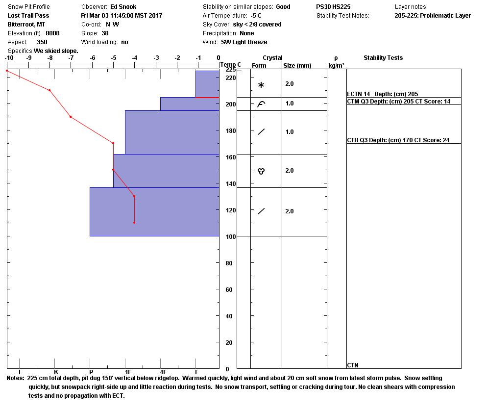
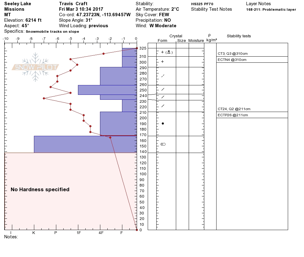
Observers near Lost Trail pass yesterday found storm slabs to be the greatest concern on non-wind loaded terrain. Travis and I also observed storm slabs to be a secondary concern. A density change in the storm snow in the Seeley area propagated in stability tests yesterday. This density change is from a brief warm up during the last storm cycle. This will need a another day or two to finish bonding but a new storm slab will start forming today. Storm slabs vary in thickness and cohesion across the region, take a few minutes to dig and see how the snow is bonding and to identify if the new load is adding to the concern before committing to avalanche terrain.
Avalanche and Weather Outlook
Snow is expected through the day today and temperatures look to cool as the next cold front pushes into the region later today and into tonight. Snow totals of up to a foot are in the forecast over the next few days. The avalanche danger will be increasing on all terrain today and through the weekend.
If you are out in the backcountry, please send us your observations, these are very helpful in producing the advisory. Travis will issue the next advisory on March 07, 2017.
Ski and ride safe.


