Posted:
Mar 23, 2017 @ 6:38 am

The current avalanche danger is LOW for the west central Montana backcountry and will rise to Moderate this afternoon. Human triggered avalanches are still possible in isolated terrain this morning and human triggered avalanches are possible this afternoon.

Good morning, this is Travis Craft with the West Central Montana Avalanche Center’s avalanche advisory for March 23, 2017. This danger rating does not apply to operating ski areas, expires at midnight tonight and is the sole responsibility of the U.S. Forest Service.

Weather and Snowpack

Mountain temperatures range from 22 F to 35 F in the region. Winds are 14 mph with gusts of 25 mph out of the W in the Bitterroot. Point Six, in the northern part of the advisory area, winds are 16 mph with gusts of 27 mph out of the W. The area received 0 to 1 new inches of snow.

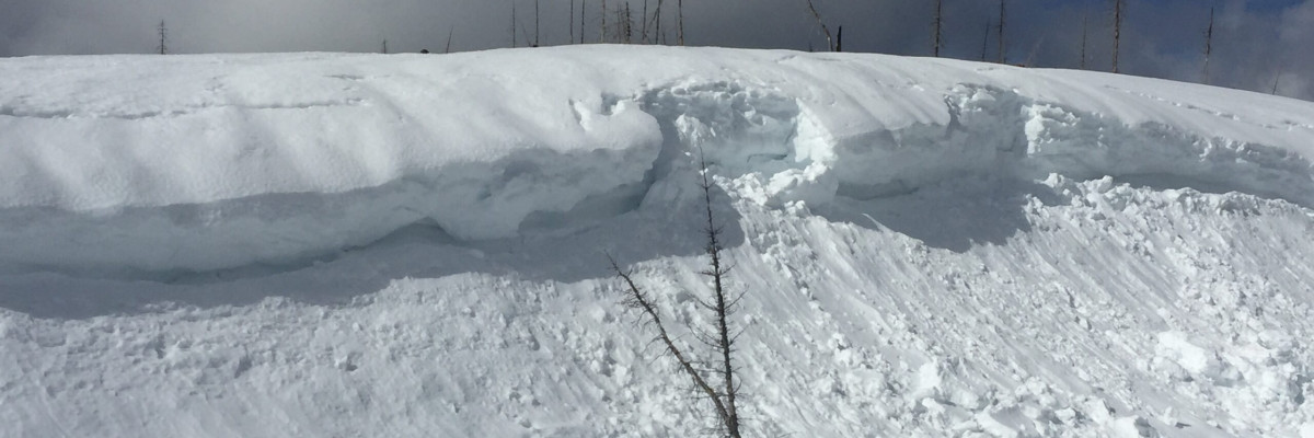
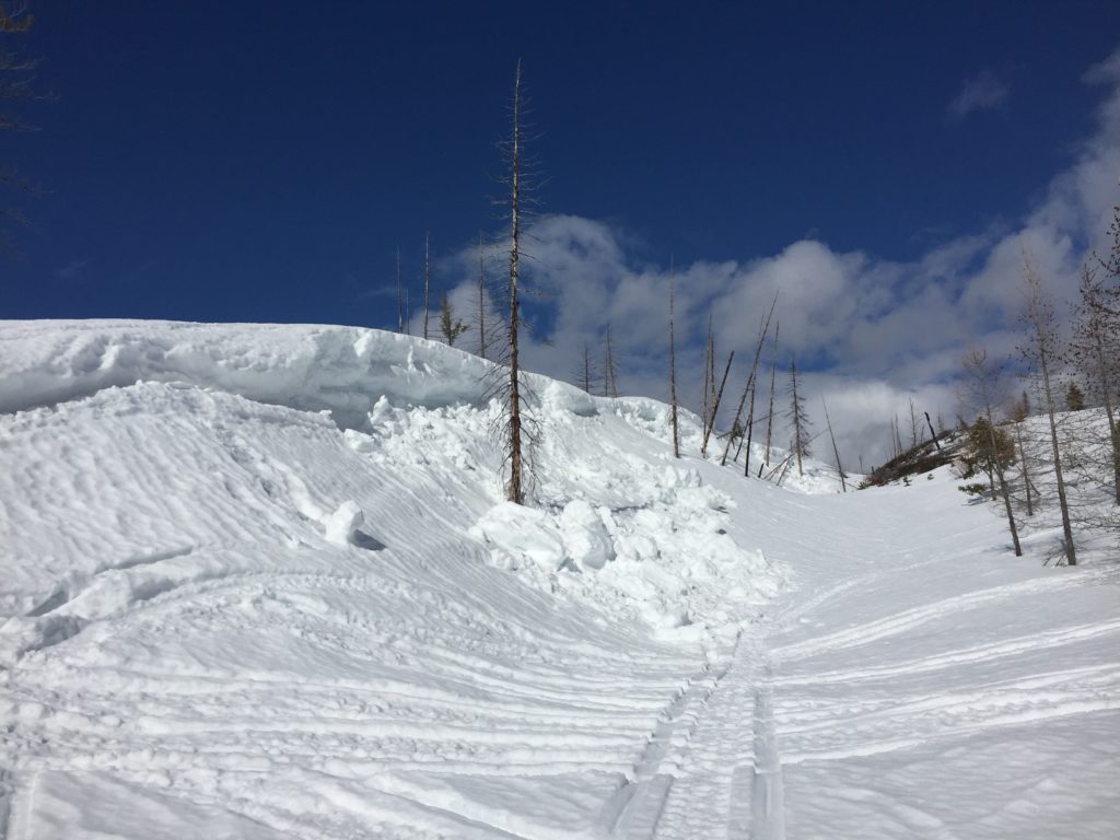
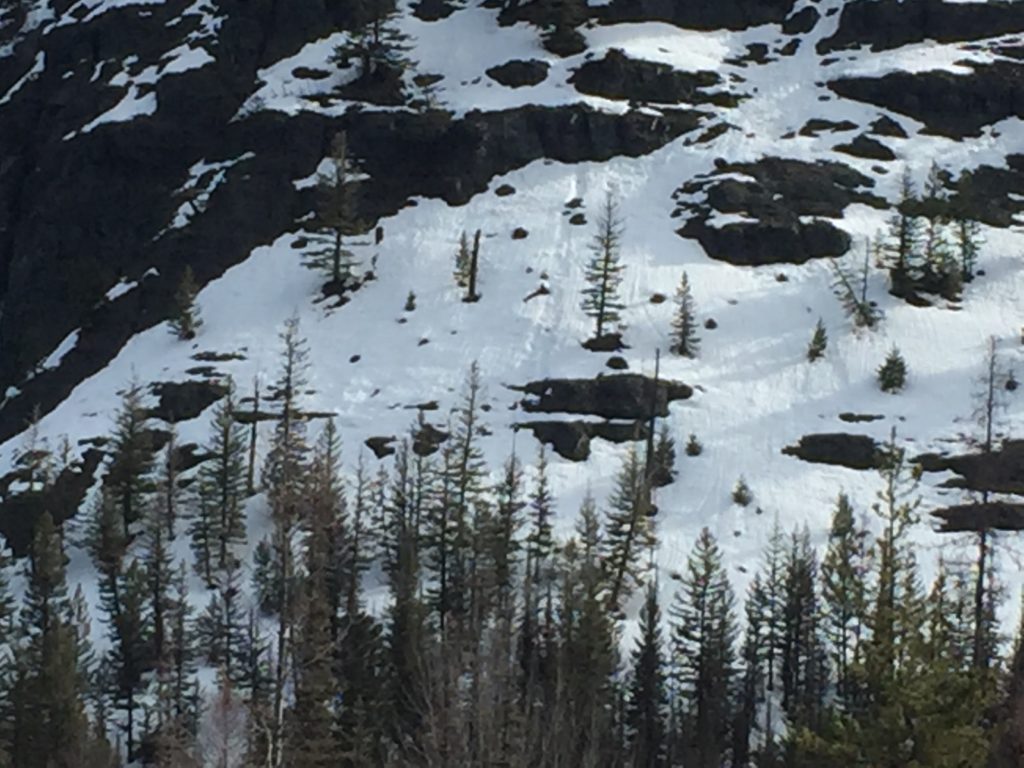
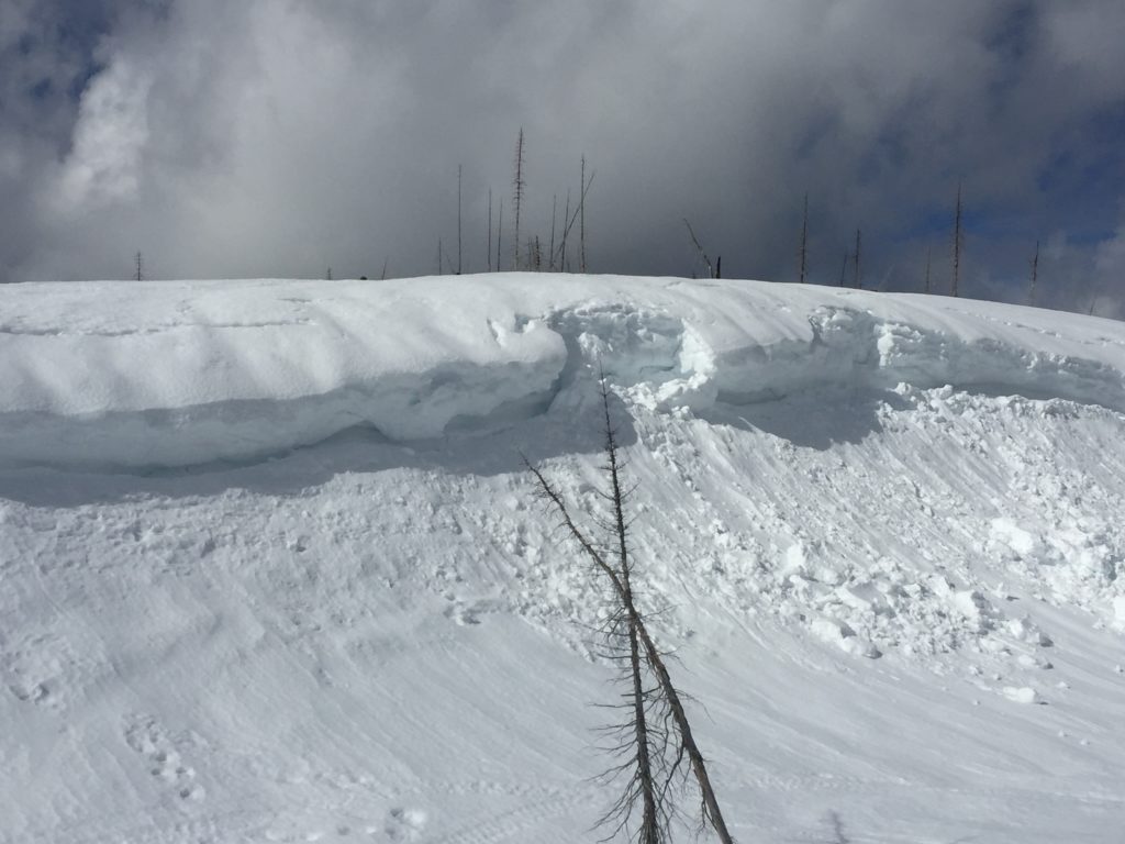
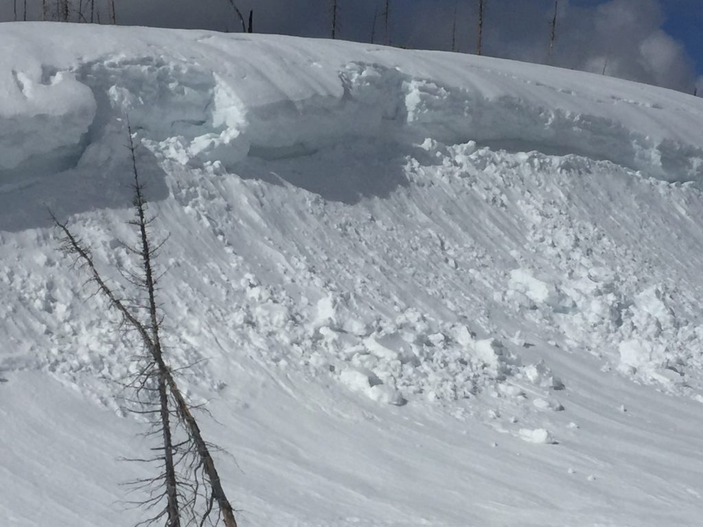
Logan and I took the sleds to the southern Missions near Seeley Lake yesterday. It was the first day of real solar activity. We saw wet releases in the afternoon and several cornice failures from the past couple of warmer days. Snotel sites got below freezing last night to 6000 feet, from 6000 feet and below it did not freeze. Warming temperatures and solar activity will increase the avalanche danger throughout the day. If you start to see roller balls or start to punch through the crust, it is time to change aspects. Cornices will continue to fail with the lack of freezing temperatures, give them a wide berth.

The primary avalanche problem today is loose wet releases this afternoon. Roller balls and pinwheels are clues to surface instability. When these start to show up, it is time to change aspects. With warm temperatures today and solar activity expect the avalanche danger to increase throughout the day.

The second avalanche concern is cornice failure. We saw many cornice failures in the southern Missions yesterday. With the warm temperatures and the sun, cornices will continue to weaken. Give them a wide berth. Cornices tend to break farther back than expected.

Avalanche and Weather Outlook

High pressure will dominate the region until Friday afternoon. Expect the avalanche danger to rise throughout the day. Overnight it is predicted to freeze to 4500 feet this will lock the snowpack up. Then with warmer temperatures and sun expect the avalanche danger to increase into the afternoon.

If you are out in the backcountry, please send us your observations, these are very helpful in producing the advisory. Logan will issue the next advisory on March 25, 2017.

Ski and ride safe.


READ FULL ADVISORY  

Problem 1 - Loose Wet

  • TYPE

    loose-wet

    Loose Wet

    Release of wet unconsolidated snow or slush. These avalanches typically occur within layers of wet snow near the surface of the snowpack, but they may quickly gouge into lower snowpack layers. Like Loose-Dry Avalanches,they start at a point and entrain snow as they move downhill, forming a fan-shaped avalanche. They generally move slowly, but can contain enough mass to cause significant damage to trees, cars or buildings. Other names for loose-wet avalanches include point-release avalanches or sluffs. Loose-wet avalanches can trigger slab avalanches that break into deeper snow layers.

  • SIZE

    3-4

    1-2 (Small-Large)

    The potential size of avalanche resulting from this problem.

  • LIKELIHOOD

    Likelihood-3

    Possible

    The likelihood of an avalanche resulting from this problem.

  • ADDED DANGER

    Increased Slope Danger

    Increased/Added Danger

    There is an increased risk of avalanches on these slopes:

    E - East
    SE - Southeast
    S - South
    SW - Southwest
    W - West

It will be possible to trigger loose wet slides this afternoon on all sun exposed aspects.

Problem 2 - Cornices

  • TYPE

    cornices

    Cornices / Cornice Fall

    Release of an overhanging mass of snow that forms as the wind moves snow over a sharp terrain feature, such as a ridge, and deposits snow on the down-wind side. They range from small wind lips of soft snow to large overhangs of hard snow that are 30 feet (~10 meters) or taller. They can break off the terrain suddenly and pull back onto the ridge top and catch people by surprise even on the flat ground above the slope. Even small cornices can have enough mass to be destructive and deadly. Cornice fall can entrain loose surface snow or trigger slab avalanches.

  • SIZE

    6-7

    3 (Large-Very Large)

    The potential size of avalanche resulting from this problem.

  • LIKELIHOOD

    Likelihood-3

    Possible

    The likelihood of an avalanche resulting from this problem.

  • IMAGE

The warmer temperatures and sun are weakening cornices.

VIDEO

Observation 03/22/2017

Observations Seeley 03/22/2017

FORECAST & OUTLOOK

High pressure will dominate the region until Friday afternoon. Expect the avalanche danger to rise throughout the day. Overnight it is predicted to freeze to 4500 feet this will lock the snowpack up. Then with warmer temperatures and sun expect the avalanche danger to increase into the afternoon.

This information is the sole responsibility of the Forest Service and does not apply to operating ski areas. The avalanche danger rating expires at midnight tonight but the information can help you make a more informed decision regarding travel in avalanche terrain for the next few days.

Our advisory area includes National Forest System lands in the Bitterroot Mountains from Lost Trail Pass north to Granite Pass, the Rattlesnake Mountains north of Missoula and the Southern Swan and Mission Mountains near Seeley Lake, MT. Avalanche information for the Lookout Pass/St. Regis Basin area is available from the Idaho Panhandle Avalanche Center.