Posted:
Apr 12, 2018 @ 9:57 pm

This is Travis Craft with a Spring update or should we say Winter update.

SPRINGTIME SNOW SAFETY CONSIDERATIONS

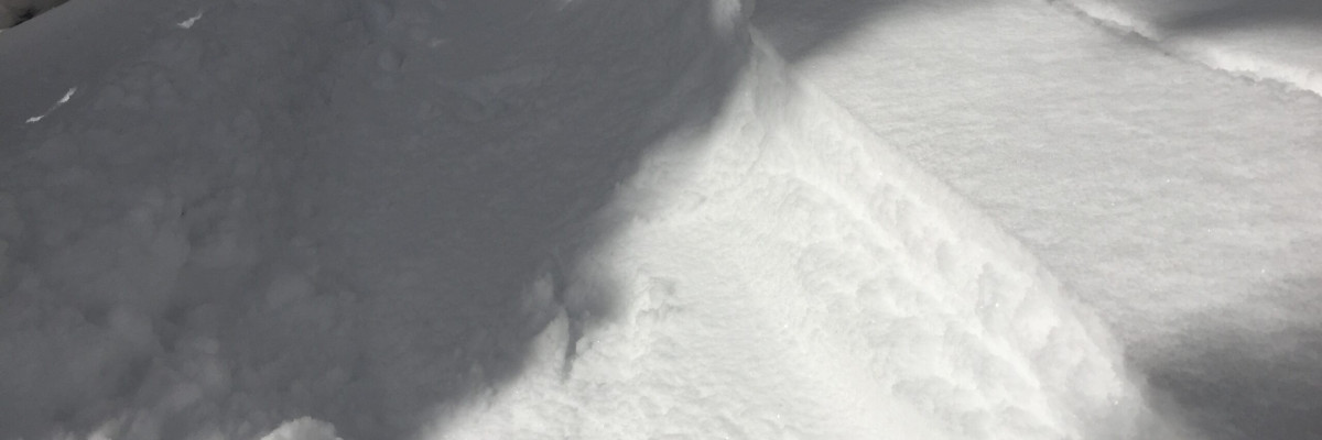
It is still winter at higher elevations. The advisory area has received several new inches of snow over the week with strong winds. We have had reports of shooting cracks and localized collapsing in the region on several different aspects and elevations. Remember when the ski areas close the terrain is no longer controlled and should be treated like backcountry slopes. Carry your beacon, shovel, and probe.

Trip planning is essential this time of year with no regular avalanche advisory. Use the backcountry weather forecast which will continue to be updated until April 13th.  Look at snotel data to get information on snow total amounts and weather station data for temperatures, wind trends, and speeds year round. With these tools, you can get an idea of the avalanche problems you could encounter on your trip and choose appropriate terrain for the day.

Keep your head on a swivel looking for signs of instability; shooting cracks, natural avalanches, roller balls, rounded pillows or signs of wind scouring, and localized collapsing. Dig a pit before committing to any steep slope. Use small test slopes to see how new snow is bonding to old snow surfaces. Pay attention to weather changes while in the field that can elevate the avalanche danger. The spring is a very dynamic season, and conditions can change rapidly.

We will continue to post public observations as we receive them and will post updated information if conditions change dramatically. If you are out recreating in the backcountry, please continue to send us observations by sending an email or use the form available on our website at missoulaavalanche.org. The information provided might keep someone out of trouble.

Thanks for another excellent season and all the support this year! We couldn’t do it without your financial help, community support, public observations, and it is deeply appreciated. A special thank you goes out to the dedicated board members of the West Central Montana Avalanche Foundation, our non-profit support organization.

Ski and ride safe.

READ FULL ADVISORY  

Problem 1 - Wind Drifted

  • TYPE

    wind-slabs

    Wind Slabs

    Release of a cohesive layer of snow (a slab) formed by the wind.  Wind typically erodes snow from the upwind sides of terrain features and deposits snow on the downwind side.  Wind slabs are often smooth and rounded and sometimes sound hollow, and can range from soft to hard. Wind slabs that form over a persistent weak layer (surface hoar, depth hoar, or near-surface facets) may be termed Persistent Slabs or may develop into Persistent Slabs.

  • SIZE

    3-4

    1-2 (Small-Large)

    The potential size of avalanche resulting from this problem.

  • LIKELIHOOD

    Likelihood-3

    Possible

    The likelihood of an avalanche resulting from this problem.

Strong winds have loaded leeward slopes. Identify wind-loaded terrain. Look for rounded pillows of snow near ridgelines and on cross-loaded slopes. Recognize signs of instability such as cracking in the surface snow.

Problem 2 - New Snow

  • TYPE

    storm-slabs

    Storm Slabs

    Release of a soft cohesive layer (a slab) of new snow which breaks within the storm snow or on the old snow surface. Storm-slab problems typically last between a few hours and few days. Storm-slabs that form over a persistent weak layer (surface hoar, depth hoar, or near-surface facets) may be termed Persistent Slabs or may develop into Persistent Slabs.

  • SIZE

    3-4

    1-2 (Small-Large)

    The potential size of avalanche resulting from this problem.

  • LIKELIHOOD

    Likelihood-3

    Possible

    The likelihood of an avalanche resulting from this problem.

New snow on old snow surfaces. Use small test slopes to see how the new snow is bonding to old snow surfaces.

Problem 3 - Cornice

  • TYPE

    cornices

    Cornices / Cornice Fall

    Release of an overhanging mass of snow that forms as the wind moves snow over a sharp terrain feature, such as a ridge, and deposits snow on the down-wind side. They range from small wind lips of soft snow to large overhangs of hard snow that are 30 feet (~10 meters) or taller. They can break off the terrain suddenly and pull back onto the ridge top and catch people by surprise even on the flat ground above the slope. Even small cornices can have enough mass to be destructive and deadly. Cornice fall can entrain loose surface snow or trigger slab avalanches.

  • SIZE

    6-7

    3 (Large-Very Large)

    The potential size of avalanche resulting from this problem.

  • LIKELIHOOD

    Likelihood-2

    Unlikely/Possible

    The likelihood of an avalanche resulting from this problem.

Cornices are very large this time of year and unpredictable in failure, give them a wide berth.

FORECAST & OUTLOOK

Use the backcountry weather forecast which will continue to be updated until April 13th.  Look at snotel data to get information on snow total amounts and weather station data for temperatures, wind trends, and speeds year round. With these tools, you can get an idea of the avalanche problems you could encounter on your trip and choose appropriate terrain for the day.

This information is the sole responsibility of the Forest Service and does not apply to operating ski areas. The avalanche danger rating expires at midnight tonight but the information can help you make a more informed decision regarding travel in avalanche terrain for the next few days.

Our advisory area includes National Forest System lands in the Bitterroot Mountains from Lost Trail Pass north to Granite Pass, the Rattlesnake Mountains north of Missoula and the Southern Swan and Mission Mountains near Seeley Lake, MT. Avalanche information for the Lookout Pass/St. Regis Basin area is available from the Idaho Panhandle Avalanche Center.