Professional Observation
Basic Information
Observation Details
Observation Date:
December 10, 2021Submitted:
December 10, 2021Observer:
WCMAC - Ryan Sorenson and Trask BaughmanZone or Region:
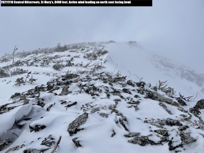
Central BitterrootsLocation:
Saint Mary'sSigns of Unstable Snow
Recent Avalanches?
None ObservedCracking?
IsolatedCollapsing?
None ExperiencedBottom Line
We braved the rocky trail on Saint Mary's today. Viable snow was found above 7,000 feet, but strong winds kept us out of the alpine and steeps.
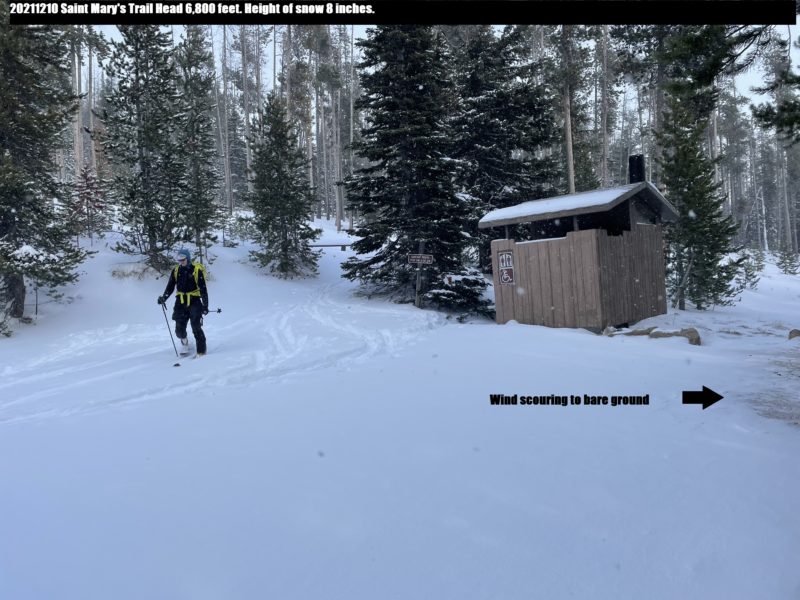
• Deeper drifted snow on the road forced us to park at a pull out at 6,200 feet.
• The snowpack is thin and lacking a base below approximately 7,000 feet.
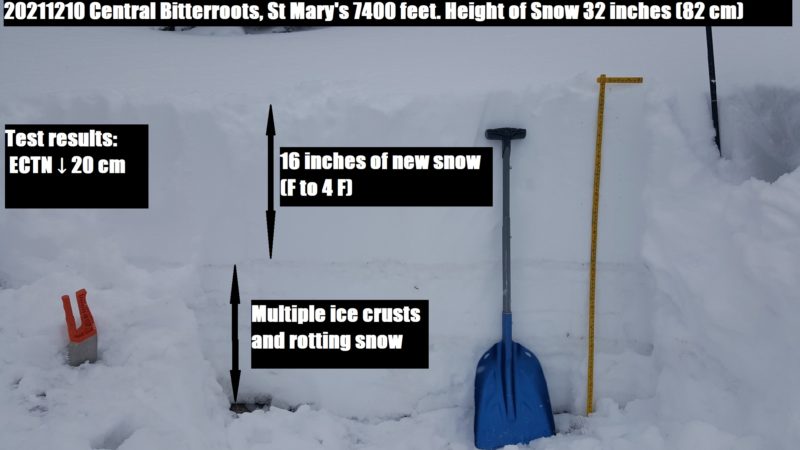
• We found 16 inches of new snow over various crust and faceting layers at 7,400 feet.
• The winds were strong and swirling in a multitude of directions.
• Looking towards alpine terrain, the strong winds have striped south and westerly slopes and loaded north and easterly.
• The upper snowpack is light and lacked the cohesion for significant cracking and slab formation in this area today. However, slab avalanches will become more of an issue with continued wind compaction, transport, and load from new snow.
Media
Advanced Information
Weather Summary
Cloud Cover:
Mostly CloudyTemperature:
22Wind:
StrongIt was snowing on and off throughout the tour. Snowfall rates were less than an inch per hour (S1). We experienced more snowfall at higher elevations. Winds were strong and swirled in various directions.
Close