Professional Observation
Basic Information
Observation Details
Observation Date:
December 17, 2021Submitted:
December 17, 2021Observer:
WCMAC - Geoff Fast and Seth TonsmeireZone or Region:
Southern BitterrootsLocation:
Lost Trail BackcountrySigns of Unstable Snow
Recent Avalanches?
None ObservedCracking?
None ExperiencedCollapsing?
None ExperiencedSnow Stability
Stability Rating:
FairConfidence in Rating:
ModerateStability Trend:
ImprovingBottom Line
Lost Trail Pass area - Generally good snowpack with 2-3 feet of new snow in the past 5 days.
However, watch for areas where early season snows persisted before this storm cycle. Mainly steeper, shaded, northerly aspect, where faceted snow shows potential for propagation 2-3 feet down.
Early season conditions persist!
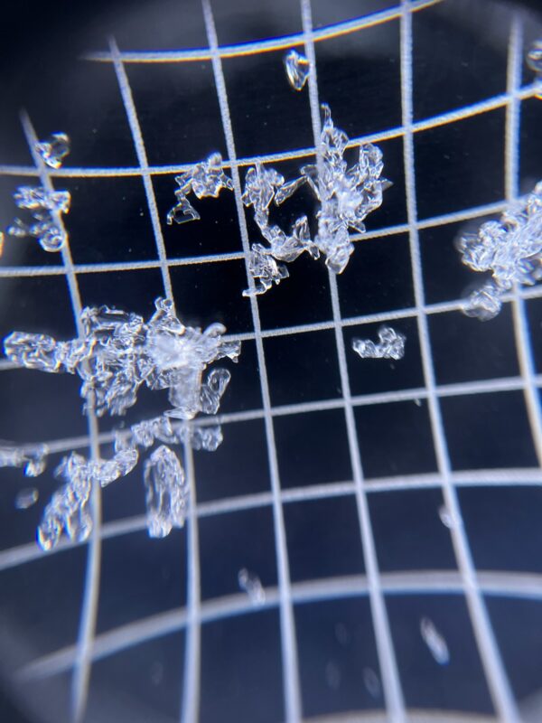
Media
Advanced Information
Weather Summary
Cloud Cover:
Mostly SunnyTemperature:
-10C; 14FWind:
Light , S
Today, temps were cold -10C, with a slight south wind, and mostly sunny skies.
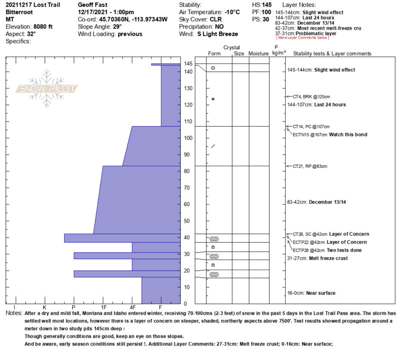
After a dry and mild fall, Montana and Idaho entered winter, with 70-100cm (2-3feet) of new snow in the past 5 days in the Lost Trail Pass area.
Snowpack Observations
The 2-3 feet of new snow in the past 5 days has settled well in most locations, however, there is a layer of concern on steeper, shaded, northerly aspects above 7500 feet. Test results showed propagation around a meter down in two study pits in 145cm snowpack. ECTP22 ↓ 103cm & ECTP28 ↓ 103cm (40").
Though generally conditions are good, keep an eye on those slopes.
Also, be aware, early season conditions persist!