Professional Observation
Basic Information
Observation Details
Observation Date:
December 20, 2021Submitted:
December 20, 2021Observer:
WCMAC - Ryan Sorenson and Todd GlewZone or Region:
RattlesnakeLocation:
Point 6Signs of Unstable Snow
Recent Avalanches?
YesCracking?
IsolatedCollapsing?
None ExperiencedBottom Line
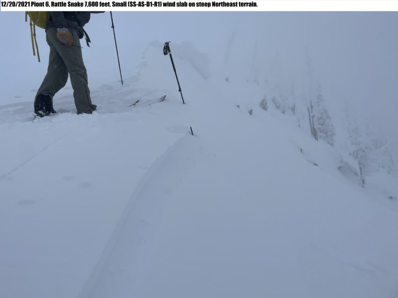
We went to Point 6 from Snowbowl today to check today's avalanche hazard. We traveled on this ridge and intentionally triggered a small soft slab avalanche on a steep, northeast-facing slope around 7800 feet from flat terrain on the ridge.
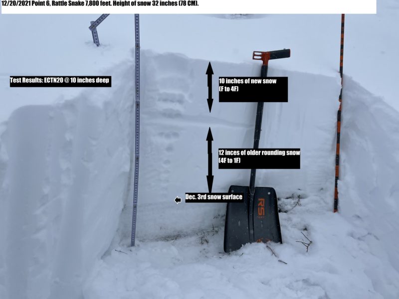
We dug a snow pit on a protected northeast aspect around 7600 feet. We found generally strong, right-side-up layers that got harder closer to the ground. We did find a layer of rounding facets just above the December 3rd snow surface. We did not get any propagating test results.
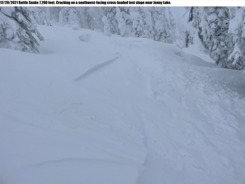
Traveling one at a time with radios to check in, we carefully skied the southeast-facing terrain above Jenny Lake. The snowpack here was the thinnest due to previous wind scouring. It had recently been cross-loaded by north and easterly wind leaving small 6 inches to 1-foot drifts. We ski cut the small drifts to mitigate any hazard on the slope before proceeding.
On lower angle terrain near Jenny Lake, the snowpack got deeper, and we noticed the newer snow was denser than lighter old snow. To avoid storm slabs, we traveled on low-angle terrain back to Snowbowl.
Media
Advanced Information
Weather Summary
Cloud Cover:
OvercastTemperature:
25°FWind:
Moderate , WIncreasing winds with elevation. We experienced moderate ridgetop winds with strong gusts out of the west. Previous winds were strong enough to transport snow to mid-slope on terrain above 7,000 feet. It was snowing less than an inch per hour (S1) throughout the day. Highest Precipitation Rate: Moderate Snowfall (S2).
Avalanche Observations
Small (SS-AS-D1-R1) wind slab from lower-angle terrain on the ridge
Snowpack Observations
Generally strong, right-side-up layers that got harder closer to the ground. We had an ECTN20 result on the new/old snow interface 10 inches deep on a northeast aspect at 7,800 feet.
Avalanche Problems
| Problem | Location | Distribution | Sensitivity | Size | Comments |
|---|---|---|---|---|---|
 Wind Slab
|
|
Layer Depth/Date: 6 inch to 1 foot |