Professional Observation
Basic Information
Observation Details
Observation Date:
December 29, 2021Submitted:
December 30, 2021Observer:
WCMAC - George D'AngeloZone or Region:
Southern BitterrootsLocation:
Lost Trail BackcountrySigns of Unstable Snow
Recent Avalanches?
None ObservedCracking?
IsolatedCollapsing?
None ExperiencedSnow Stability
Stability Rating:
GoodConfidence in Rating:
HighStability Trend:
SteadyBottom Line
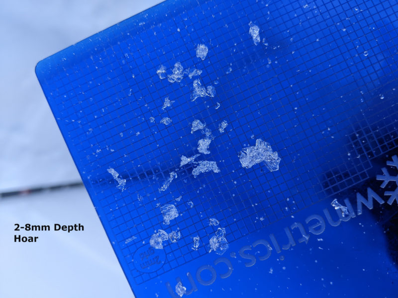
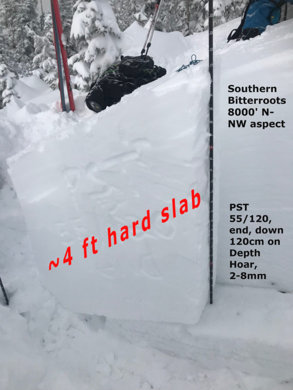
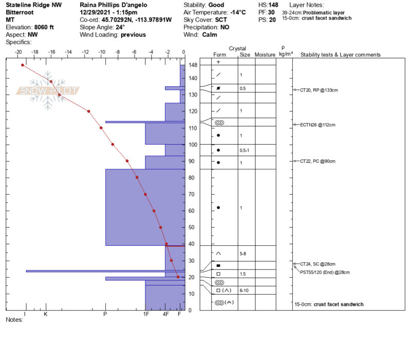
The lingering deep slab instability and small wind slabs are what you should be focused on today in the Southern Bitterroots. The persistent weak layer (PWL) shows signs of propagation down almost 4ft. Be wary of shallow, NW-E aspects at mid and upper elevations. Wind slabs will continue to grow if winds materialize as forecast. These will most likely be isolated to ridgelines at treeline and above. South facing mid-elevation slopes have a melt-freeze crust down about a foot worth observing. These southerly slopes do not appear to have a uniform persistent weak layer (PWL), but it's worth checking to see if it exists, especially at upper elevations. PWLs on southerly or wind-scoured slopes will likely be easier to trigger than their shaded, wind-protected counterparts.
Media
Advanced Information
Weather Summary
Cloud Cover:
Mostly CloudyTemperature:
-14*CWind:
Light , WLight snow accumulations and moderate winds should keep snow available for wind slab/cornice formation at ridgelines.
Terrain Use
We skied a 30* soft, south facing, mid elevation slope and found some early season hazards still exist. We avoided the deep slab problem on the northern slopes
Close