Professional Observation
Basic Information
Observation Details
Observation Date:
January 7, 2022 - January 7, 2022Submitted:
January 7, 2022Observer:
WCMAC - Todd GlewZone or Region:
RattlesnakeLocation:
Blue PointSigns of Unstable Snow
Recent Avalanches?
None ObservedCracking?
IsolatedCollapsing?
IsolatedSnow Stability
Stability Rating:
FairConfidence in Rating:
ModerateStability Trend:
SteadyBottom Line
Travel was from the base of Marshall Mountain 3950' to the top of Blue Point at 7000.' Trail breaking was difficult today because the new snow was not yet consolidated.
Observations made were:
- Several feet of unconsolidated new snow above 5500.'
- Isolated cracking and collapsing between 5500' and 6300.'
- Above 6300' we found no instabilities in snow pits.
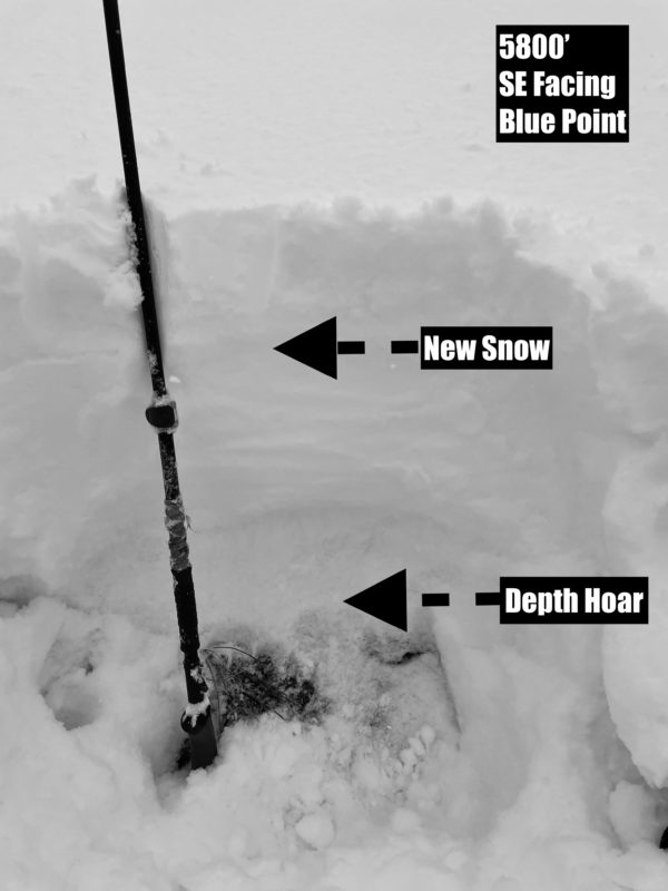
Media
Advanced Information
Weather Summary
Cloud Cover:
ObscuredTemperature:
28Wind:
Moderate , SWAt 6800' it was 28ºF(-2ºC) at 1:30 PM. At 3950' it was 36ºF(2ºC) at 3:00 PM. Winds were moderate out of the SW. There were scattered snow showers today with minimal accumulation.
Snowpack Observations
Between 5500' and 6300,' we found well-developed facets/depth hoar below the new snow from the past week or so. The new snow has not had time to consolidate into a slab yet. Once the new snow consolidates or is wind-loaded, slab avalanches will be a concern between 5500' and 6300'.
Above 6300', we found several feet of new unconsolidated snow. We performed several stability tests on multiple aspects. All of our stability tests yielded no results.