Professional Observation
Basic Information
Observation Details
Observation Date:
January 21, 2022Submitted:
January 21, 2022Observer:
WCMAC - Jeff CartyZone or Region:
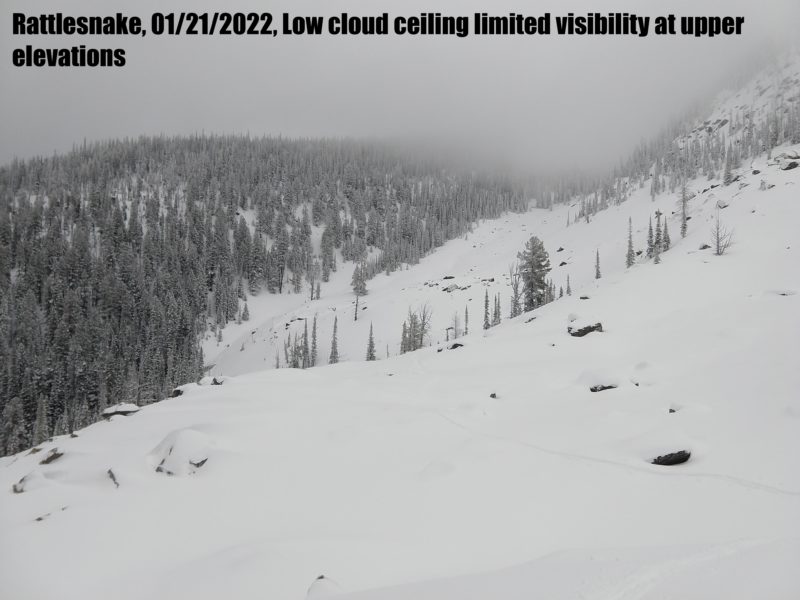
RattlesnakeLocation:
Point 6 and Evaro BowlSigns of Unstable Snow
Recent Avalanches?
None ObservedCracking?
None ExperiencedCollapsing?
None ExperiencedSnow Stability
Stability Rating:
GoodConfidence in Rating:
HighStability Trend:
ImprovingBottom Line
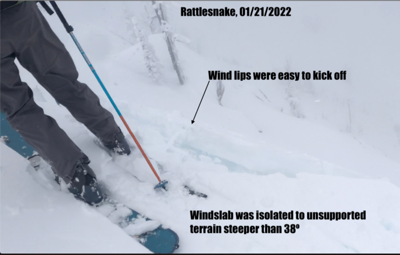
Yesterday's snow bonded well to old surfaces in Rattlesnake. We found no reactive storm slab. Wind slab is isolated and small but it is possible to kick of slabs in wind loaded terrain over 38º.
Basal facets can still be found under areas of shallow snowpack, despite warm temperatures for the past week. These facets are isolated and unlikely to cause and avalanche, but they are worth noting and planning for if you are entering steep terrain with a snowpack less that 4 feet thick.
Media
Advanced Information
Weather Summary
Cloud Cover:
OvercastTemperature:
21º F (-Wind:
Moderate , SWThe cloud ceiling hovered around 7400' today making for poor visibility at upper elevations. Winds were light to moderate out of the southwest. Temps stayed cool and yesterdays wet snow dried out making for decent skiing. The dry snow is available for transport although winds stayed light enough for this to be limited to the peak of Point 6.
Close