Professional Observation
Basic Information
Observation Details
Observation Date:
January 31, 2022Submitted:
January 31, 2022Observer:
WCMAC - Jeff CartyZone or Region:
Central BitterrootsLocation:
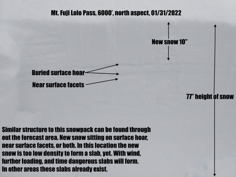
Mt. Fuji, Lolo PassSigns of Unstable Snow
Recent Avalanches?
None ObservedCracking?
IsolatedCollapsing?
None ExperiencedSnow Stability
Stability Rating:
FairConfidence in Rating:
HighStability Trend:
WorseningMedia
Advanced Information
Weather Summary
Cloud Cover:
ObscuredTemperature:
19ºF (-7ºC)Wind:
Moderate , SWSnowing steadily all day at Lolo pass, 0.5" to 1" an hour. Up to 10" new snow on the ground, with more coming. Winds are intermittently moderate to strong. Ridgetops are wind lipped but transport is minimal due to trees. Higher elevation ridges will see significant wind transport.
Snowpack Observations
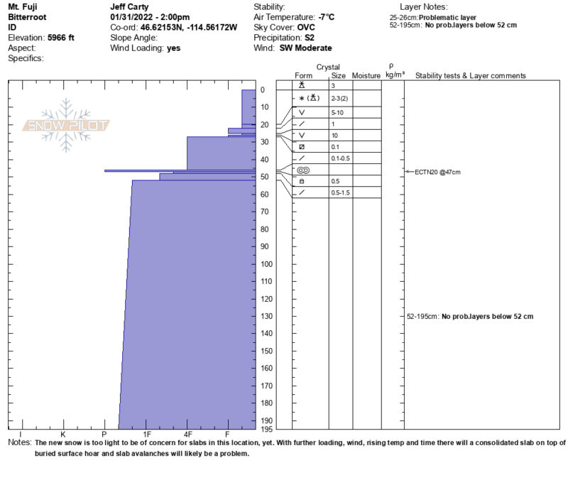
The new snow is very low density and lacks the cohesion needed for slab avalanches. It sits on two layers of surface hoar and near surface facets. As the new snow consolidates into a slab dangerous avalanche conditions could develop. The lower snowpack is very consolidated and there are no layers of concern.
Height of snow was 77" (195cm) in the location of our pit.
No test results of note, the new snow compresses immediately during taps.