Professional Observation
Basic Information
Observation Details
Observation Date:
February 16, 2022Submitted:
February 16, 2022Observer:
WCMAC - Jeff CartyZone or Region:
MissionsLocation:
Deer Creek, past Driftriders warming hutSigns of Unstable Snow
Recent Avalanches?
None ObservedCracking?
None ExperiencedCollapsing?
None ExperiencedSnow Stability
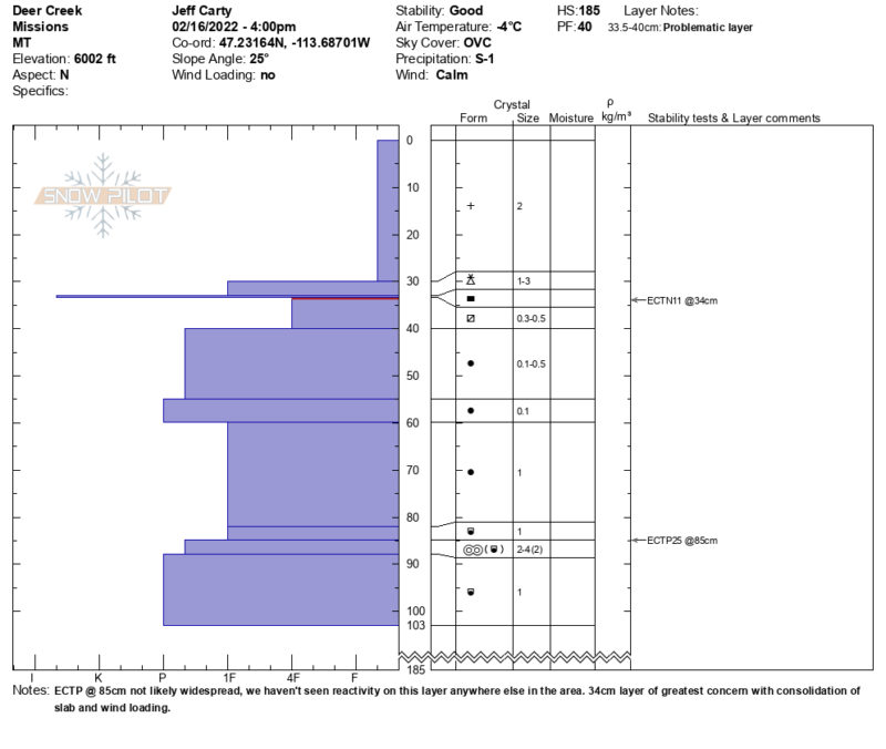
Stability Rating:
GoodConfidence in Rating:
ModerateStability Trend:
SteadyBottom Line
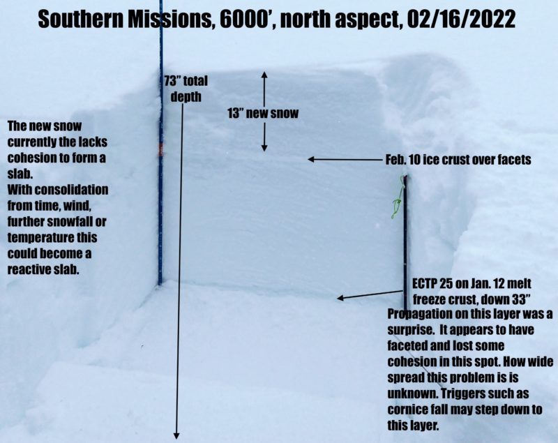
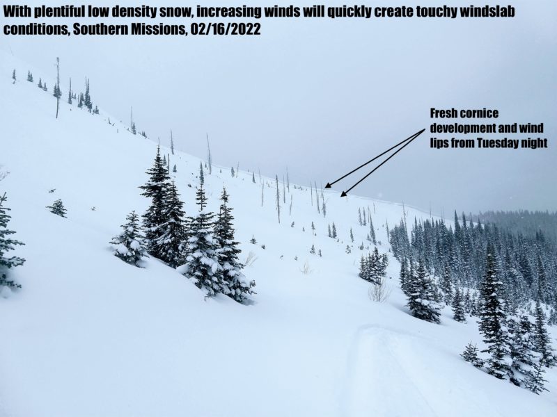
13" of snow fell in the southern Missions at 6000'. It sits on an ice layer over top of near surface facets. The new snow lacks the cohesion to form a slab, but with could become a problem with consolidation. Sluffing could be a problem on slopes greater than 38º. There is plentiful low density snow for wind transport, wind slab will form quickly if the winds pick up. Now signs of instability today, I rate the hazard moderate in this area due to the amount of new snow sitting on a slick bed surface.
Media
Advanced Information
Weather Summary
Cloud Cover:
OvercastTemperature:
25º F (-4ºC)Wind:
Calm
Clear in the morning, increasing clouds till noon, then overcast and obscured.
Snow beginning at 1:30 PM
Light snowfall until 4:00 pm, less than 1" accumulation
Wind calm, no snow transport
Evidence of west winds last night
Snowpack Observations
At 6000' on a north aspect
Height of snow 73" (185 cm)
13" (33cm) new snow on an ice crust over near surface facets.
ECTN 11 down 13" (33cm)
ECTP 25 down 33" (85cm) on faceted Jan. 12 melt freeze layer