Professional Observation
Basic Information
Observation Details
Observation Date:
February 16, 2022 - February 16, 2022Submitted:
February 16, 2022Observer:
WCMAC - Ryan SorensonZone or Region:
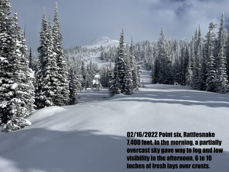
RattlesnakeLocation:
Rattlesnake, Snowbowl backcountry, Point SixSigns of Unstable Snow
Recent Avalanches?
YesCracking?
IsolatedCollapsing?
None ExperiencedSnow Stability
Stability Rating:
FairConfidence in Rating:
HighStability Trend:
WorseningBottom Line
I toured in the Snowbowl backcountry today. Winds were moderate out of the northwest early in the morning but calmed after approximately 10 am. We found reactive storm slabs breaking in the top 4 to 6 inches (10-15 cm) of fresh snow on slopes steeper than 35 degrees. These would turn to sluff after a few feet of sliding. There has been 6 to 10 inches (15-25 cm) of fresh snow since Monday night (2/14).
Media
Advanced Information
Weather Summary
Cloud Cover:
Mostly CloudyTemperature:
23°FWind:
Light , NWIn the morning, a partially overcast sky gave way to fog and low visibility in the afternoon. Snow bands would move in and out lightly snowing.
Avalanche Observations
| # | Date | Location | Size | Type | Bed Sfc | Depth | Trigger | Comments | Photo |
|---|---|---|---|---|---|---|---|---|---|
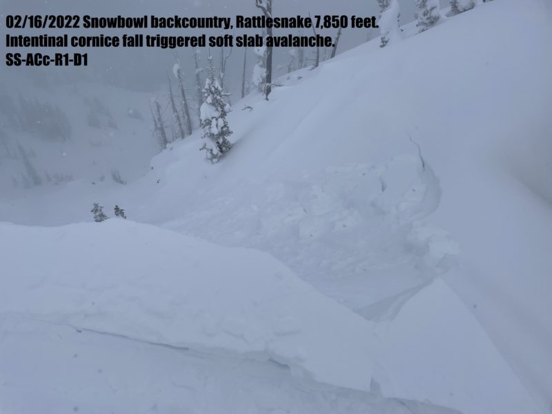
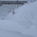
| 1 | Today |
Top of Point Six, 7,850 Feet E 7,850 |
D1 | SS | S-New Snow | 4 to 6 inches (10-15 cm) |
AS-Skier c-Intentional |
Intentional cornice fall triggered soft wind slab. |
|
Snowpack Observations
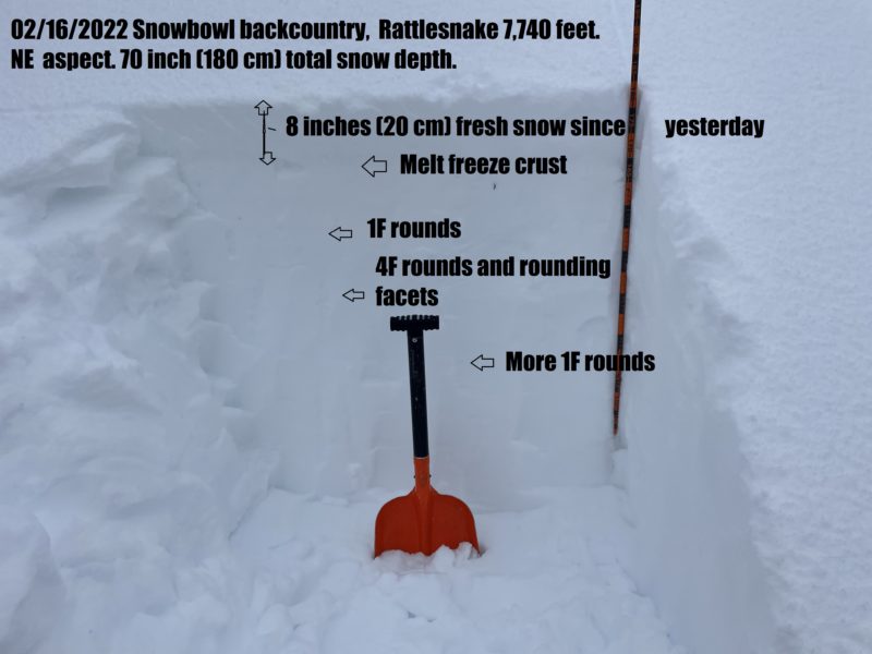
6 to 10 inches of fresh snow lays over various crusts, rounded snow, and rounding facets.
Avalanche Problems
| Problem | Location | Distribution | Sensitivity | Size | Comments |
|---|---|---|---|---|---|
 Storm Slab
|
|
Layer Depth/Date: 4 to 6 inches (10-15 cm) New snow |