Professional Observation
Basic Information
Observation Details
Observation Date:
February 21, 2022 - February 21, 2022Submitted:
February 21, 2022Observer:
WCMAC - Ryan SorensonZone or Region:
MissionsLocation:
Near Lake ElsinaSigns of Unstable Snow
Recent Avalanches?
None ObservedCracking?
None ExperiencedCollapsing?
None ExperiencedSnow Stability
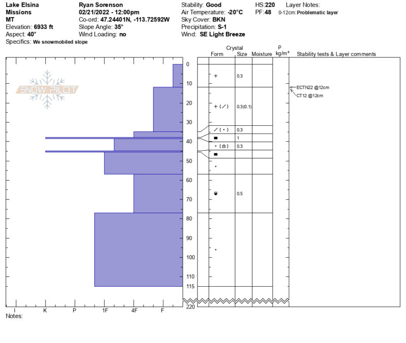
Stability Rating:
GoodConfidence in Rating:
HighStability Trend:
SteadyBottom Line
We noticed a lot of blowing snow on the drive to Seeley Lake. However, we were surprised to find a stable snowpack and calm conditions in the Lake Elsina and Dinah zone. We rode in treed and open terrain from 4,000 to 7,000 feet.
• Temperatures were frigid. We measured -5°F at 6,900 feet at noon.
• 4 to 8 inches of cohesionless fresh snow from last night sit over the slightly denser snow from last week, which has bonded well to the underlying crusts.
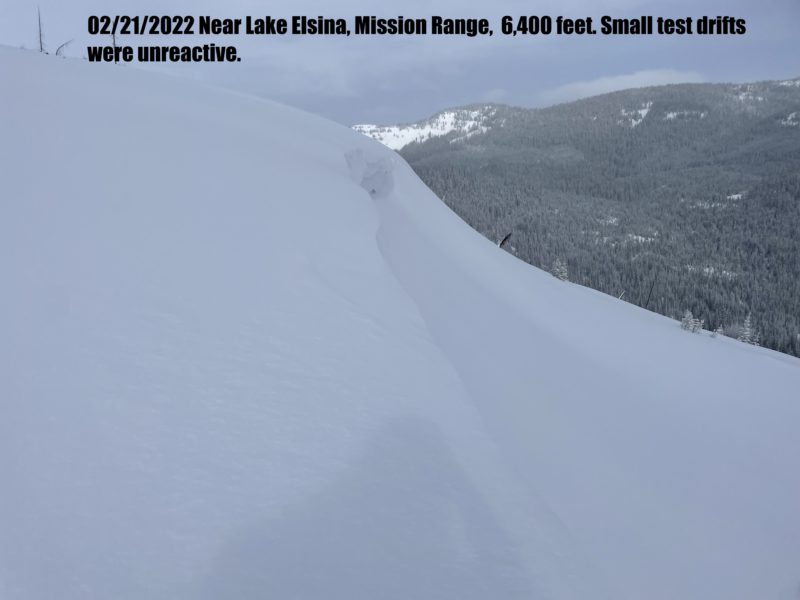
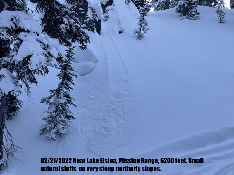
• Small natural sluffs were observed on very steep northern slopes.
• The west aspects of exposed ridgelines are scoured and thin from previous winds.
• The previous westerly wind has left old hard small drifts even in treed areas in some spots.
• No cracking or other signs of instability.
Media
Advanced Information
Weather Summary
Cloud Cover:
Mostly CloudyTemperature:
-5°F (-20 °C)Wind:
Light , SEBroken skies and fridged temps. Small very light snowfall S-1 would occasionally move overhead. Calm to light easterly winds throughout the day. We notice significantly more wind on the drive back to Missoula.
Close