Professional Observation
Basic Information
Observation Details
Observation Date:
February 28, 2022Submitted:
February 28, 2022Observer:
WCMAC - Jeff CartyZone or Region:
RattlesnakeLocation:
Little AlaskaSigns of Unstable Snow
Recent Avalanches?
YesCracking?
WidespreadCollapsing?
None ExperiencedSnow Stability
Stability Rating:
FairConfidence in Rating:
HighStability Trend:
WorseningMedia
Advanced Information
Weather Summary
Cloud Cover:
ObscuredTemperature:
30F (-1C)Wind:
Light , SW
Rain to 5600'
Freezing level 6400'
Snowing up to 1" per hour, tapering to 1/2" an hour in the afternoon
Winds light and southwest until 1:30 PM when moderate gusts began
Avalanche Observations
| # | Date | Location | Size | Type | Bed Sfc | Depth | Trigger | Comments | Photo |
|---|---|---|---|---|---|---|---|---|---|
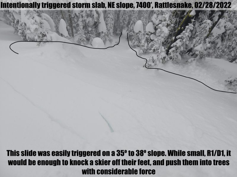
| 1 | Today |
Ridge above Tele meadows NE 7400 |
D1 | SS | I-New/Old Interface | 6" (15cm) |
AS-Skier c-Intentional |
None |
Snowpack Observations
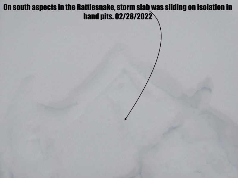
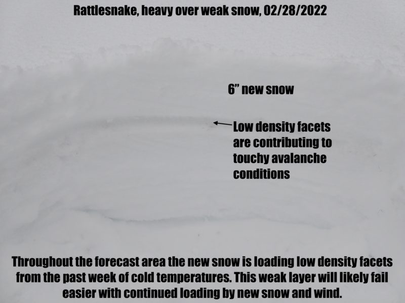
Storm slab is the primary problem above 6400'. Dense new snow overlays low density faceted snow from the past week on some aspects and sun crust on other aspects. Slabs were easily triggered on slopes over 35º. Touchiness will likely increase with continued loading.
Below 6400' rain is saturating the snowpack. No loose wet or wet slab were observed today.
Terrain Use
We stayed on slopes under 30º today.
Close