Professional Observation
Basic Information
Observation Details
Observation Date:
March 11, 2022 - March 11, 2022Submitted:
March 11, 2022Observer:
WCMAC - Ryan SorensonZone or Region:
RattlesnakeLocation:
Rattlesnake, Snowbowl backcountrySigns of Unstable Snow
Recent Avalanches?
None ObservedCracking?
IsolatedCollapsing?
None ExperiencedSnow Stability
Stability Rating:
GoodConfidence in Rating:
ModerateStability Trend:
WorseningBottom Line
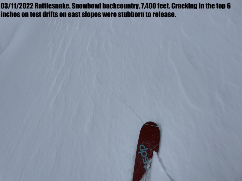
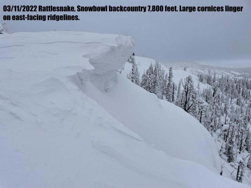
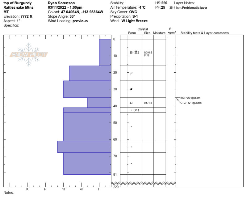
We toured off Point Six from Snowbowl down the south and west aspects of Jenny Bowl and north-facing Burgandy Bowl. North and west aspects host wind-packed and scoured snow surfaces in open terrain and ridgelines. Protected areas have up to 6 inches (20 cm) of low-density snow over icy crusts. The rain crust disappears above approximately 7,700 feet in this zone. We found up to 30 inches (75 cm) of snow above the crusts in the protected south-facing wind-loaded trees of Jenny Bowl at 7,600 feet. We observed some cracking in the top 6 inches on test drifts on east slopes that were stubborn to release. Large cornices linger on east-facing ridgelines. Our primary concern is avalanches running on the rain crust as temperatures warm up and we receive more snow.
Media
Advanced Information
Weather Summary
Cloud Cover:
OvercastTemperature:
23°FWind:
Moderate , WThere were light snow showers between 10 and 11 am accompanied by moderate west winds and blowing snow. This dissipated around noon, and winds calmed to light. Another snow shower moved overhead around 3 pm with light westerly winds and snowfall rates in the 1 cm per hour range (S1).
Close