Professional Observation
Basic Information
Observation Details
Observation Date:
March 23, 2022Submitted:
March 23, 2022Observer:
WCMAC - Ryan SorensonZone or Region:
MissionsLocation:
Southern MissionsSigns of Unstable Snow
Recent Avalanches?
YesCracking?
None ExperiencedCollapsing?
None Experienced
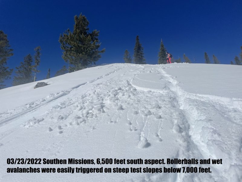
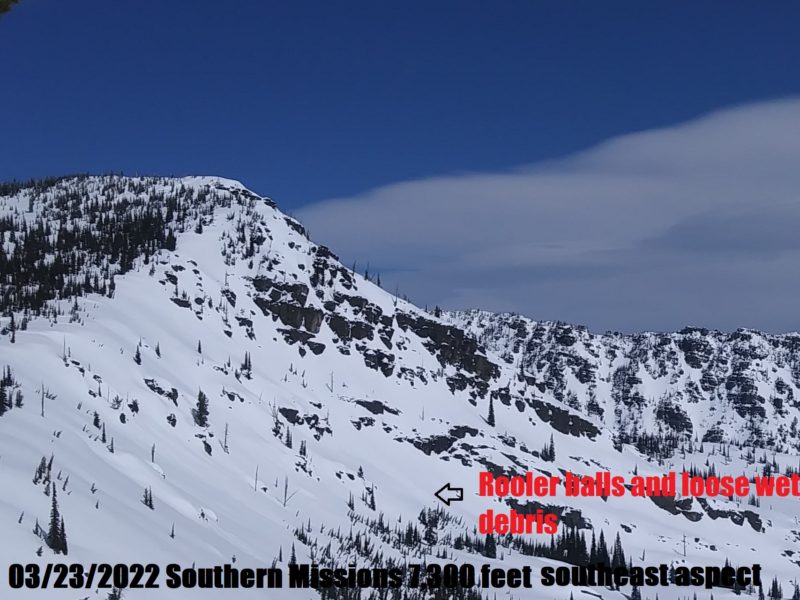
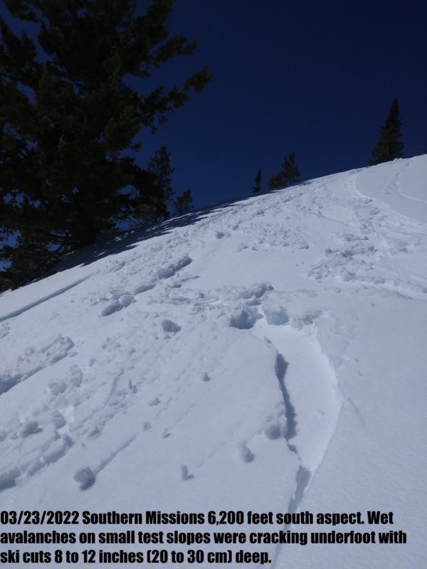
It was easy to trigger small wet slides on steep rollovers on south aspects below 7,000 feet.
Snow Stability
Stability Rating:
FairConfidence in Rating:
HighStability Trend:
SteadyBottom Line
Snow surfaces were saturated approximately a foot (30 cm) deep at 6,800 feet at noon on a southeast aspect in the southern Mission today. Even northerly aspects were sticky and beginning to saturate. Large rollerballs were forming on the south and east aspects below 7,000 feet. It was easy to trigger wet avalanches that released underfoot that quickly entrained snow as they slid. There are 2 to 2.5 feet (60 to 75 cm) of snow in the flats at 4,300 feet. The south aspect we traveled had patchy coverage to 5,200 feet.
Media
Advanced Information
Weather Summary
Cloud Cover:
Mostly SunnyTemperature:
48°FWind:
Calm , SEHigh wispy clouds did little to block the sun and the blue sky cleared after 11 am.
Avalanche Problems
| Problem | Location | Distribution | Sensitivity | Size | Comments |
|---|---|---|---|---|---|
 Wet Loose
|
|
Saturated snow was easily triggered on southerly aspects below 7,000 feet | |||
| None Specified |
|