Professional Observation
Basic Information
Observation Details
Observation Date:
April 6, 2022Submitted:
April 6, 2022Observer:
WCMAC - Ryan SorensonZone or Region:
Seeley SwanLocation:
Seeley Swan, Richmond Peak, Sunday Mountain areasSigns of Unstable Snow
Recent Avalanches?
YesCracking?
None ExperiencedCollapsing?
None ExperiencedBottom Line
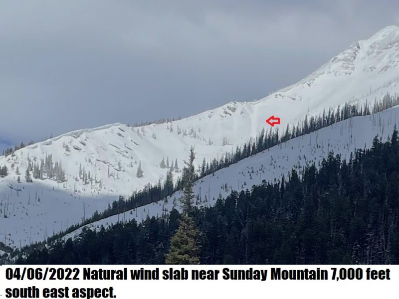
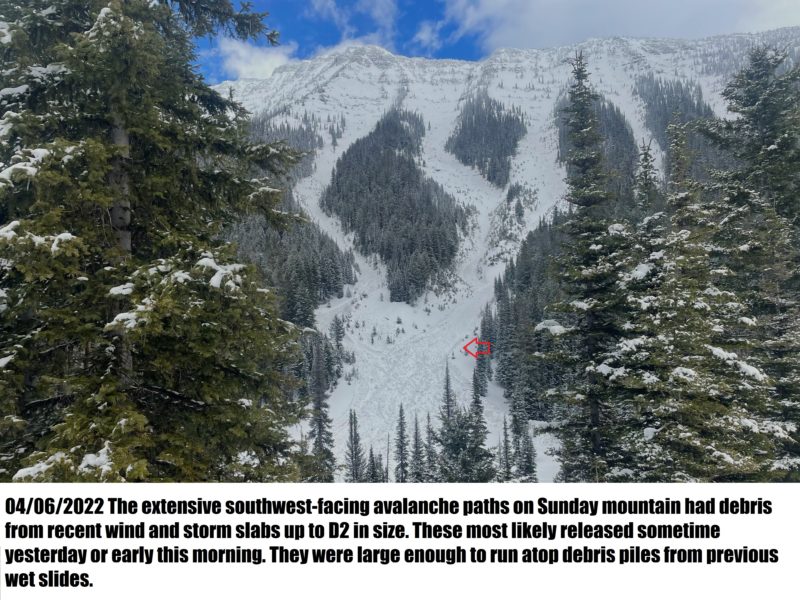
We rode sleds into the west side of the Swans near Richmond Peak Sunday Mountain and Clearwater lake. We rode elevations ranging from 4,000 to 6,600 feet. Ten inches (25 cm) was the deepest fresh snow we found. Winds transported most of the snow off west-facing slopes leaving 2 to 4 inches over the firm melt-freeze crusts. Protected north aspects held dry cold snow elsewhere was sticky and easy to form a snowball. Small rollerballs were starting on the south aspects below 5,500 feet at 2 pm. The extensive southwest-facing avalanche paths on Sunday mountain had debris from recent wind and storm slabs up to D2 in size. These most likely released sometime yesterday or early this morning. They ran over the large debris piles from previous wet slides. Large drifts were visible at upper elevations.
Media
Advanced Information
Weather Summary
Cloud Cover:
Partly CloudyWind:
LightVarious cloud layers moved in and out. Winds were light to moderate out of the west.
Close