Basic Information
Observation Details
Observation Date:
April 8, 2022Submitted:
April 8, 2022Observer:
WCMAC - Ryan SorensonZone or Region:
Central BitterrootsLocation:
Lolo PeakSigns of Unstable Snow
Recent Avalanches?
YesCracking?
None ExperiencedCollapsing?
None ExperiencedSnow Stability
Stability Rating:
FairConfidence in Rating:
HighStability Trend:
ImprovingBottom Line
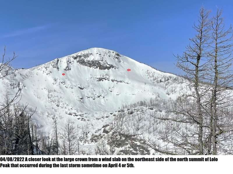
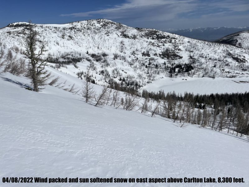
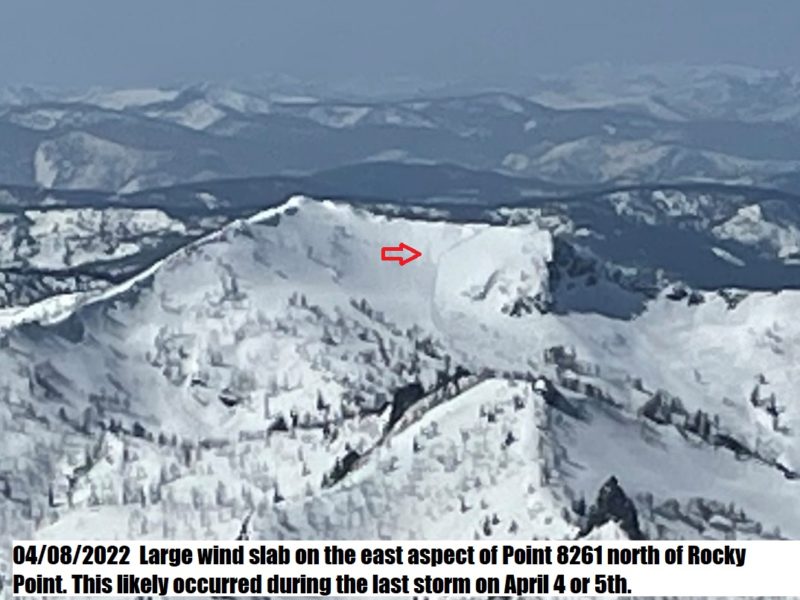
It was a mixed bag of conditions on Lolo peak today. We found skinnable snow at 6,500 feet after stepping over and crawling around at least 100 burnt and blown-down trees on the Mill Creek trail. Westerly winds have packed, sculpted, and scoured the newest snow throughout. Aspects that receive the sun's rays were melting by 11 am, and even the northeast was beginning to feel sticky. However, protected and shaded slopes held cold snow above 7,800 feet. Warm temperatures followed by sold nightly refreezes allowed the newer to begin to bond to the underlying crust. We experienced no cracking or notable test results. However, productive westerly winds are blowing snow around, and it's still worth investigating for fresh wind slabs before committing to steep terrain with cold snow. A closer look at the large crown from a wind slab on the northeast side of the north summit of Lolo Peak that occurred during the last storm on April 4 or 5th shows it almost wraps across the entire face. There was also a crown from a similar large wind slab on the east aspect of Point 8261 north of Rocky Point. We were able to ski down to 5,800 feet on a protected north ridge, but it still took around a 100 or so step over and crawl throughs to get back to the trail.
Media


Advanced Information
Weather Summary
Cloud Cover:
Partly CloudyWind:
Moderate , SWThin wispy clouds in the morning increased after noon. Southwest winds were light to moderate with occasional stronger gusts.
Close