Professional Observation
Basic Information
Observation Details
Observation Date:
November 10, 2022Submitted:
November 10, 2022Observer:
WCMAC - Jeff CartyZone or Region:
RattlesnakeLocation:
Snowbowl sidecountrySigns of Unstable Snow
Recent Avalanches?
None ObservedCracking?
IsolatedCollapsing?
None ExperiencedBottom Line
We toured up Snowbowl from 5000 feet to 7400 feet to the Rattlesnake sidecountry. The snowpack grew steadily as we climbed. The maximum snow depth we found was 27" (70 cm) in protected areas. The snowpack lacks the cohesion to form slabs in protected areas. However, wind transport is building wind slabs on easterly slopes, the likelihood of triggering an avalanche will increase with continued winds.
The biggest hazard is the rocks, trees, and debris just below the snow surface. I would not venture off cut runs; there are too many thinly veiled hazards to contend with.
Media

Advanced Information
Weather Summary
Cloud Cover:
OvercastTemperature:
14º F (-10º C)Wind:
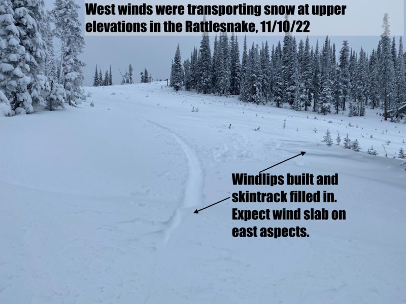
Moderate , WWest winds were transporting low-density new snow at upper elevations today.
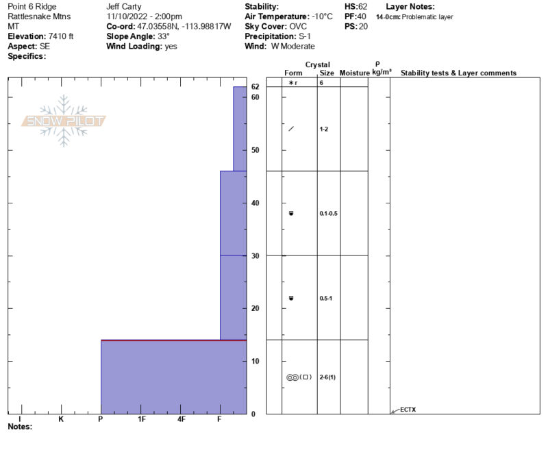
Snowpack Observations
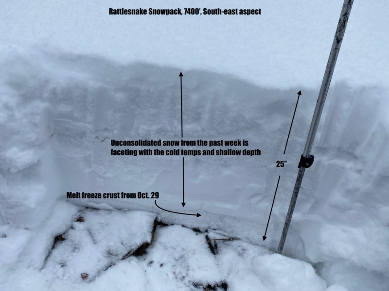
At 7400' on an east-south-east slope, we found 25 Inches (65cm) of snow depth.
50 cm (2') of low-density snow from the past week sits on 6" of melt-freeze crust from the Oct. 29th storm.
Facets are beginning to form throughout the snowpack.
In the location we dug, we did not find any stability issues. The snow currently lacks the cohesion to form a slab.
West winds were transporting snow today, and east slopes below ridgeline will be wind loaded. Where wind slab overlies low-density new snow, there is a higher likelihood of triggering an avalanche.