
The avalanche danger is now LOW in the west central Montana backcountry. Conditions are generally safe but it is possible to find unstable snow in isolated areas particularly on shaded terrain steeper than 35 degrees above 7500 feet.
Good morning, this is Steve Karkanen with the west central Montana backcountry avalanche advisory for Friday February 20, 2015. The avalanche danger rating expires at midnight tonight and does not apply to operating ski areas.
Weather and Snowpack
This morning mountain temperatures are in the twenties to low thirties and a NW wind is gusting to 26mph. Moisture is moving through the area and SNOTEL stations are reporting a trace to an inch of new snow.
Cooler temperatures the past couple days have locked up the snow surface on all but the most heavily shaded terrain. There were plenty of wet, loose snow avalanches earlier this week but this condition won’t reappear until after we see more new snow.
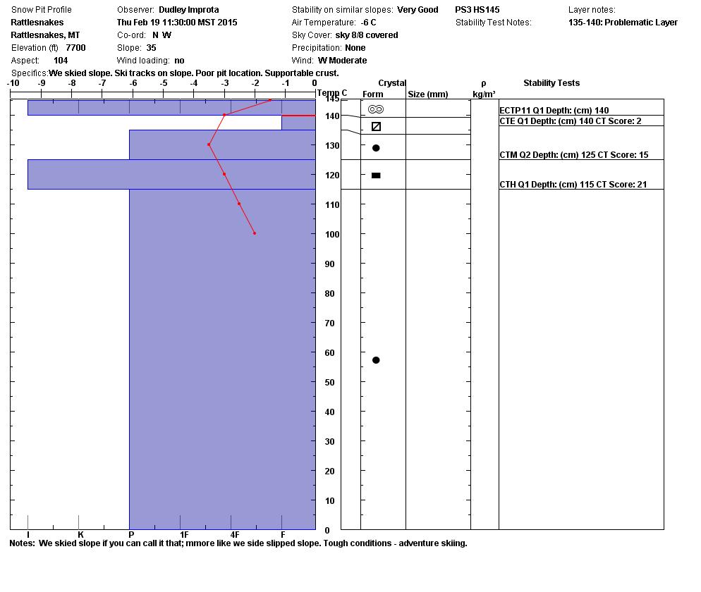
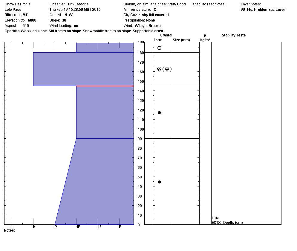
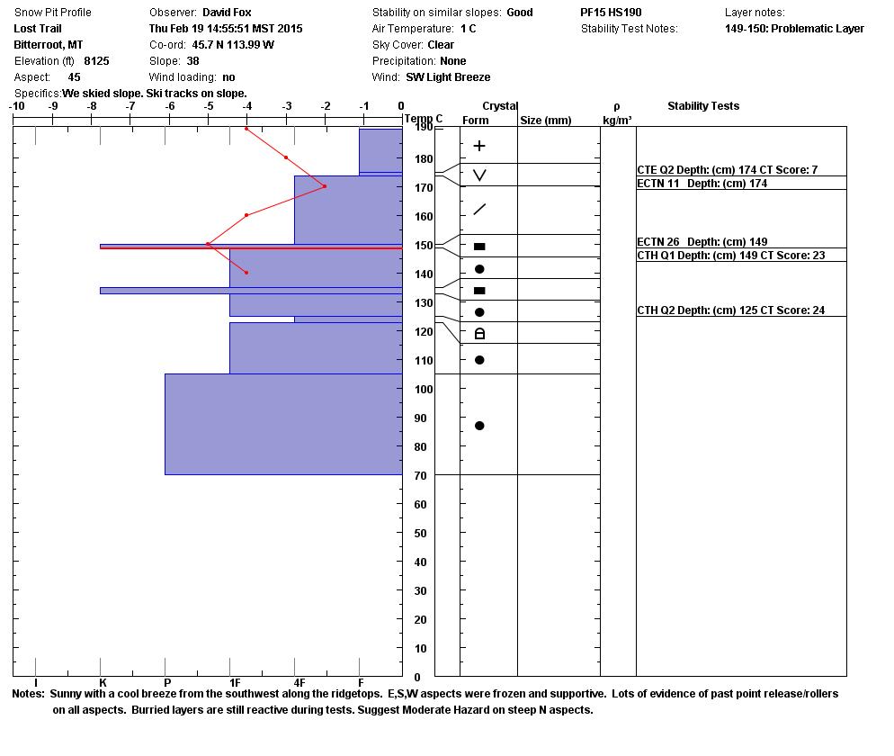
The good news is that we are feeling more confident that the widespread weak layers we’ve been describing have now healed to the point where the slab no longer propagates and is mostly confined to isolated areas. We haven’t heard of any avalanches involving these deeper layers for a couple of weeks and all the observers report continued strengthening of these layers. Expect to find lingering instability on shaded terrain above 7000 feet especially in the southern Bitterroot near the Lost Trail backcountry and along the higher state line ridges.
The bad news is that the freeze up created very tricky skiing conditions with a variable sun crust and frozen roller balls on the steeper ground. This crust overlies yet another weak layer that will be the next avalanche problem when it snows several inches. It’s not a problem now, but watch how the new snow bonds to this glassy surface and if it will support a heavy load.
Weather and Avalanche Forecast
The Missoula Office of the National Weather Service is forecasting an Arctic air mass to move into the area from the northeast tonight with increased wind and much colder temperatures. Not much snow is expected with this system and what we get will surely be blown around.
Expect the avalanche danger to remain similar until the area receives several inches of new snow. Heavy new snow on the current surface will raise the avalanche danger on any slope steeper than 35 degrees.


