Here we are approaching the end of January, and I’m just getting to the first blog post. Less than six weeks ago, we issued our first forecast of the season, and it also feels like much more time has passed. In addition to a busy holiday season, a lot has happened in the mountains. The snowpack that started as almost non-existent has built to a solid base, free of the basal facets that caused such a problem the past two years. We’ve been through an avalanche cycle with three days of high danger and an extended high-pressure period. Currently, we have low hazard and high pressure for the rest of the week. Next week should see a return to a more active weather pattern.
This year brings changes to the Avalanche Center. I (Jeff Carty) have stepped into the director role, filling the large shoes left by Travis Craft, who retired after last season. We’ve hired Ryan Sorenson to fill the forecasting role. Ryan comes to us from the Mt. Shasta Avalanche Center, where he was a forecaster for the past three years. He alternated winter forecasting with mountain ranger work on Shasta in the summer months. Ryan’s move to Missoula brings him closer to his hometown of Sheridan, Wyoming.
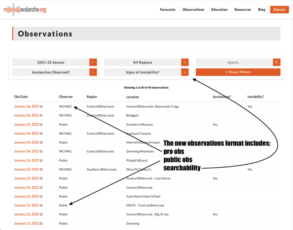
We are continuing the Professional Observer Program that successfully expanded last year, allowing us to gather more observations and better represent conditions in the forecast. The Professional Observer team has increased to 5, including Trask Baughman, Todd Glew, George D’Angelo, Geoff Fast, and David Fox.
Anyone who has visited the website will have noticed that it has been updated this year. We’ve moved onto the platform provided by the National Avalanche Center, which provides many benefits. One is that we are on a similar platform as many other avalanche centers in the US, so there is uniformity with other forecast centers. Users benefit from a familiar platform in multiple areas and increased functionality, including:
- Improved forecast graphics, including elevation bands.
- Automatic hyperlinks to the Avalanche.org encyclopedia of avalanche terms.
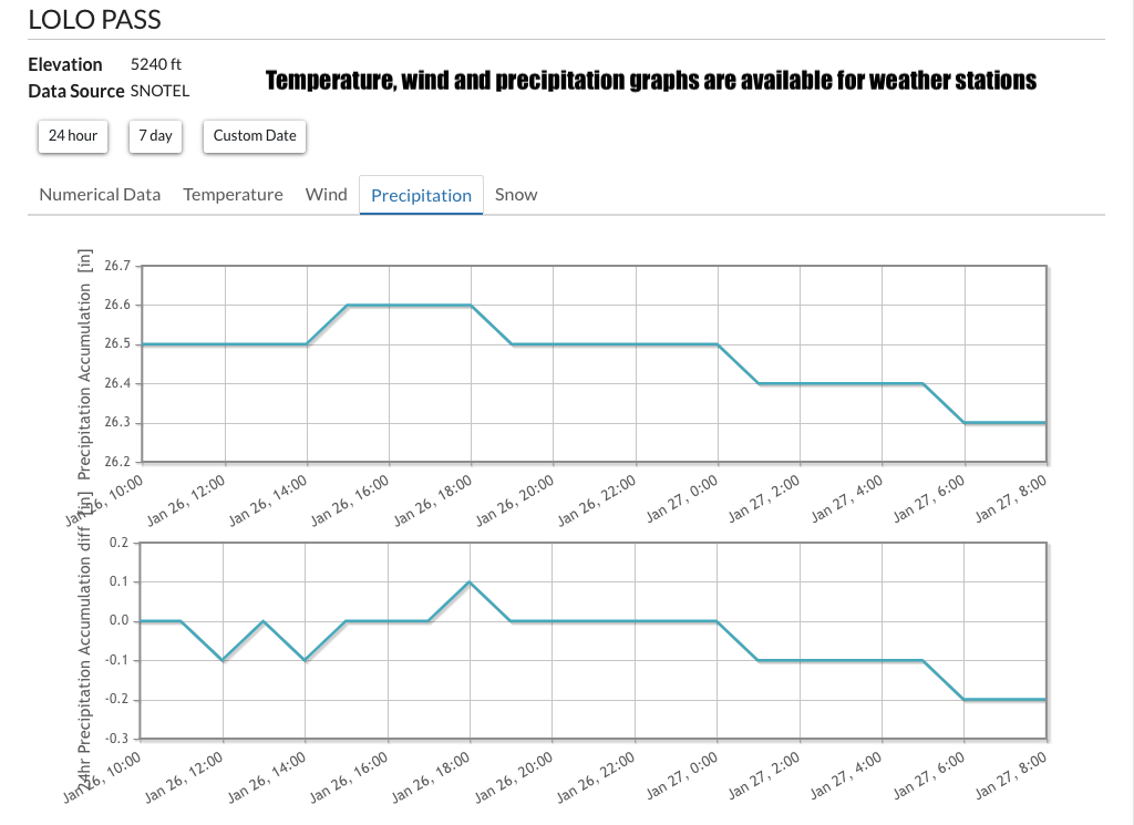
- A weather tab that includes the high elevation weather forecast and local SNOTEL site data.
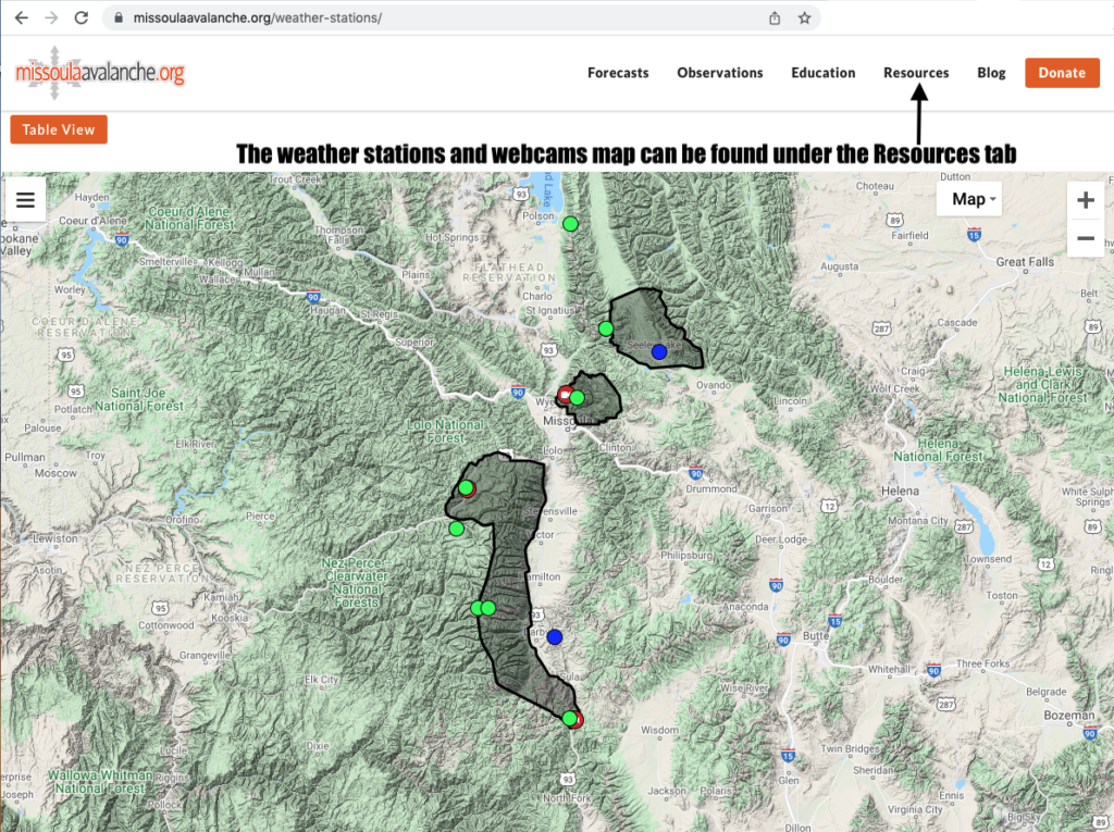
- A map of weather stations and webcams that can be found under the resources tab here.
- Professional snowpack observations displayed along with public observations.
With the inclusion of professional observations, the website displays considerably more information on area conditions. We hope this will become the go-to place to learn about skiing, riding, and avalanche conditions throughout the forecast area. This, of course, depends on public use of this feature. We’ve received record numbers of observations over the past two years. The past weekend saw a flurry of high-quality public observations that we hope will continue as a trend this year. The more observations the public submits, the more representative of conditions the avalanche forecast can be. In addition, this is a great resource for avalanche and ski conditions throughout the forecast area. Public submissions can be made here. If you get out anywhere with snow, let us know what you see. It doesn’t have to be detailed; a couple of pictures alone can be of great help.
We intend to update the blog portion of the website more regularly this year. Last year we began posting educational articles intended to help people update, revisit, and remember the skills taught on their avalanche course. We aim to continue this, with the goal to post an education article weekly. We’ll begin by reposting last year’s articles, followed by new ones.
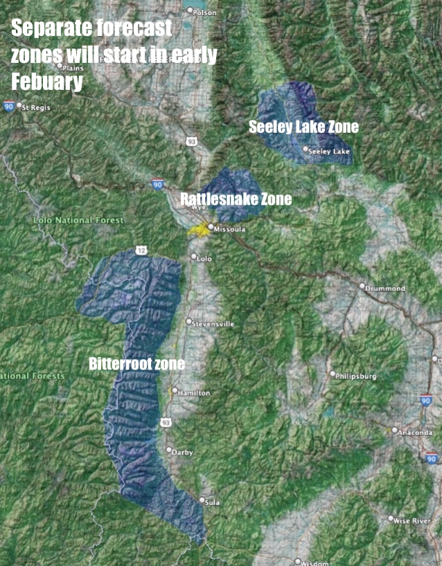
Upcoming changes at the Avalanche Center include dividing the forecast area into three zones; the Bitterroot, the Rattlesnake, and the Seeley Lake zone. This will help us tailor hazard ratings throughout the forecast area and provide more zone-specific details. We’ll be rolling into the separate zones in early February.
Thank you for visiting the new blog page. Please check back in and watch for additional content coming soon.
Ski and ride safe.
Jeff Carty


