We have officially entered spring, and warming temperatures are melting the snow and altering the snowpack. I’ve written this quick update of snowpack history and outlook to give you some reading into what’s under those diurnal corn-fed turns you may be chasing.
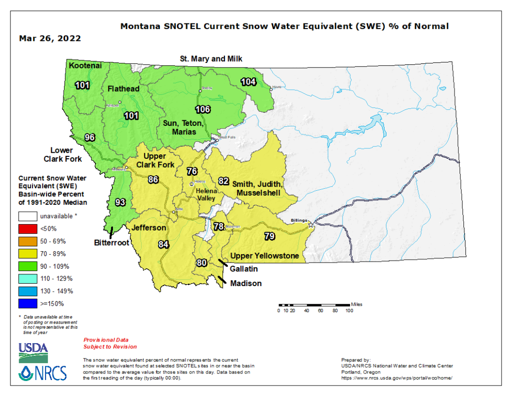
Another look at the Natural Resources Conservation Service (NRCS) snow water equivalency maps, we’re still coming in near normal for water totals for most of the forecast area. Below is the most recent map of the basin-wide snow water equivalency calculations. A zoomed-in look at our forecast region has the northern river basins, Lower Flathead and Swan, at 98% and 100% of median, and the southern river basins, Bitterroot, Blackfoot, and Middle Clarks Fork at 93%, 82%, and 93% compared to the most recent 30-year averages.
Snowpack Summary
Picking up this final chapter of seasonal snowpack history, we left off at a mid-February (02/6-02/14) spring tide of high pressure and strong westerly winds. Valentine’s day conditions changed to winter with continued snowfall, cold temperatures, and northerly winds. The snow was light and lacked cohesion for destructive avalanches at first. On February 17, increasing temperatures, strong winds, and high snowfall rates prompted us to issue a special avalanche bulletin for the central and northern Bitterroot and Lolo Pass due to the dangerous avalanche condition that was building.

Light winds and warmer temperatures on February 18 gave the snowpack a brief chance to adjust to the loading, but continued wind transport out of the west and north kept fresh wind slabs touchy throughout the weekend (Feb 19th and 20th).

When the storm cleared, temperatures plummeted, and winds switched to easterly. The week of February 21 through the 26th was frigid, and generally, light winds kept the avalanche danger moderate. Surface hoar likely grew in many areas during periods of cold nights with clear skies this week.

An atmospheric river from February 27 to March 2 brought 2 to 3.8 inches of snow water equivalent (SWE) with elevated snow lines up to 8,000 feet in the Bitterroot and 7,500 feet in the northern reach of the forecast area. This heavy snow-loaded faceted snow from the previous weeks of colder weather made for touchy avalanche conditions.

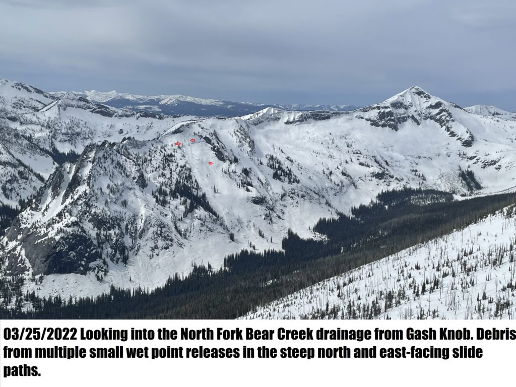
On March 2, when the storm began to clear, we discovered many large slides had released during this impressive avalanche cycle.

The start week of March 6 through the 12th saw sub-zero overnight temperatures and cold days faceting the 5 to 10-inch dust overlaying the thick crusts formed by the atmospheric river. The sun came out on March 12, and temperatures began to rise.

Showery snow squalls brought approximately an inch of water, equating to 4 to 12 inches of snow throughout the week of March 13 to 19th. The sun came out on Saturday, March 19, and temperatures spiked into the mid to upper 40’s °F, followed by strong winds and a temperature swing to the teens °F on Sunday, March 20.
We’ve had elevated temperatures, and shallow overnight refreezes this past week, March 20th to 26th. The snowpack has decomposed due to moisture from melting snow and rain on Wednesday (03/23). It has transitioned into a spring snowpack in most places. Large cohesionless loose wet avalanches have become the primary concern.
Outlook
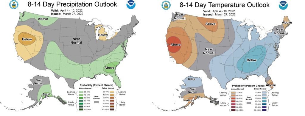
The outlook for the next two weeks looks warm and wet according to the latest Climate Prediction Center model. Drought continues to plague the majority of the western US and NOAA’s most recent spring outlook talks about drought expanding amid warmer conditions. We’re fortunate that we have the moisture this year but elevated temperatures could lead to a rapid melt off of the spring snowpack. I suspect we’re already seeing a more rapid melt off in recent days.