What an exciting end to 2022 and a promising start to 2023. To understand the state of our snowpack, it is necessary to start at the beginning…
Minimal snow fell in October. By the end of the month, there was only a shallow 12 inch base, primarily on north aspects. The first significant snowfall of the 22/23 season arrived November 5th. The Missions received the most snow with 25” between November 3rd and November 5th. The central Bitterroot wasn’t far behind with 24” of snow. The Rattlesnake received the least snow, with just 12” in the same timeframe.
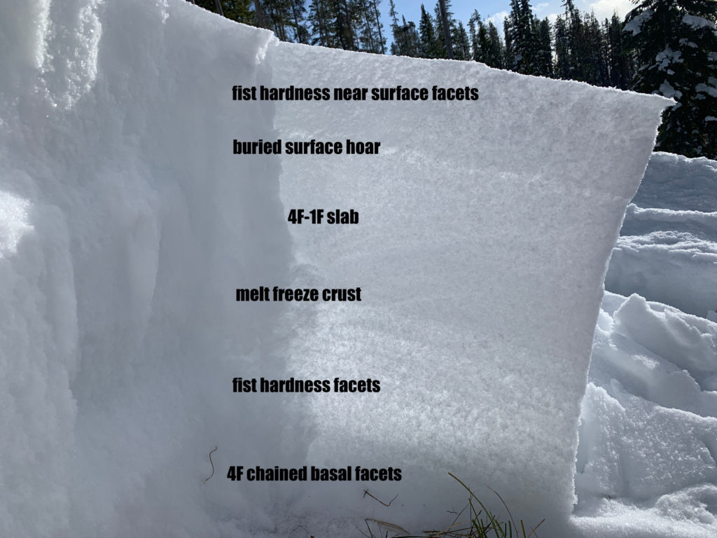
Although weather conditions varied across forecast zones following this storm, significant weak layer formation occurred across all zones. Cold temperatures and clear skies created a widespread layer of surface hoar across the Bitterroot and Rattlesnake. On November 14th, WCMAC forecasters had their first field day of the season at Lolo Pass and noted surface hoar and a faceted snowpack.
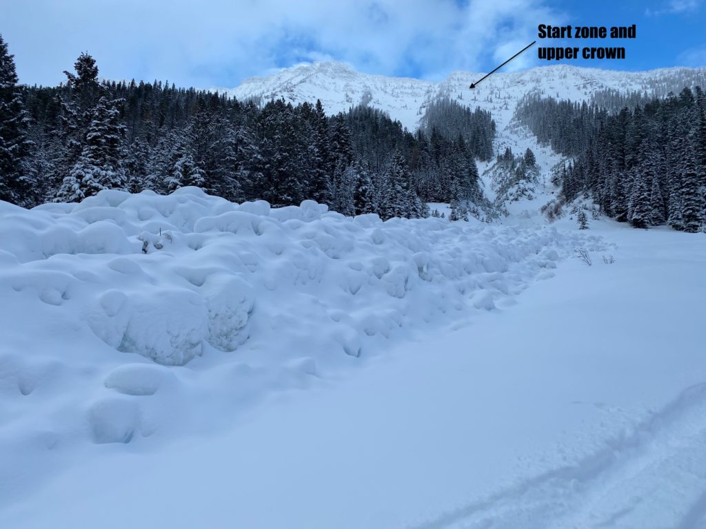
The next storm arrived on November 17th with perfect conditions to preserve existing weak layers. Calm conditions as the snow fell preserved and buried the surface hoar setting the snowpack up for a persistent weak layer. Light snowfall continued through Thanksgiving, further burying the surface hoar layer. While all this was happening, the snowpack continued to facet, and depth hoar began to form. Forecasters looked to December with concern and interest as we were set for trouble. December started fast with heavy snow and wind. Snowfall began on November 30th, and by the end of December 1st, over an inch of water fell. Avalanches began immediately in the Southern Bitterroot. This natural cycle continued, and on the 3rd, a significant natural avalanche was released in the Crystal Amphitheatre at Lolo Pass.
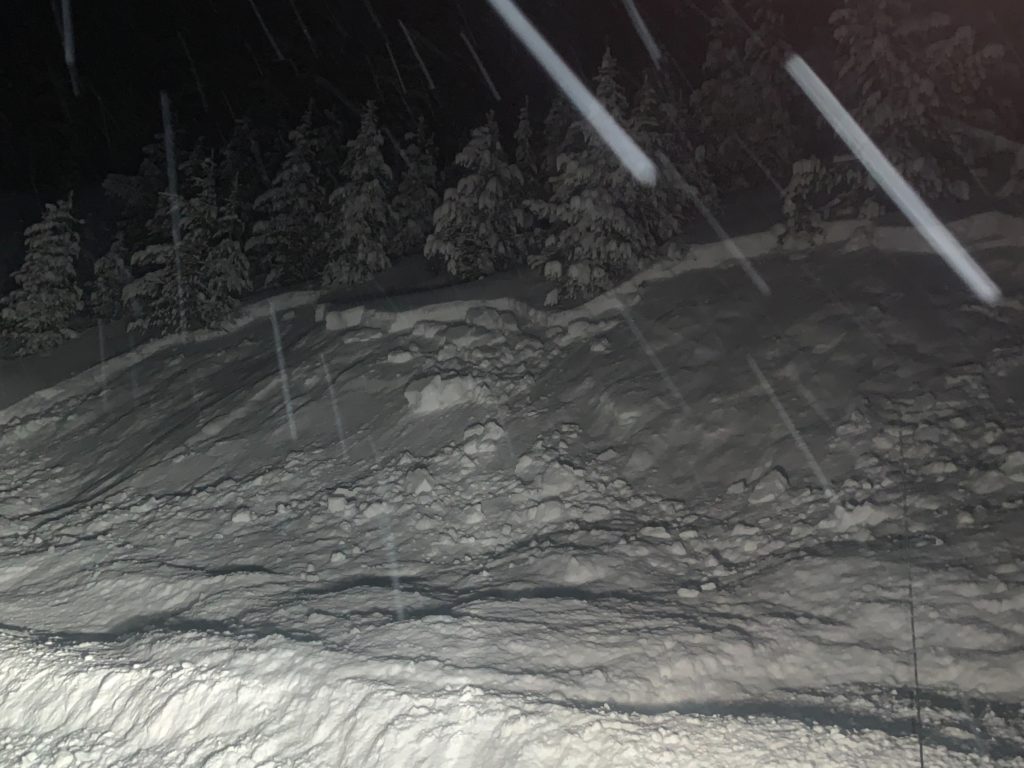
December 6th marked the first avalanche forecast of the season for the WCMAC. Across all zones, the hazard was considerable at the upper elevation and moderate at middle and lower. The persistent weak layers of surface hoar and buried near surface facets sat below a reactive 2-3 foot deep slab. Intermittent snowfall and wind transport continued to build the overriding slab. These conditions continued for nearly two weeks, with all signs pointing to a weak snowpack and widespread weak layer distribution.
On December 19th, things began to get crazy as a strong winter storm arrived. 1-2 feet of snow fell by the 21st, and the hazard was high at all elevations. An avalanche warning was issued due to the high certainty of triggering avalanches and the possibility of avalanches 4-5’ deep. The additional load strained buried weak layers. Strong winds shifted around the compass as temperatures dropped rapidly. A web of avalanche issues combined persistent slab, new snow, wind loading, and rapid temperature changes. December 22nd and 23rd saw a lull in the storm with clear conditions and cold temperatures. Across all forecast zones, temperatures dropped to below -20f. With the break in the storm came a drop in avalanche hazard to considerable.
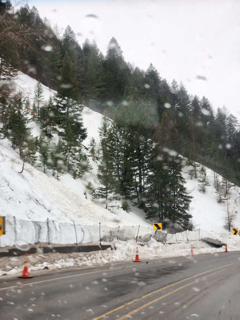
As a rule, snow does not like rapid change. When temperatures began to rise rapidly on the 24th, we braced for a significant avalanche cycle. Snow turned to rain, and the rain line rose steadily to over 8000’. An avalanche watch was issued for all zones on the 25th. Over an inch of rain fell in 24 hours across the high elevations of western Montana. By the end of Christmas day, we saw some truly impressive precipitation numbers, with the central Bitterroot showing almost 3” of water since the start of the storm. On the 26th and 27th, an avalanche warning was issued for wet snow, rain, and rising temperatures as the hazard rose back to high at all elevations. We saw widespread activity along roadcuts and test slopes. One significant wet slab impacted Montana Highway 200 northeast of Bonner.
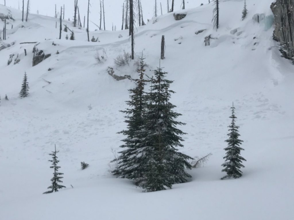
On December 30th, the storm subsided, and forecasters were able to take advantage of clear conditions to survey the natural cycle. In the Seeley zone, a forecaster found debris from a D3 wet slab that ran during the rain event. In the Gash, another large natural avalanche was discovered that was released during the storm. Although some large natural avalanches were discovered, overall, the cycle was less widespread than anticipated. Why is somewhat unknown. All the ingredients were there for a massive natural cycle… a weak snowpack, rapid change, and a mid winter rain on snow event, yet the snowpack responded more robustly than we expected.
2022 ended with mild temperatures and decreasing hazard. The snowpack did not stay wet after the rain event, and a stout crust had formed up to 7000’. Upper elevations above 7000’ formed a thin melt freeze crust. At low elevations, the hazard decreased to low as the rain event had effectively melted the snow. For the rest of December, isolated wind slabs were the primary concern, and on December 31st, the hazard fell to moderate for the first time this winter.
So, where are we going into 2023? What is the status of the persistent weak layers we have been tracking all of December? In short, they are still there in places but increasingly stubborn to trigger. The buried surface hoar layer is still present, however, the weight of the snowpack above it has effectively laid the hoar crystals down flat. It is becoming increasingly unlikely to fail and propagate, but don’t totally discount it moving forward. As for the rest of the persistent weak layers, they are gaining strength, and sensitivity to triggering is decreasing. Distribution is primarily on upper elevation north terrain. There are other isolated potential weak layers to track, such as small facets around the Christmas crust and buried near surface facets. The top of the snowpack is actively faceting, and we are seeing isolated surface hoar growth. Moving into 2023, we will continue to watch all of these layers develop.
Long term weather forecasting is difficult, but we can all hope for above average precipitation and cold temperatures for the rest of winter.
We rely heavily on public observations to generate the most accurate forecasts possible. If you’re struggling to find a New Years’ resolution, consider submitting an observation after each day of skiing and riding!
Happy new year, and ski and ride safe!


