Posted:
Mar 25, 2021 @ 6:17 am

The avalanche danger in the west-central Montana backcountry is MODERATE. New snow and winds have created avalanche conditions.

Good Morning. This is Travis Craft with the West Central Montana Avalanche Center advisory on Thursday, March 25, 2021. This advisory does not apply to operating ski areas and expires at midnight tonight. The USDA Forest Service is solely responsible for its content.

Weather and Snowpack

Temperatures range from 23 to 29 degrees this morning. Over the last 24 hours, .3 to .7 inches of SWE have been recorded. Winds will be gusting into the 20’s today.

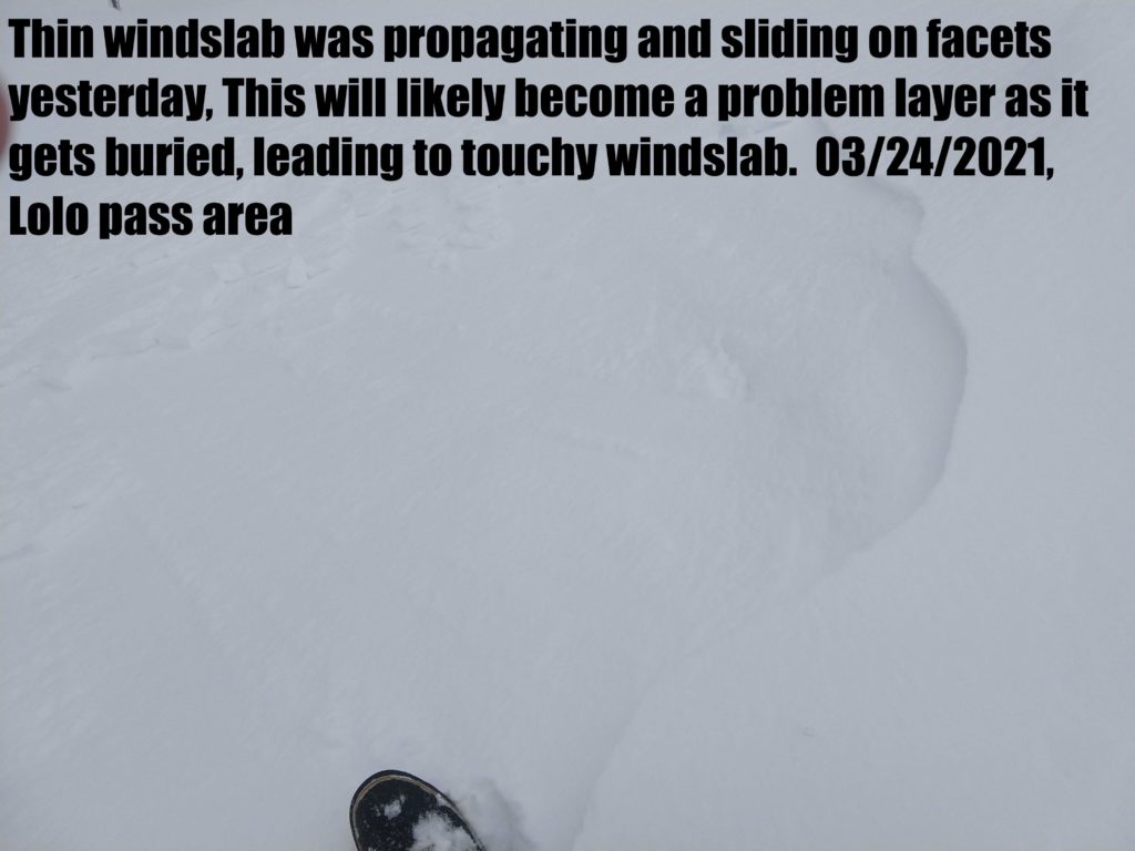
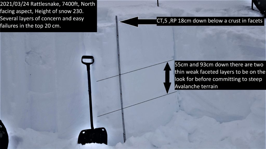
Yesterday, we found that the new snow was not bonding well to old snow surfaces. The new snow has fallen on slick crusts. We found facets in the upper third of the snowpack that should be investigated before committing to any steep terrain. We found wind slabs that were sensitive to human triggers on leeward slopes.

The new snow yesterday was easily triggered and ran long distances as sluffs. Use test slopes to see how the new snow is bonding to old snow surfaces. Terrain traps such as gullies concentrate the depth and strength of these slides. Obstacles such as cliffs or rocks will increase the likelihood of trauma. Today with more loading look for these sluffs to gain consolidation and create storm slabs. Cracking from skis or machines will be good indicators of this problem.

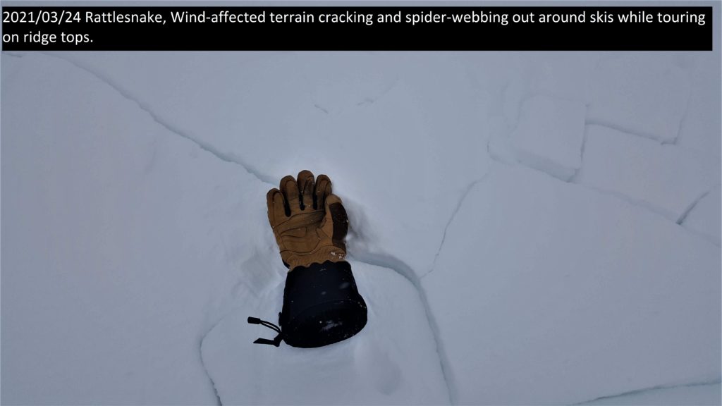
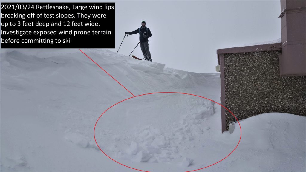
Winds have created small to large wind slabs on ridges and start zones. Shooting cracks are a sign of instability.

Facets are in our snowpack buried in the top third of the snowpack. Not reactive yesterday, but should be investigated with more loading today.

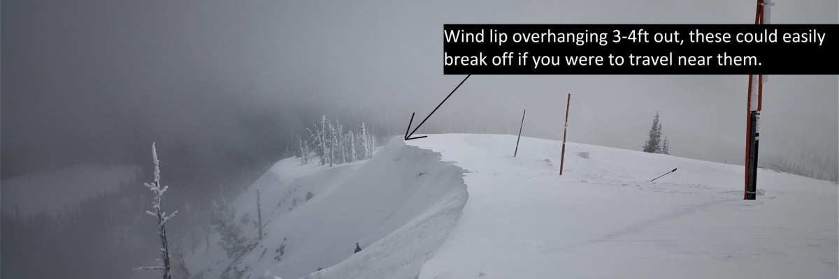
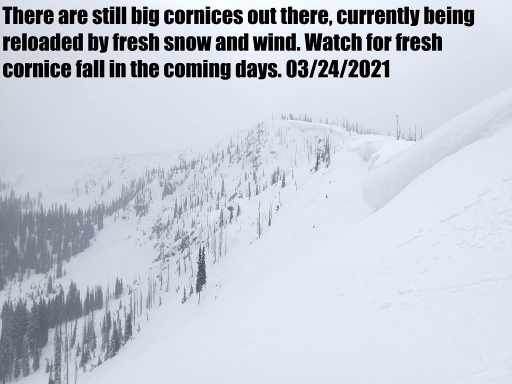
Cornices and glide cracks will be with us for the rest of the season. These are two unpredictable avalanche problems. The cornices remaining after the warmth are a hazard. This hazard will increase with warmth, sun, or rain. Give them a wide berth above and stay out from underneath. Glide cracks will have opened and accelerated with the warmth. While slowed, they are still opening despite cold temperatures as the ground beneath the snowpack remains unfrozen. They can fail unexpectedly, creating full-depth avalanches. Stay off slopes where they are present.

Bottom Line

Use caution today and do your homework before committing to steep terrain. Seek slopes sheltered from the wind. Use small test slopes and hand pits to check new snow depth and bonding to old snow surfaces. Dig a pit. Pay attention to terrain traps. Search for instabilities, not stability. Reassess conditions throughout the day and stay alert for signs of instability. Look for red flags. Carry a beacon, shovel, and probe.

Public Observations

Thank you to everyone who has taken the time to send in a public observation. Please keep sharing what you find and see while out in the backcountry. You can now text us your observations to (406) 219-5566 when you don’t have time to fill out the observations page.

Ski and ride safe.

READ FULL ADVISORY  

Problem 1 - Wind Drifted Snow

  • TYPE

    wind-slabs

    Wind Slabs

    Release of a cohesive layer of snow (a slab) formed by the wind.  Wind typically erodes snow from the upwind sides of terrain features and deposits snow on the downwind side.  Wind slabs are often smooth and rounded and sometimes sound hollow, and can range from soft to hard. Wind slabs that form over a persistent weak layer (surface hoar, depth hoar, or near-surface facets) may be termed Persistent Slabs or may develop into Persistent Slabs.

  • SIZE

    3-4

    1-2 (Small-Large)

    The potential size of avalanche resulting from this problem.

  • LIKELIHOOD

    Likelihood-3

    Possible

    The likelihood of an avalanche resulting from this problem.

Winds have loaded leeward slopes. Look for small to large wind slabs on ridges and in start zones at higher elevations.

Problem 2 - New Snow

  • TYPE

    loose-dry

    Loose Dry

    Release of wet unconsolidated snow or slush. These avalanches typically occur within layers of wet snow near the surface of the snowpack, but they may quickly gouge into lower snowpack layers. Like Loose-Dry Avalanches,they start at a point and entrain snow as they move downhill, forming a fan-shaped avalanche. They generally move slowly, but can contain enough mass to cause significant damage to trees, cars or buildings. Other names for loose-wet avalanches include point-release avalanches or sluffs. Loose-wet avalanches can trigger slab avalanches that break into deeper snow layers.

  • SIZE

    3-4

    1-2 (Small-Large)

    The potential size of avalanche resulting from this problem.

  • LIKELIHOOD

    Likelihood-3

    Possible

    The likelihood of an avalanche resulting from this problem.

The new snow is not bonding well to the slick crusts. In areas that received more snow overnight look for sluffs to transition to slabs. Use test slopes to see how the new snow is bonding to old snow surfaces. Hand pits are another great option.

Problem 3 - Persistent Weak Layers

  • TYPE

    persistent-slabs

    Persistent Slabs

    Release of a cohesive layer of soft to hard snow (a slab) in the middle to upper snowpack, when the bond to an underlying persistent weak layer breaks.  Persistent layers include: surface hoar, depth hoar, near-surface facets, or faceted snow. Persistent weak layers can continue to produce avalanches for days, weeks or even months, making them especially dangerous and tricky. As additional snow and wind events build a thicker slab on top of the persistent weak layer, this avalanche problem may develop into a Persistent, Deep-Slab.

  • SIZE

    3-4

    1-2 (Small-Large)

    The potential size of avalanche resulting from this problem.

  • LIKELIHOOD

    Likelihood-2

    Unlikely/Possible

    The likelihood of an avalanche resulting from this problem.

There are facets in the top third of the snowpack. Dig a pit and investigate these layers. Propagation equals dialing back objectives.

FORECAST & OUTLOOK

  • Danger Trend

    same

    Same Danger

  • Area Forecast

    Light Snow

Light snow today and gusts in the 20’s. See the forecast.

This information is the sole responsibility of the Forest Service and does not apply to operating ski areas. The avalanche danger rating expires at midnight tonight but the information can help you make a more informed decision regarding travel in avalanche terrain for the next few days.

Our advisory area includes National Forest System lands in the Bitterroot Mountains from Lost Trail Pass north to Granite Pass, the Rattlesnake Mountains north of Missoula and the Southern Swan and Mission Mountains near Seeley Lake, MT. Avalanche information for the Lookout Pass/St. Regis Basin area is available from the Idaho Panhandle Avalanche Center.