Missoula Avalanche
  • Forecasts
    • Current Forecast
    • Forecast Archive
    • Forecast Mailing List
    • National Map
  • Observations
    • Recent Observations
    • 2022 Obs before 12/10
    • Submit Observation
  • Education
    • All Education Events
    • Education Information
  • Resources
    • Weather Stations
    • Avalanche Links
    • Accidents & Reports
    • Photo Archive
    • Snow Profiles
    •   Avalanche Terms
    •   Weather Forecast
  • Blog
  • Memberships
  • Cart
  • Donate

Bitterroot Avalanches – March 30, 2010

 Missoula Avalanche Photo Gallery
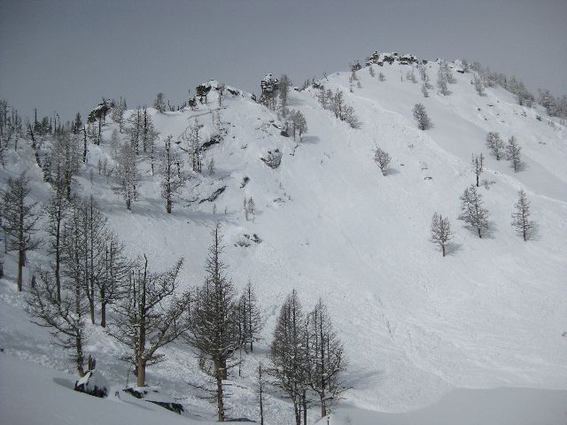
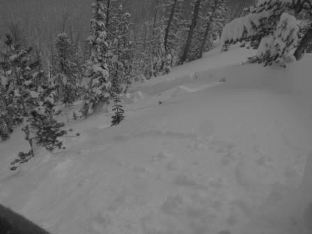
8300' N-NE aspect near Downing Mountain courtesy of Darren Schwehr
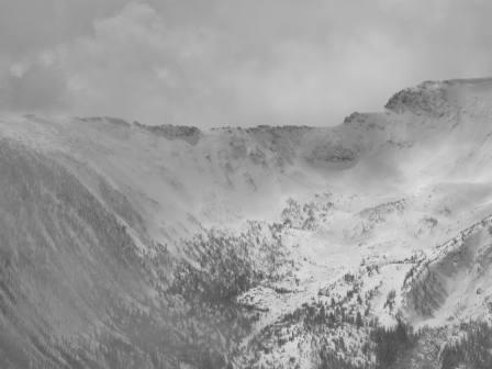
Multiple avalanches on north face of St. Joe Peak courtesy of Jason Leppi
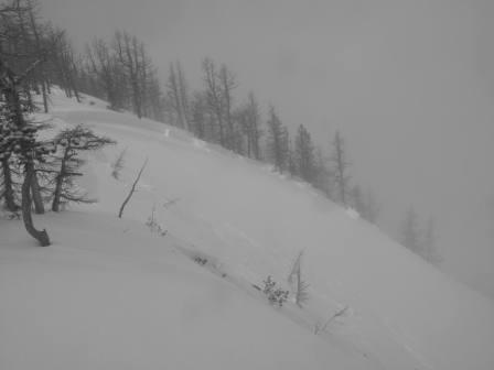
Large slab avalanche near Sweeney Peak courtesy Jason Leppi
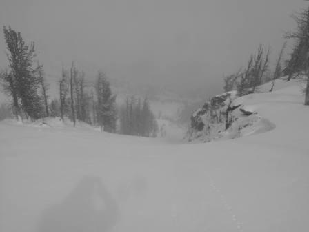
Ridgeline east of Sweeney Peak courtesy Jason Leppi

Supporters

Goat Maps Image
Mountain Riding Lab Image
Sapphire Physical Therapy Image
Board of Missoula Image
Montana Backcountry Yurts Image
TDS Fiber Image
Tradeworks Construction Image
Gull Boats & RV Image
Inspire Physical Therapy Image
On X Maps Image
Spark R&D Image
Krispy Kreme Image
The TrailHead Image
Downing Mountain Lodge Image
Yamaha OAI Image
Zilla State Image
LB Snow Image
WRO Image
Polaris Image
Proven Progression Image
Florence Coffee Company Image
CalTopo Image
Western States Trailer Image
Gull Ski & Snowboard Image

Resources

  • Observations
  • Avalanche Links
  • Accidents & Reports
  • Photo Gallery
  • Snow Profiles
  • Avalanche Terms
  • Weather Forecast

About

  • Mission & Vision
  • Board of Directors
  • Staff
  • Beacon Training Parks
  • Contact Us

Support

  • Advertising & Sponsorship
  • Donate
West Central Montana Avalanche Foundation - Missoula Avalanche

© 2025 MissoulaAvalanche.org  |  Contact Us

Subscribe: Forecasts, News, Events

Forest Service Logo

This West Central Montana Avalanche Foundation is a 501(c)(3) nonprofit organization, an equal opportunity employer, and a special use permittee of the Bitterroot, Nez Perce-Clearwater, and Lolo National Forests. Avalanche information is provided through the U.S.D.A. Forest Service and describes general backcountry avalanche hazards and conditions. It does not apply to ski areas and highways where avalanche mitigation occurs.

Pro Login