Posted:
Dec 16, 2014 @ 6:02 am

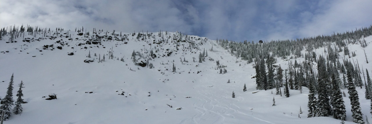
The avalanche danger is MODERATE in the west central Montana backcountry. Weak snow can still be found near the base of the snowpack in many locations above 7000 feet. Moderate temperatures this past week have strengthened this layer but it can’t be completely trusted. The moderate rating applies to terrain steeper than 35 degrees above 7000 feet. We’re finding the weakest snow structure in shallow snow in rocky terrain. The avalanche danger is LOW at other locations.

Hello! This is Steve Karkanen with the backcountry avalanche advisory for December 16, 2014 from the West Central Montana Avalanche Center. This information does not apply to operating ski areas and the danger rating expires at midnight tonight.


Weather and Snowpack

This morning mountain temperatures are in the teens with no precipitation the past 24 hours.

Weather conditions of the past few days have helped strengthen overall snowpack stability. We’re still finding and getting reports of the early November facets failing in stability tests with propagation at this layer. This is most apparent in rocky areas where the snow is less than 4 feet deep. Wherever these facets exist, I would be suspicious of the steepest terrain and places where the snow is deep enough to cover anchors.  It’s worth doing a little digging to see if the slope you want to ski or ride on has this condition.

Providing that we don’t drop back into an arctic deep freeze and it keeps snowing, we can expect this (deep persistent weakness) to no longer be an issue for us after a few more days. Our attention now turns to what is happening at the surface.  The moderate weather improves stability but clear dry conditions weaken the snow surface. Surface hoar was noted yesterday at several locations above 7000′ as well as small grain facets forming due to the temperature differences at the snow/air interface.  This will most likely be the next problem to be aware of the next time it snows heavily.


Weather and Avalanche Forecast

The Missoula Office of the National Weather Service is forecasting a weak ridge to move through the area this week with only minimal precipitation amounts. A more robust system is expected to arrive by early next week. Stay tuned.

Expect continued strengthening of the snowpack with the higher and more shaded terrain holding weak snow longer than sun exposed terrain.


We’ve received several great reports so far this winter. If you get out and see something worth passing along, you can use our public observations form or e-mail us at  [email protected] . The information you share may save a life!

I will issue the next advisory on Friday, December 19.
READ FULL ADVISORY  

Problem 1 - November facets

  • TYPE

    deep-persistent-slabs

    Deep Persistent Slabs

    Release of a thick cohesive layer of hard snow (a slab), when the bond breaks between the slab and an underlying persistent weak layer, deep in the snowpack or near the ground.  The most common persistent weak layers involved in deep, persistent slabs are depth hoar, deeply-buried surface hoar, or facets surrounding a deeply-buried crust. Persistent, Deep-Slabs are typically hard to trigger, are very destructive and dangerous due to the large mass of snow involved, and can persist for months once developed. They are often triggered from areas where the snow is shallow and weak, and are particularly difficult to forecast for and manage. They commonly develop when Persistent Slabs become more deeply-buried over time.

  • SIZE

    3-4

    1-2 (Small-Large)

    The potential size of avalanche resulting from this problem.

  • LIKELIHOOD

    Likelihood-2

    Unlikely/Possible

    The likelihood of an avalanche resulting from this problem.

  • ADDED DANGER

    Increased Slope Danger

    Increased/Added Danger

    There is an increased risk of avalanches on these slopes:

    N - North
    NE - Northeast
    E - East
    SE - Southeast

  • MAP

    ECTP19 and 21

    Stability continues to improve but tests do show propagation with energy. ECT scores on N and SE aspects ECTP19 and ECTP23. It's worth digging down to see if these facets exist.

The faceted layers at the ground and above the Halloween crust are still evident in many areas above 7000 feet but they have gained considerable strength.  Stability testing produces failure with propagation at either the ground or on the crust.  Observations in the Bitterroot are indicating even stronger conditions there (ECT scores in Rattlesnake on N and SE aspects: ECTP 19-21, ECTX in Bitterroot Mountains).

This week’s snow profiles and photos

FORECAST & OUTLOOK

A weak high pressure system with a few imbedded snow showers is moving through the area this week. Little precipitation is expected for the next few days.

This information is the sole responsibility of the Forest Service and does not apply to operating ski areas. The avalanche danger rating expires at midnight tonight but the information can help you make a more informed decision regarding travel in avalanche terrain for the next few days.

Our advisory area includes National Forest System lands in the Bitterroot Mountains from Lost Trail Pass north to Granite Pass, the Rattlesnake Mountains north of Missoula and the Southern Swan and Mission Mountains near Seeley Lake, MT. Avalanche information for the Lookout Pass/St. Regis Basin area is available from the Idaho Panhandle Avalanche Center.