Posted:
Dec 19, 2014 @ 6:21 am

Mostly stable conditions exist with MODERATE avalanche danger in isolated areas above 7000 feet where the snow is shallow and on rocky terrain steeper than 35 degrees.  The avalanche danger is LOW on other high elevation terrain. The lower elevation terrain is fairly locked up now thanks to the moderate temperatures and melt-freeze cycles of the past few days.

Good morning backcountry sliders and riders!  This is Steve Karkanen with today’s avalanche advisory from the West Central Montana Avalanche Center.  This information is the responsibility of the Forest Service and does not apply to operating ski areas. The danger rating expires at midnight tonight.


Weather and Snowpack

This morning SNOTEL stations are reporting temperatures in the twenties and low thirties.  Wind speeds this morning are SSE 3 gusting to 11 at Point Six and SSE 16 gusting to 20 mph at Deer Mountain at east of Darby. Hoodoo picked up 4 inches new snow and North Fork Jocko 7 inches in the past 24 hours.

Our moderate weather has given us more confidence that the overall condition of the weak basal layers has vastly improved over the past 2 weeks. Although its unlikely, shaded, shallow snow on steep rocky terrain above 7000 feet are the places where it is possible to trigger a slide to the ground on this persistent weakness.

In the Lost Trail Pass backcountry, Ed Snook, Dave Fox, Geoff Fast and Dudley found this layer to be reactive only after a lot of force is applied to an isolated column and no propagation in extended column tests (see profile below).

They did report finding the surface hoar that formed earlier in the week but there wasn’t enough new snow to make it reactive or to form a slab.

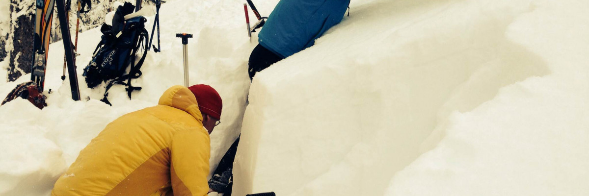
David Williams, Justin Singer and I visited Hoodoo Pass Thursday and did not find the surface hoar. I expect the sun destroyed it in many places Wednesday. What we found at Hoodoo was a nearly isothermic snowpack with a surface condition hard enough to walk around on.  The depth hoar that formed in early December is mostly gone in fact the bottom 16 inches is solid (1 finger to pencil hard) and wet. Similar conditions exist around Lolo Pass.

Earlier reports from the Rattlesnake and southern Swan also show continued strengthening of the overall snowpack.

It is easy to move around now but remember, it is early and there are a lot of other hazards like rocks, logs and stumps poking out just waiting to tear your sled up or rip the edges off your skis or board.


Weather and Avalanche Forecast

The Missoula Office of the National Weather Service is forecasting heavy wet snow to begin Saturday with Bitterroot mountain passes expected to receive between 4 and 12 inches before the event transitions from snowfall to heavy rain by Sunday. The snow level is expected to rise to about 6000 feet before precipitation decreases and a more northwesterly flow with cooler air allows snow levels to drop back to pass elevations.

The first time either melt water or rain is introduced to snow, it causes it to become unstable. A lot of weight is added quickly and the water percolates down to a weak layer or harder bed surface.

Expect the avalanche danger to slowly increase with any new snow and wind but as soon as it starts raining, the avalanche danger will rapidly increase to CONSIDERABLE possibly HIGH.  Keep informed of weather developments and get off and out from under anything steep enough to slide.

Dudley issues the next advisory on Tuesday, December 23.

Enjoy the snow and be safe this weekend.
READ FULL ADVISORY  

Problem 1 - Depth hoar remains in some areas

  • TYPE

    deep-persistent-slabs

    Deep Persistent Slabs

    Release of a thick cohesive layer of hard snow (a slab), when the bond breaks between the slab and an underlying persistent weak layer, deep in the snowpack or near the ground.  The most common persistent weak layers involved in deep, persistent slabs are depth hoar, deeply-buried surface hoar, or facets surrounding a deeply-buried crust. Persistent, Deep-Slabs are typically hard to trigger, are very destructive and dangerous due to the large mass of snow involved, and can persist for months once developed. They are often triggered from areas where the snow is shallow and weak, and are particularly difficult to forecast for and manage. They commonly develop when Persistent Slabs become more deeply-buried over time.

  • SIZE

    2-3

    1 (Small)

    The potential size of avalanche resulting from this problem.

  • LIKELIHOOD

    Likelihood-1

    Unlikely

    The likelihood of an avalanche resulting from this problem.

  • ADDED DANGER

    Increased Slope Danger

    Increased/Added Danger

    There is an increased risk of avalanches on these slopes:

    N - North
    NE - Northeast
    E - East
    SE - Southeast

We’re still finding faceted snow near the ground and a crust that formed in late October.  This part of the snowpack continues to strengthen but there are isolated areas where it may be possible to trigger a slab. Places to look for these weaker pockets are at elevations above 7000 feet on wind loaded terrain steeper than 35 degrees. Be suspicious of shallow pockets of snow on rocky slopes.

Problem 2 - Wind slabs forming today

  • TYPE

    wind-slabs

    Wind Slabs

    Release of a cohesive layer of snow (a slab) formed by the wind.  Wind typically erodes snow from the upwind sides of terrain features and deposits snow on the downwind side.  Wind slabs are often smooth and rounded and sometimes sound hollow, and can range from soft to hard. Wind slabs that form over a persistent weak layer (surface hoar, depth hoar, or near-surface facets) may be termed Persistent Slabs or may develop into Persistent Slabs.

  • SIZE

    2-3

    1 (Small)

    The potential size of avalanche resulting from this problem.

  • LIKELIHOOD

    Likelihood-3

    Possible

    The likelihood of an avalanche resulting from this problem.

  • ADDED DANGER

    Increased Slope Danger

    Increased/Added Danger

    There is an increased risk of avalanches on these slopes:

    N - North
    NE - Northeast
    E - East
    SE - Southeast
    S - South

Fresh wind slabs are forming today and will likely become more sensitive as weight is added by the wind. These slabs will quickly form on any leeward terrain if there is enough snow for transport. The wind was moving snow around in the southern Bitterroot yesterday.  Not so much further north but we can expect much higher winds by early next week.

Snow profiles and photos from Thursday.

FORECAST & OUTLOOK

A series of weak storm systems is moving through the Northern Rockies this weekend.  Accumulation will be minimal. By Sunday, a significant subtropical surge of moisture is expected to rapidly raise snow levels from 3500 feet to 6500 feet. There is a good chance for moderate amounts of rain to fall on the established snowpack.  The immediate affect of rain on snow is to destabilize it. Expect to see increasing avalanche activity as the storm warms turning snow to rain.

This information is the sole responsibility of the Forest Service and does not apply to operating ski areas. The avalanche danger rating expires at midnight tonight but the information can help you make a more informed decision regarding travel in avalanche terrain for the next few days.

Our advisory area includes National Forest System lands in the Bitterroot Mountains from Lost Trail Pass north to Granite Pass, the Rattlesnake Mountains north of Missoula and the Southern Swan and Mission Mountains near Seeley Lake, MT. Avalanche information for the Lookout Pass/St. Regis Basin area is available from the Idaho Panhandle Avalanche Center.