Posted:
Mar 17, 2016 @ 6:29 am

The current avalanche danger is MODERATE in the west central Montana backcountry. Human triggered avalanches are possible. Heightened avalanche conditions exist in isolated terrain. Evaluate snow and terrain carefully and identify features of concern.

Good morning, Happy St. Patrick’s Day, this is Travis Craft with the West Central Montana Avalanche Center’s avalanche advisory for March 17, 2016. This danger rating does not apply to operating ski areas, expires at midnight tonight and is the sole responsibility of the U.S. Forest Service.

Weather and Snowpack

Mountain temperatures range from 14 F to 23 F in the region. Winds are 08 mph with gusts of 12 mph out of the WSW in the Bitterroot and Point Six in the northern part of the advisory area is 11 mph with gusts of 14 mph out of the NW. The forecast area received 3 to 5 inches of new snow overnight.  In the last 72 hours the region has received around 14 to 16 inches.  Winter has returned.

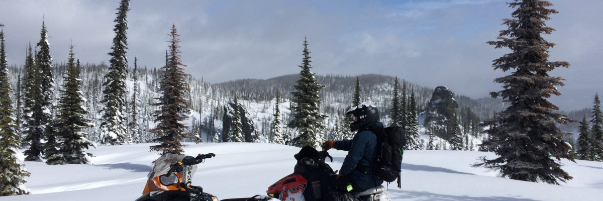
Steve and I took sleds to the Lolo Pass area yesterday.  The primary avalanche  concern today are wind slabs.  These slabs will be located on leeward terrain.  There has been a lot of new snow with wind,  look for scoured snow or hollow, drumlike sounding snow.  These wind slabs could be triggered by a rider.

The second avalanche problem is dry loose avalanches.  There is a lot of new snow,  these loose dry avalanches will be found on steep slopes (>35 degrees), they should not be a problem unless they carry you into a terrain trap (tree, cliff, or gully).  If the sun comes out expect these to turn to loose wet avalanches on sun exposed slopes.

There are some layers in the top meter of the snowpack to look at.  There are several crusts with facets on top or below the crust.  These layers have become less reactive in the last month but it is always prudent to dig a pit before recreating on a steep slope.

Weather and Avalanche Outlook.

A cold front will bring snow showers to the area today.  The forecast calls for 3-6 inches of new snow today with gusty winds.  High pressure will start to build in the area on Friday.  I would expect the avalanche danger to remain the same with these conditions.

Ski and ride safe.  Have a great St. Patricks Powder Day.  I will issue the next advisory on Saturday.
 

READ FULL ADVISORY  

Problem 1 - Wind Slabs

  • TYPE

    wind-slabs

    Wind Slabs

    Release of a cohesive layer of snow (a slab) formed by the wind.  Wind typically erodes snow from the upwind sides of terrain features and deposits snow on the downwind side.  Wind slabs are often smooth and rounded and sometimes sound hollow, and can range from soft to hard. Wind slabs that form over a persistent weak layer (surface hoar, depth hoar, or near-surface facets) may be termed Persistent Slabs or may develop into Persistent Slabs.

  • SIZE

    3-4

    1-2 (Small-Large)

    The potential size of avalanche resulting from this problem.

  • LIKELIHOOD

    Likelihood-3

    Possible

    The likelihood of an avalanche resulting from this problem.

Wind slabs can be found on leeward terrain above 6000 ft.

Problem 2 - Loose Dry

  • TYPE

    loose-dry

    Loose Dry

    Release of wet unconsolidated snow or slush. These avalanches typically occur within layers of wet snow near the surface of the snowpack, but they may quickly gouge into lower snowpack layers. Like Loose-Dry Avalanches,they start at a point and entrain snow as they move downhill, forming a fan-shaped avalanche. They generally move slowly, but can contain enough mass to cause significant damage to trees, cars or buildings. Other names for loose-wet avalanches include point-release avalanches or sluffs. Loose-wet avalanches can trigger slab avalanches that break into deeper snow layers.

  • SIZE

    2-3

    1 (Small)

    The potential size of avalanche resulting from this problem.

  • LIKELIHOOD

    Likelihood-4

    Possible/Likely

    The likelihood of an avalanche resulting from this problem.

  • IMAGE

With the new snow it is possible to trigger a loose dry avalanche on steep slopes (>35 degrees).

VIDEO

State of the Snow

03/16/2016 Advisory

FORECAST & OUTLOOK

A cold front will bring gusty winds and 3-5 new inches of snow today.

This information is the sole responsibility of the Forest Service and does not apply to operating ski areas. The avalanche danger rating expires at midnight tonight but the information can help you make a more informed decision regarding travel in avalanche terrain for the next few days.

Our advisory area includes National Forest System lands in the Bitterroot Mountains from Lost Trail Pass north to Granite Pass, the Rattlesnake Mountains north of Missoula and the Southern Swan and Mission Mountains near Seeley Lake, MT. Avalanche information for the Lookout Pass/St. Regis Basin area is available from the Idaho Panhandle Avalanche Center.