
The current avalanche danger is Considerable on wind loaded terrain across the West Central Montana backcountry. Large human triggered avalanches are likely in areas of wind deposition. On all non-wind loaded terrain the avalanche danger is MODERATE. Identification of wind loaded terrain is critical for backcountry travel today.
Good morning, this is Logan King with the West Central Montana Avalanche Center’s avalanche advisory for Saturday, December 15th, 2018. This danger rating does not apply to operating ski areas, expires at midnight tonight and is the sole responsibility of the U.S. Forest Service.
Weather and Snowpack
Light snow showers are lingering in the region early this morning but are subsiding. Temperatures at 5 am are in the twenties and a prominent SW-SSW wind is impacting the advisory area with sustained winds in the teens and gust to the mid to upper twenties (mph). Snotels are reporting an additional 1-4 inches of snow with an that has added 0.1-0.4 inches SWE to the snowpack.
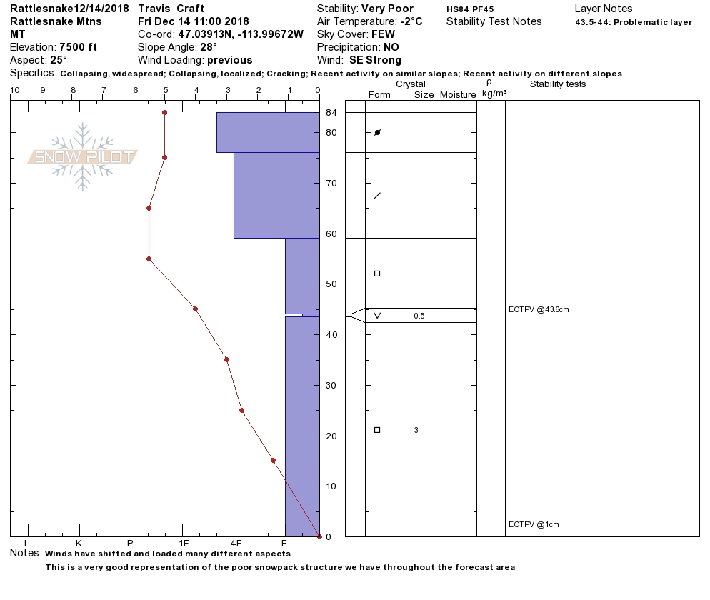
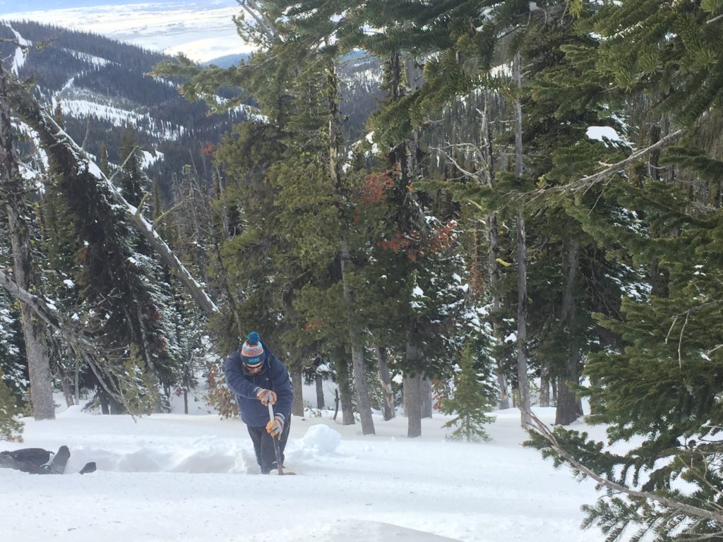
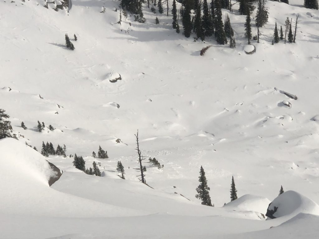
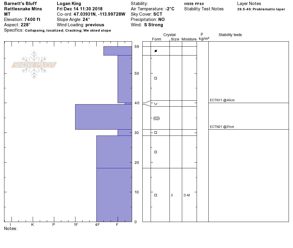
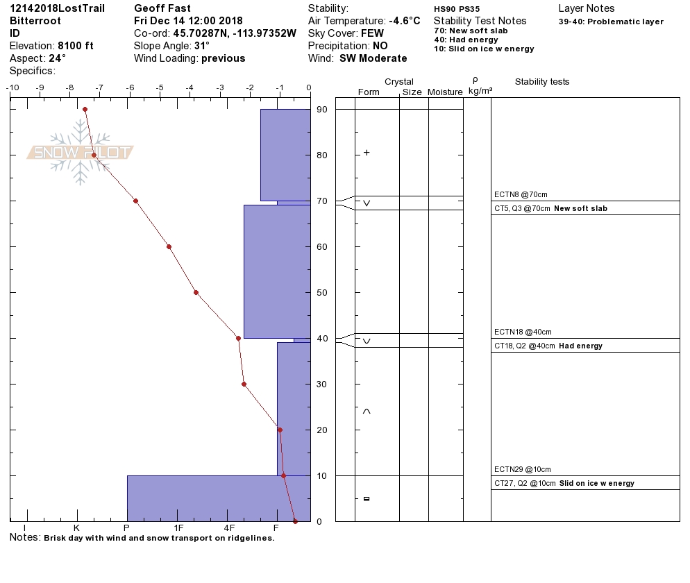
While touring yesterday we observed strong southerly winds that followed the westerlies from earlier this week. At upper elevations there was wind-loading on most aspects to varying extents. The locations with heavier wind loads had collapsing, whumphing and shooting cracks that clearly indicate a lack of stability. On a wind loaded slope we had and extended column test fail and propagate while isolating the column (profile).
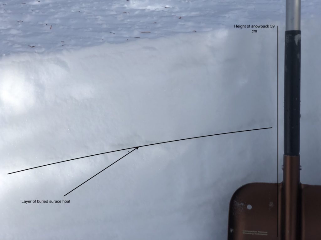
The wind slab problem is further complicated by the weak snow structure. Most of the failures are occurring on a layer of buried layer of surface hoar. Along with the buried surface hoar there is a weak unconsolidated pack consisting primarily of facets. The weak granular snowpack lacks strength or stability and will be suspect until deeply buried or the snow starts to change forms and bond.
Carefully evaluate terrain to identify locations where the wind may have deposited snow. Look for rounded pillows of snow, cross loaded slopes, new cornices and sastrugi or anything else that may indicate which slopes are loaded. Remember the winds have been loading slopes unevenly and in uncharacteristic ways so take the time to actually assess if wind loading has occurred, don’t be surprised to find a pocket of wind-loaded snow somewhere that you have never seen before. If you hear whumphing or collapses and see shooting cracks, adjust you travel according to avoid areas that are suspect.
Avalanche and Weather Outlook
The forecast indicates light snow showers across West Central Montana this morning with the possibility of some stronger bands developing but snow should taper off by mid day today. Strong winds will impact the region this morning as a cold front passes through the region. Sunday looks to be dry and warm. The next round of snow looks to develop Tuesday or Wednesday (Forecast). The avalanche conditions look to remain the same for the next few days.
If you make it out into the backcountry feel free to share what you see on our public observations page. They are not only helpful to your community but extremely helpful in producing the forecasts.
Ski and ride safe.


