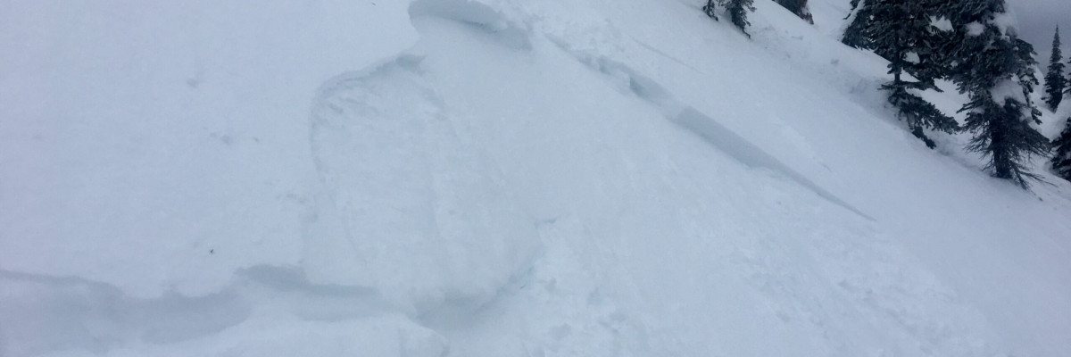
A MODERATE avalanche danger exists today for the West Central Montana backcountry. Heightened avalanche conditions exist on wind loaded terrain above 5,500 feet and at locations with shallow snowpacks. Human triggered avalanches are possible and careful evaluation is necessary to identify areas of heightened concern.
Good morning, this is Logan King with the West Central Montana Avalanche Center’s avalanche advisory for Thursday, March 7th, 2019. This danger rating does not apply to operating ski areas, expires at midnight tonight and is the sole responsibility of the U.S. Forest Service.
Weather and Snowpack
Over the past 24 hours, 2-6 inches of snow have fallen across the forecast area adding an additional .2-.5 inches of SWE. Temperatures as of 4 am are just below freezing. Winds are light in the north at 5 mph and gusting to 8 mph from the ENE and are slightly stronger to the south at 11 mph gusting to 1 mph from the SSE.
Above 5,500 feet the primary avalanche concern is wind slabs. Winds have created pockets of isolated slabs that are generally small but can pack a punch as they can release with a lot of energy. Wind slabs are sitting on weak faceted snow and are now buried under a few inches of new snow making them harder to identify but still primed for a trigger. Larger wind slabs are possible but are isolated and less reactive. Persistent slabs and deep persistent slabs are also possible at upper elevations in isolated locations. In the rattlesnake, yesterday areas with shallow snow were found to have extensive faceting and were failing readily in stability tests (Video). Widespread faceting has occurred throughout the snowpack but is only reactive at some locations. Deep instability is not widespread but if found will result in very large avalanches that have high consequences.
At lower elevations persistent weak layers are widespread but lack the slab overlying the weaknesses to produce avalanches at most locations. Although weak faceted snow can be found on any slope, it is only reactive under the right circumstances. Locations where a denser or stiff slab overlying facets will be susceptible to triggers for the foreseeable future. The only way to know if the persistent weak layers are reactive is to perform stability tests in pits and on test slopes. Wind loading is very isolated at lower elevations and can primarily be found near channeling corridors and major valleys. These areas will be the likely trigger points as they will have the structure required to propagate a failure for a slab avalanche.
Human triggered avalanches are possible today. If you are in the wrong place at the wrong time it will be easy to trigger a slide. Avalanches will generally be small but a few have the potential to be large with high consequences. Remember that Moderate and Low danger doesn’t mean that things are “safe”. The conditions right now are a great example of the fact that there are places you can and will trigger avalanches during Moderate danger and you have to carefully assess conditions and terrain to identify areas and features of heightened concern.
Avalanche and Weather Outlook
Light snow showers are expected today with a brief break tonight. Continued light and scattered snow is forecasted through Friday and Saturday. Winds will shift directions and complicated wind loading today and into the weekend. Surface hoar formed at many locations earlier this week and has been knocked down at some locations but can now be found in certain areas. The newly buried surface hoar will become more reactive as more load is added on top of this very weak layer. Overall the avalanche danger should remain the same without any major changes in the forecast.
If you get out into the backcountry, please share your observations on our public observation page.
Ski and ride safe.


